- Mota Lava
-
Mota Lava Mota Lava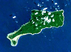
Gewässer Korallenmeer Inselgruppe Banks-Inseln Geographische Lage 13° 41′ 0″ S, 167° 40′ 0″ O-13.683333333333167.66666666667411Koordinaten: 13° 41′ 0″ S, 167° 40′ 0″ O 

Fläche 24 km² Höchste Erhebung 411 m Einwohner 1.451 (2009)
60 Einw./km²Hauptort Lahlap Banks-Inseln mit Mota Lava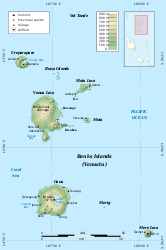
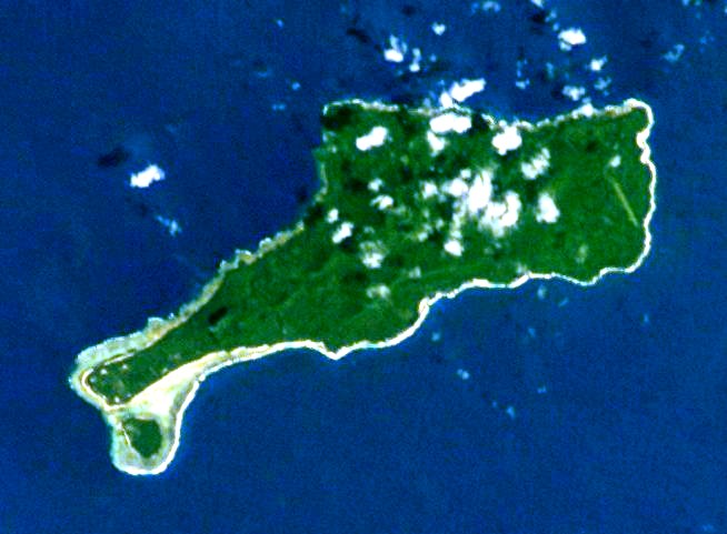
Mota Lava, auch Motalava, ist eine Insel der Banks-Inseln im Norden des pazifischen Inselstaates Vanuatu.
Sie liegt nordöstlich von Vanua Lava und zählt wie diese zur vanuatuischen Provinz Torba. Mota Lava ist bewohnt und verfügt sogar über ein kleines Flugfeld. Die 24 km²[1] große Insel besteht aus mindestens fünf basaltischen Schichtvulkanen sowie zwei Pyroklastischen Kegeln und erreicht eine Höhe von 411 m über dem Meer. Knapp 300 Meter vor der Südwestküste liegt die ebenfalls bewohnte Nebeninsel Ra. Ra und Mota Lava werden von einem gemeinsamen Korallenriff umgeben.
Weblinks
 Commons: Mota Lava – Sammlung von Bildern, Videos und Audiodateien
- Mota Lava im Global Volcanism Program der Smithsonian Institution (englisch)
Einzelnachweise
- ↑ UNEP Islands Directory (englisch)
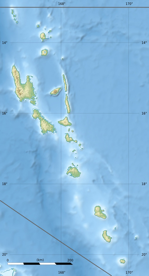
Vétaounde | Uréparapara | Rowa-Inseln | Mota Lava | Ra | Vanua Lava | Ravenga | Mota | Kwakéa | Niwula | Gaua | Mérig | Mere Lava
Wikimedia Foundation.
Schlagen Sie auch in anderen Wörterbüchern nach:
Mota Lava — M̄otlap Photographie satellite de Mota Lava. On aperçoit l’îlot Ra au sud ouest de l’île principale. Géographie Pays … Wikipédia en Français
Mota Lava — Motalava Native name: Mwotlap Mota Lava, viewed from space. On the southwest point one may see the islet of Ra … Wikipedia
Mota Lava Airport — Mota Lava IATA: MTV – ICAO: NVSA … Wikipedia
Mota (Vanuatu) — Vorlage:Infobox Insel/Wartung/Bild fehlt Mota Gewässer Korallenmeer Inselgruppe Banks Inseln Geographische Lage … Deutsch Wikipedia
Mota (île) — Pour les articles homonymes, voir Mota. Mota Carte des îles Banks. Mota est proche du centre … Wikipédia en Français
Mere Lava — Vorlage:Infobox Insel/Wartung/Bild fehlt Mere Lava Gewässer Pazifischer Ozean Inselgruppe Banks Inseln Geographische Lage … Deutsch Wikipedia
Vanua Lava — Karte von Vanua Lava Gewässer Korallenmeer Inselgruppe … Deutsch Wikipedia
Vanua Lava — Carte de Vanua Lava datant de 1943 Géographie Pays … Wikipédia en Français
Mere Lava — Carte des îles Banks. Merelava est au sud est. Géographie Pays … Wikipédia en Français
Vanua Lava Airport — IATA: SLH – ICAO: NVSC … Wikipedia
Mota Lava

18+
© Academic, 2000-2026
- Kontaktieren Sie uns: Unterstützung, Werbung
Wörterbücher Export, schritte mit PHP, Joomla, Drupal, WordPress, MODx.