- Pastovce
-
Pastovce
Wappen Karte 
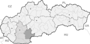

Pastovce BasisdatenKraj: Nitriansky kraj Okres: Levice Region: Nitra Fläche: 12,74 km² Einwohner: 542 (31. Dez. 2010) Bevölkerungsdichte: 42,54 Einwohner je km² Höhe: 124 m n.m. Postleitzahl: 935 74 Telefonvorwahl: 0 36 Geographische Lage: 47° 58′ N, 18° 45′ O47.967518.7525124Koordinaten: 47° 58′ 3″ N, 18° 45′ 9″ O Kfz-Kennzeichen: LV Gemeindekennziffer: 502626 StrukturGemeindeart: Gemeinde Verwaltung (Stand: April 2011)Bürgermeister: Oto Mészáros Adresse: Obecný úrad Pastovce
51
935 74 PastovceWebpräsenz: www.pastovce.sk Gemeindeinformation
auf portal.gov.skStatistikinformation
auf statistics.skPastovce (bis 1927 slowakisch „Pastuchov“; ungarisch Ipolypásztó) ist eine Gemeinde im Okres Levice innerhalb des Nitriansky kraj in der Slowakei mit etwa 500 Einwohnern.
Geographie
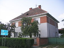 Das Rathaus und die Schule von Pastovce
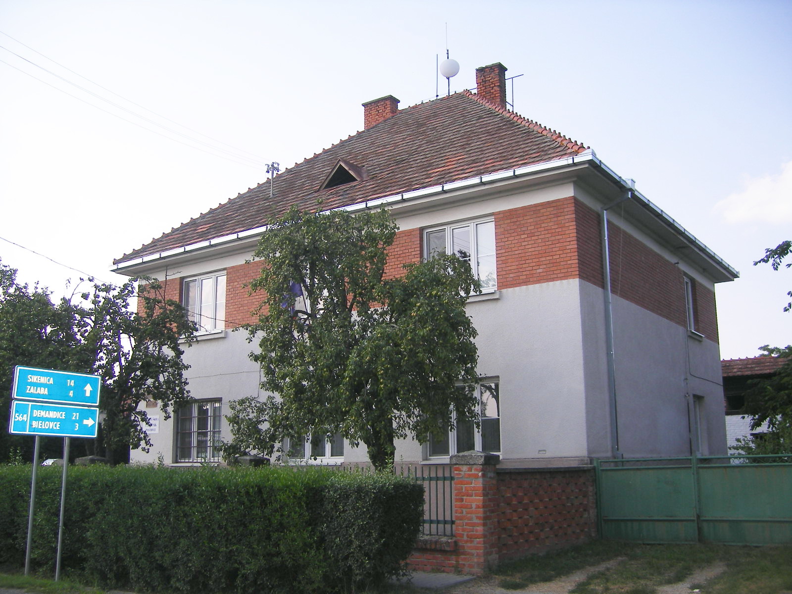
Die Gemeinde liegt in der Ipeľská pahorkatina („Eipel-Hügelland“), welche zum slowakischen Donautiefland gehört. Sie liegt am rechten Ufer des Grenzflusses Ipeľ, gleich gegenüber der ungarischen Gemeinde Vámosmikola; dort besteht jedoch keine Verbindung. Pastovce liegt an der Landesstraße 564 und ist 21 Kilometer nördlich von Štúrovo, 30 Kilometer südwestlich von Šahy und 40 Kilometer südlich von Levice entfernt.
Geschichte
Im heutigen Gemeindegebiet sind Funde der Lengyel-Kultur, aus der Hallstatt- und Laténezeit nachgewiesen, ebenso wie eine slawische Grabstätte. Der heutige Ort wird zum ersten Mal 1135 als Paztuh schriftlich erwähnt und hatte das Fischfang-Recht. Im 14. Jahrhundert war sie von der Familie Pásztó beherrscht, 1554 der Burg Lewenz. Nach den verheerenden Türkenkriegen erwarb den Ort die Familie Esterházy, die bis ins 19. Jahrhundert Eigentümer waren. Ein Tag nach den Ostern 1774 brannte der ganze Ort aus.
Bis 1919 lag der Ort im Komitat Hont im Königreich Ungarn und kam danach zur neu entstandenen Tschechoslowakei. 1938-45 war er auf Grund des Ersten Wiener Schiedsspruches noch einmal ein Teil Ungarns.
Weblinks
 Commons: Pastovce – Sammlung von Bildern, Videos und AudiodateienGemeinden im Okres Levice
Bajka | Bátovce (Frauenmarkt) | Beša | Bielovce | Bohunice | Bory | Brhlovce (Berflowetz) | Čajkov | Čaka | Čata | Demandice (Demenditz) | Devičany (Prandorf) | Dolná Seč | Dolné Semerovce (Untersemered) | Dolný Pial (Unterpill) | Domadice | Drženice (Dersenitz) | Farná | Hokovce (Hockowitz) | Hontianska Vrbica | Hontianske Trsťany | Horná Seč | Horné Semerovce (Obersemered) | Horné Turovce (Oberthur) | Horný Pial (Oberpill) | Hrkovce | Hronovce | Hronské Kľačany (Klatschan) | Hronské Kosihy | Iňa | Ipeľské Úľany | Ipeľský Sokolec | Jabloňovce (Almasch) | Jesenské | Jur nad Hronom | Kalná nad Hronom | Keť | Kozárovce (Koscharowetz) | Krškany | Kubáňovo | Kukučínov | Kuraľany | Levice (Lewenz) | Lok | Lontov | Lula | Málaš | Malé Kozmálovce | Malé Ludince | Mýtne Ludany | Nová Dedina | Nový Tekov (Neubarsch) | Nýrovce | Ondrejovce | Pastovce | Pečenice | Plášťovce | Plavé Vozokany | Podlužany | Pohronský Ruskov | Pukanec (Pukanz) | Rybník | Santovka | Sazdice | Sikenica | Slatina | Starý Hrádok | Starý Tekov (Bersenberg) | Šahy (Eipelschlag) | Šalov | Šarovce | Tehla | Tekovské Lužany | Tekovský Hrádok | Tlmače | Tupá | Turá | Uhliská | Veľké Kozmálovce | Veľké Ludince | Veľké Turovce | Veľký Ďur | Vyškovce nad Ipľom | Vyšné nad Hronom | Zalaba | Zbrojníky | Želiezovce (Zelis) | Žemberovce | Žemliare
Wikimedia Foundation.
Schlagen Sie auch in anderen Wörterbüchern nach:
Pastovce — (Village) Administration Pays Slovaquie … Wikipédia en Français
Pastovce — ( hu. Ipolypásztó) is a village and municipality in the Levice District in the Nitra Region of Slovakia.HistoryIn historical records the village was first mentioned in 1135.GeographyThe village lies at an altitude of 124 metres and covers an area … Wikipedia
District de Levice — Levice Informations Pays … Wikipédia en Français
Nitra Region — Coordinates: 48°18′25″N 18°05′11″E / 48.30694°N 18.08639°E / 48.30694; 18.08639 … Wikipedia
Levice District — District Country Slovakia Re … Wikipedia
List of municipalities and towns in Slovakia — Slovakia This is a comprehensive list of municipalities and towns in Slovakia. For lists of towns and municipalities sorted by Regions see the individual articles on Regions. For an outdated list of towns only in Slovakia see also List of towns… … Wikipedia
Demandice — Location of Levice District in the Nitra Region Demandice is a village and municipality in the Levice District in the Nitra Region of south west Slovakia. Contents … Wikipedia
Devičany — Location of Levice District in the Nitra Region Devičany is an old village and municipality in the Levice District in the Nitra Region of Slovakia. Contents … Wikipedia
Dolná Seč — Location of Levice District in the Nitra Region Dolná Seč (Hungarian: Alsószecse) is a village and municipality in the Levice District in the Nitra Region of Slovakia … Wikipedia
Dolné Semerovce — Location of Levice District in the Nitra Region Dolné Semerovce (Hungarian: Alsószemeréd) is a village and municipality in the Levice District in the Nitra Region of Slovakia … Wikipedia
Pastovce

18+
© Academic, 2000-2025
- Kontaktieren Sie uns: Unterstützung, Werbung
Wörterbücher Export, schritte mit PHP, Joomla, Drupal, WordPress, MODx.