- Poljice-Pass
-
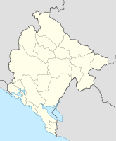
Poljice-Pass Nord Süd Passhöhe 665 m. i. J. Opština Bar Podgorica Talorte Petrovac Virpazar Ausbau Straße Sperre - Karte Koordinaten 42° 12′ 57″ N, 18° 58′ 53″ O42.21583333333318.981388888889665Koordinaten: 42° 12′ 57″ N, 18° 58′ 53″ O Der Poljice-Pass in Montenegro ist ein Teil der M2 und verbindet Petrovac na moru mit Virpazar. Durch die Fertigstellung des Sozina-Tunnels und dem Ausbau der M2-3 hat der Pass stark an Bedeutung verloren.
Kategorien:- Verkehr (Montenegro)
- Gebirgspass
- Geographie (Montenegro)
Wikimedia Foundation.

