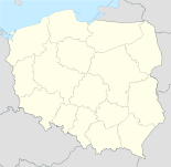
- Przodkowo
-
Przodkowo 
Basisdaten Staat: Polen Woiwodschaft: Pommern Landkreis: Kartuzy Geographische Lage: 54° 23′ N, 18° 17′ O54.37972222222218.2875Koordinaten: 54° 22′ 47″ N, 18° 17′ 15″ O Einwohner: 1200 ([1])
Postleitzahl: 83-304 Telefonvorwahl: (+48) 58 Kfz-Kennzeichen: GKA Gemeinde Gemeindeart: Landgemeinde Gemeindegliederung: 15 Schulzenämter Fläche: 85,4 km² Einwohner: 7627
(31. Dez. 2010) [2]Bevölkerungsdichte: 89 Einw./km² Gemeindenummer (GUS): 2205032 Verwaltung Bürgermeister: Andrzej Wyrzykowski Adresse: ul. Kartuska 21
83-304 PrzodkowoWebpräsenz: www.przodkowo.pl Przodkowo (deutsch Seefeld, kaschubisch Przodkòwò) ist ein Dorf und Sitz der gleichnamigen Landgemeinde in Polen. Es liegt im Powiat Kartuski der Wojewodschaft Pommern.
Gemeinde
Zur Landgemeinde Przodkowo gehören 15 Ortsteile (deutsche Namen bis 1945)[3] mit einem Schulzenamt:
- Hopy (Hoppen)
- Kawle Dolne (Kable)
- Kczewo (Exau)
- Kłosowo (Klossau)
- Kobysewo (Kobissau)
- Kosowo (Kossowo)
- Pomieczyno (Pomietschin, 1939–1945: Pomiszyn)
- Przodkowo (Seefeld)
- Przodkowo Działki
- Rąb (Romb)
- Smołdzino (Smolsin)
- Szarłata (Charlotten)
- Tokary (Tockar)
- Warzenko (Warschenko)
- Załęże (Zalensee, 1939–1945: Zalense)
Weitere Ortschaften der Gemeinde sind:
- Bagniewo (Teufelsbruch)
- Barwik (Barwick)
- Bielawy (Bilawi)
- Brzeziny
- Buczyno
- Bursztynik
- Czarna Huta (Schwarzhütte)
- Czeczewo
- Gliniewo
- Hejtus
- Kawle Górne
- Kłosowo-Piekło
- Kłosowo-Wybudowanie
- Kłosówko
- Krzywda
- Masłowo (Butterfaß)
- Młynek
- Nowe Tokary
- Osowa Góra (Ossowagora)
- Otalżyno (Ottalsin)
- Piekiełko
- Pomieczyno Małe
- Przodkowo-Wybudowanie
- Sośniak
- Stanisławy (Stanislawi)
- Tokarskie Pnie
- Trzy Rzeki
- Warzeńska Huta
- Wilanowo (Willanowo)
- Załęskie Piaski
Fußnoten
- ↑ Szukacz.pl, Przodkowo - Informacje dodatkowe, abgerufen am 7. August 2010
- ↑ Population. Size and Structure by Territorial Division. As of December 31, 2010. Główny Urząd Statystyczny (GUS), abgerufen am 6. August 2011.
- ↑ Das Genealogische Orts-Verzeichnis
Wikimedia Foundation.


