- Sierakowice
-
Sierakowice 
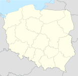
Basisdaten Staat: Polen Woiwodschaft: Pommern Landkreis: Kartuzy Fläche: 7,84 km² Geographische Lage: 54° 21′ N, 17° 54′ O54.34611111111117.891666666667Koordinaten: 54° 20′ 46″ N, 17° 53′ 30″ O Einwohner: 5400 ([1])
Postleitzahl: 83-340 Telefonvorwahl: (+48) 58 Kfz-Kennzeichen: GKA Wirtschaft und Verkehr Straße: DW 211: Żukowo–Kartuzy ↔ Czarna Dąbrówka–Nowa Dąbrówka DW 214: Łeba–Lębork ↔ Kościerzyna–Skórcz–Warlubie Schienenweg: kein Bahnanschluss Nächster int. Flughafen: Danzig Gemeinde Gemeindeart: Landgemeinde Gemeindegliederung: 23 Schulzenämter Fläche: 182,4 km² Einwohner: 17.588
(31. Dez. 2010) [2]Bevölkerungsdichte: 96 Einw./km² Gemeindenummer (GUS): 2205042 Verwaltung Gemeindevorsteher: Tadeusz Roman Kobiela Adresse: ul. Lęborska 30
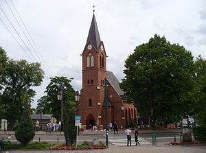
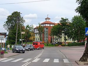
83-340 SierakowiceWebpräsenz: www.sierakowice.pl Sierakowice (deutsch Sierakowitz, kaschubisch Serakòjce) ist ein Dorf und Sitz der gleichnamigen Landgemeinde in Polen. Es liegt im Powiat Kartuski der Wojewodschaft Pommern.
Inhaltsverzeichnis
Gemeinde
Zur Landgemeinde Sierakowice gehören 23 Ortsteile (deutsche Namen bis 1945)[3] mit einem Schulzenamt:
- Bącka Huta (Bontscherhütte)
- Borowy Las (Borrowilass, 1942–1945: Borwald)
- Bukowo (Bukowo)
- Długi Kierz
- Gowidlino (Gowidlino, 1942–1945: Göbeln)
- Kamienica Królewska (Kaminitza, 1942–1945: Kamstein)
- Karczewko (Karzewko)
- Kowale (Kowall)
- Leszczynki (Nußdorf)
- Łyśniewo Sierakowickie (Lißniewo, 1943–1945: Lischnau)
- Mojusz (Moisz, 1942–1945: Mooswalde)
- Mrozy
- Nowa Ameryka
- Paczewo (Patschewo)
- Pałubice (Pallubitz)
- Puzdrowo (Pusdrowo)
- Sierakowice (Sierakowitz, 1942: Rockwitz, 1942–1945: Sierke)
- Sierakowska Huta (Sierakowitzerhütte, 1942–1945: Sierkenhöhe)
- Smolniki
- Stara Huta (Starrahutta)
- Szklana (Sklana, 1942–1945. Glasfelde)
- Tuchlino (Tuchlin)
- Załakowo (Sallakowo, 1942–1945: Salkau)
Weitere Ortschaften der Gemeinde sind:
- Ameryka
- Bór
- Ciechomie (Czechomie, 1942–1945: Zechen)
- Dolina Jadwigi
- Dąbrowa Puzdrowska
- Gowidlinko
- Gowidlino-Wybudowanie
- Jagodowo
- Janowo (Johannisthal)
- Jelonko (Jelonke, 1942–1945: Hirschlanke)
- Kamienicka Huta
- Kamienicki Młyn
- Kamionka Gowidlińska
- Karwacja (Karwacia)
- Karłowo
- Kokwino (Kockwein)
- Koryto
- Kujaty
- Kukówka
- Lemany
- Lisie Jamy (Lindendorf)
- Łączki
- Migi (Muggen)
- Moczydło
- Mojuszewska Huta
- Nowalczysko (Nowalczysko, 1942–1945: Neuenhagen)
- Olszewko
- Patoki
- Piekiełko
- Poljańska
- Poręby
- Przylesie
- Puzdrowski Młyn
- Rębienica (Rembinitza)
- Sierakowice-Wybudowanie
- Skrzeszewo
- Sosnowa Góra
- Srocze Góry
- Stara Maszyna
- Szopa
- Szramnica
- Tuchlinek
- Welk
- Wygoda Sierakowska
- Zarębisko
Verkehr
Das Dorf und die Landgemeinde Sierakowice liegen verkehrsgünstig am Schnittpunkt der zwei Woiwodschaftsstraßen 211 und 214, die den Ort in Nord-Süd- und Ost-West-Richtung verbinden. Bahntechnisch hat Sierakowice den Anschluss eingebüßt, der seit 1905 mit der Bahnlinie von Pruszcz Gdański (Praust) nach Łeba (Leba) bestand. Am 23. Juni 2000 erfolgte die Schließung der Strecke zwischen Kartuzy (Karthaus) und Lębork (Lauenburg (Pommern)).
Verweise
Weblinks
Fußnoten
- ↑ Szukacz.pl, Sierakowice - Informacje dodatkowe, abgerufen am 6. August 2010
- ↑ Population. Size and Structure by Territorial Division. As of December 31, 2010. Główny Urząd Statystyczny (GUS), abgerufen am 6. August 2011.
- ↑ Das Genealogische Orts-Verzeichnis
Wikimedia Foundation.


