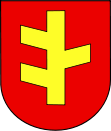
- Rychwał
-
Rychwał 
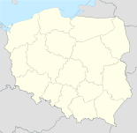
Basisdaten Staat: Polen Woiwodschaft: Großpolen Landkreis: Konin Fläche: 9,7 km² Geographische Lage: 52° 4′ N, 18° 10′ O52.07111111111118.171666666667Koordinaten: 52° 4′ 16″ N, 18° 10′ 18″ O Einwohner: 2364
(31. Dez. 2010)[1]Postleitzahl: 62-570 Telefonvorwahl: (+48) 63 Kfz-Kennzeichen: PKN Gemeinde Gemeindeart: Stadt- und Landgemeinde Gemeindegliederung: 23 Schulzenämter Fläche: 117,8 km² Einwohner: 8300
(31. Dez. 2010) [2]Bevölkerungsdichte: 70 Einw./km² Gemeindenummer (GUS): 3010073 Verwaltung (Stand: 2011) Gemeindevorsteher: Stefan Dziamara Adresse: pl. Wolności 16
62-570 RychwałWebpräsenz: www.rychwal.pl Rychwał (deutsch Rychwal, 1943–1945 Reichwald (Wartheland))[3] ist eine Stadt und Sitz der gleichnamigen Stadt- und Landgemeinde im Powiat Koniński der Wojewodschaft Großpolen in Polen.
Gemeinde
Zur Stadt- und Landgemeinde gehören neben der Stadt Rychwał weitere 23 Ortsteile mit einem Schulzenamt.
- Biała Panieńska
- Broniki
- Czyżew
- Dąbroszyn (Eichenhagen 1943-1945)
- Franki
- Gliny
- Grabowa
- Grochowy
- Jaroszewice Grodzieckie
- Jaroszewice Rychwalskie
- Kuchary Borowe
- Kuchary Kościelne
- Lubiny
- Modlibogowice
- Rozalin
- Rybie
- Siąszyce
- Siąszyce Trzecie
- Święcia (Schwentz [4]1804-1891, 1939-1945)
- Wardężyn
- Wola Rychwalska
- Złotkowy
- Zosinki
Weblinks
- Anordnung über Ortsnamenänderung im Reichsgau Wartheland im Verordnungsblatt des Reichstatthalters im Warthegau vom 18. Mai 1943 (pdf)
Fußnoten
- ↑ Population. Size and Structure by Territorial Division. As of December 31, 2010. Główny Urząd Statystyczny (GUS), abgerufen am 23. Juni 2011.
- ↑ Population. Size and Structure by Territorial Division. As of December 31, 2010. Główny Urząd Statystyczny (GUS), abgerufen am 23. Juni 2011.
- ↑ Vgl. Weblink "Anordnung über Ortsnamenänderung im Reichsgau Wartheland" - Landkreis Konin
- ↑ http://www.upstreamvistula.org/Documents/ABreyer_Warthebruch.pdf
Wikimedia Foundation.

