White City (Saskatchewan)
- White City (Saskatchewan)
-
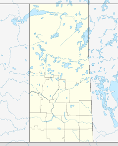
White City ist eine Trabantenstadt in der kanadischen Provinz Saskatchewan. Die Stadt liegt am Trans-Canada Highway.
Im Jahr 2000 wurde aus dem Dorf eine Stadt.
In White City gibt es unter anderem eine medizinische Klinik, drei Restaurants, eine Eishockey-Arena und eine Bibliothek.
Der Emerald Park Golf and Country Club liegt in der Nähe.
Persönlichkeiten
Wikimedia Foundation.
Schlagen Sie auch in anderen Wörterbüchern nach:
White City, Saskatchewan — White City is a suburban town in the Canadian province of Saskatchewan. White City is 10 kilometres (6 mi) east of Regina on the Trans Canada Highway. The town is primarily populated by urban professionals and young families who work in Regina.… … Wikipedia
White City — may refer to one of the following:Australia* White City Woodville, a football club from the South Australian Super League * White City Football Club, a football club from the NSW Conference League South * White City railway station, Melbourne, a… … Wikipedia
White City — ist ein Stadtteil des London Borough of Hammersmith and Fulham White City Stadium, ehemaliges Stadion daselbst White City (London Underground), Bahnstation daselbst ein Ort in England, siehe White City (Colchester) ein Ort in Kanada: White City… … Deutsch Wikipedia
White City (Radomsky) Airport — is located convert|1.5|NM|abbr=on|lk=in east of White City, Saskatchewan, Canada.References … Wikipedia
Saskatchewan Highway 35 — Infobox road marker province=SK type=Hwy route=35 alternate name= length km=573.1 length round=1 length ref= established= maint=Ministry of Highways and Infrastructure Transport Canada direction a=South starting terminus= junction= direction… … Wikipedia
Saskatchewan Highway 1 — Pioneer homesteaders in the early 1900s farmed quarter section homesteads which were ] Piapot Creek, Bear Creek and Skull Creek are near the Bench also known as the Cypress Hills plateau. After leaving the Maple Creek Plain, there is the Gull… … Wikipedia
Saskatchewan Highway 48 — Infobox road province= marker highway name=Highway 48 name notes= type= route= alternate name= maint= section= length first=km length km=239 length mi=149 length round= length ref= length notes= established= decommissioned= direction a=West… … Wikipedia
White Bear — The name White Bear might refer to:* Polar Bear also known as a White Bear. * The Spirit bear an endangered subspecies of black bears in coastal British Columbia. * White Bear Lake Area High School public school serving White Bear Lake and White… … Wikipedia
Saskatchewan Highway 11 — Infobox road highway name=Highway 11 alternate name=Louis Riel Trail maint= length mi= length round= length ref=cite web last = first = authorlink = coauthors = title = Microsoft Streets and Tips work = Route Planner publisher = Microsoft Corp.… … Wikipedia
Saskatchewan Highway 9 — Infobox road province=SK type=Hwy route=9 alternate name=Saskota Flyway maint= length km=606.2 length round=1 length ref=cite map publisher=Microsoft Corp. title= Microsoft Streets and Tips url= edition=2004 section=Route Planner accessdate=2008… … Wikipedia