Wołosate

Wołosate
Wołosate
Wappen fehlt
Hilfe zu Wappen
Wołosate (Polen)
Wołosate
Wołosate
Basisdaten
Staat: Polen
Woiwodschaft: Karpatenvorland
Landkreis: Bieszczadzki
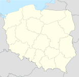
Geographische Lage: 49° 3′ N, 22° 42′ O49.05472222222222.695277777778Koordinaten: 49° 3′ 17″ N, 22° 41′ 43″ O
Einwohner:

44

Postleitzahl: 38-714
Telefonvorwahl: (+48) 13
Kfz-Kennzeichen: RBI
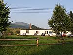
Hotel im Ortszentrum

Wołosate ist ein Dorf im Verwaltungsbezirk der Gmina Lutowiska im Powiat Bieszczadzki der Woiwodschaft Karpatenvorland in Südost-Polen nahe der Grenze zur Ukraine.

Das im Jahr 1557 erstmals erwähnte Wołosate ist der südlichste bewohnte Ort Polens, gelegen im Bieszczady-Nationalpark im Flusstal des Wołosaty, etwa 3 km nördlich der Grenze zur Ukraine und 15 km nordwestlich des Südostzipfels Polens, der von der Ukraine umschlossen ist. Die Ortschaft liegt am Beginn der Woiwodschaftsstraße 897 ungefähr 22 km südlich von Lutowiska und 120 km südsüdöstlich der Woiwodschaftshauptstadt Rzeszów.[1] Im Nordosten und Osten stehen in 3 bis 5 Kilometern Entfernung die Bergketten mit den höchsten Erhebungen der Bieszczady wie dem Tarnica (1346), dem Krzmień (1335) und dem Halicz (1333 m).

In den umliegenden Wäldern findet sich die urtümliche Fauna der Bieszczady, u.a. Bär, Wolf und Luchs.

Der Ort wurde wie alle anderen Ansiedlungen der Gegend nach dem Zweiten Weltkrieg im Zuge der ukrainisch-polnischen Auseinandersetzungen entvölkert. In den 1970er-Jahren entstand, auch mit Hilfe der Armee, nach der Rekultivierung des Tales eine Zucht von Huzulenpferden. Wołosate hat gegenwärtig 44 Einwohner.

Einzelnachweise

  1. http://www.stat.gov.pl/broker/access/prefile/listPreFiles.jspa

Weblinks


Wikimedia Foundation.

Игры ⚽ Поможем сделать НИР

Schlagen Sie auch in anderen Wörterbüchern nach:

  • Wołosate — Infobox Settlement name = Wołosate settlement type = Village total type = image shield = subdivision type = Country subdivision name = POL subdivision type1 = Voivodeship subdivision name1 = Subcarpathian subdivision type2 = County subdivision… …   Wikipedia

  • Muczne —   Village   …   Wikipedia

  • Prešov — Geobox | Settlement name = Prešov category = City image caption = City centre of Prešov symbol = etymology = official name = motto = nickname = country = Slovakia country state = region = Prešov district = Prešov municipality = parent = Šariš… …   Wikipedia

  • Extreme points of Poland — This is a list of the extreme points of Poland, the points that are farther north, south, east or west than any other location. Latitude and longitude * Northernmost point: coord|54|50|N|18|04|E|region:PL type:landmark *: Rozewie cape, on the… …   Wikipedia

  • Dukla — This article is about a town in Poland. For other uses, see Dukla (disambiguation). Dukla Church of the Bernardyni Fathers in Dukla …   Wikipedia

  • Bieszczady Mountains — See also Bieszczady County and Bieszczady National Park. Geobox| Range name = Bukovské vrchy, Bieszczady native name = other name = en. Bukovec Mountains other name1 = en. Bieszczadzkie Mountains image size = image caption = Location in Slovakia… …   Wikipedia

  • Bieszczady National Park — Infobox protected area | name = Bieszczady National Park native name = Bieszczadzki Park Narodowy iucn category = II caption = Tarnica locator x = locator y = location = Subcarpathian Voivodeship, Poland nearest city = lat degrees = lat minutes …   Wikipedia

  • Iwonicz Zdrój — Infobox Settlement name = Iwonicz Zdrój image caption = Mineral water tap room in Iwonicz Zdrój image shield = POL Iwonicz Zdrój COA.svg pushpin pushpin label position = bottom subdivision type = Country subdivision name = POL subdivision type1 …   Wikipedia

  • Tarnica — Geobox|Mountain name = Tarnica native name = other name = category = etymology = Its name comes from the west slavic dialect word tarnina , meaning sloe peak nickname = Tarnica image caption = Northern summit country = POL country1 = state =… …   Wikipedia

  • Cisna — Coordinates: 49°12′41″N 22°19′44″E / 49.21139°N 22.32889°E / 49.21139; 22.32889 …   Wikipedia

Share the article and excerpts

Direct link
Do a right-click on the link above
and select “Copy Link”