Deir Al-Balah

Deir Al-Balah
Deir Al-balah
دير البلح
דיר אל בלח
Staat: Palästina Paläst. Autonomiegebiete
Gebiet: Gazastreifen
Gouvernement: Gaza
Koordinaten: 31° 25′ N, 34° 21′ O31.41666666666734.3515-18Koordinaten: 31° 25′ 0″ N, 34° 21′ 0″ O
Höhe: 15-18 m. ü. NN
Fläche: 27 km²
 
Einwohner: 62.000 (2009)
Bevölkerungsdichte: 2.296 Einwohner je km²
 
Zeitzone: UTC+2
Telefonvorwahl: (+970) 82532
 
Gemeindeart: Stadt
Bürgermeister: Ahmad Al-kurd
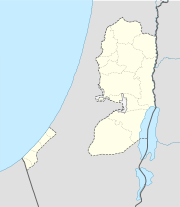
Deir Al-balah (Palästinensische Autonomiegebiete)
DEC
Deir Al-balah
Deir Al-balah

Dair al-Balah (arabischدير البلح‎, DMG Dayr al-Balaḥ) ist eine palästinensische Stadt im Dair al-Balah Gouvernement, im Gazastreifen. Sie liegt 19 Kilometer südwestlich von Gaza-Stadt und 1,5 Kilometer von der Mittelmeer-Küste entfernt. In der Stadt ist die Verwaltung der zentralen Region des Gazastreifens angesiedelt. Die Stadt hatte 2006 49.751 Einwohner [1], seit 2005 hält die Hamas 13 der 15 Sitze des Stadtparlaments[2] und stellt somit auch den Bürgermeister, Ahmad Kurd.

Die Stadt war seit 2001 häufig Ziel israelischer Militäroperationen, zuletzt bei der Operation Gegossenes Blei[3] mit der Begründung, sie sei Basis für Abschüsse von Qassam-Raketen gegen Israel.

Im UNRWA-Flüchtlingslager Dair al-Balah leben 20.215 Menschen. [4]

Siehe auch

Einzelnachweise

  1. Statistische Angaben
  2. Washington Post:Hamas Dominates Local Vote in Gaza
  3. Israels Offensive geht weiter - Sarkozy trifft Assad
  4. GAZA REFUGEE CAMP PROFILES. In: http://www.un.org/unrwa/. UNRWA, 31. Dezember 2006, S. 1. Abgerufen am 16. März 2009. (Englisch)

31.41899434.3516037Koordinaten: 31° 25′ N, 34° 21′ O


Wikimedia Foundation.

Игры ⚽ Поможем написать реферат

Schlagen Sie auch in anderen Wörterbüchern nach:

  • Deir al-Balah — This article is about a Palestinian city. For the nearby refugee camp, see Deir el Balah camp. Deir el Balah Other transcription(s)  – Arabic دير البلح  – Also spelled Deir al Balah (official) Dayr al Balah (unofficial) …   Wikipedia

  • Deir Al Balah — Admin ASC 2 Code Orig. name Deir Al Balah Country and Admin Code PS.GZ.7870268 PS …   World countries Adminstrative division ASC I-II

  • Deir al-Balah camp — This article is about the refugee camp. For the nearby city, see Deir el Balah. Deir al Balah camp Other transcription(s)    Arabic مخيّم دير البلح …   Wikipedia

  • Deir al-Balah Governorate — Gaza Strip Palestinian territories v · …   Wikipedia

  • Gobernación de Deir el-Balah — محافظة دير البلح Organización territorial de Palestina …   Wikipedia Español

  • Deir 'Ammar (camp) — Deir Ammar Refugee Camp Other transcription(s)    Arabic مخيّم دير عمّار …   Wikipedia

  • DEIR (Dayr) AL-BALAH — DEIR (Dayr) AL BALAH, Arab town in southern Ereẓ Israel, 8½ mi. (13.7 km.) southwest of gaza . It appears to have existed since Byzantine times, when it bore the name Darom or Kefar Darom and Jews were among its inhabitants. Under the early… …   Encyclopedia of Judaism

  • Dair Al-Balah — Deir Al balah دير البلح דיר אל בלח Staat: Paläst. Autonomiegebiete Gebiet: Gazastre …   Deutsch Wikipedia

  • Dair al-Balah Gouvernement — Gouvernement Dair al Balah محافظة دير البلح Gouvernements der Palästinensischen Autonomiebehörde Palestine …   Deutsch Wikipedia

  • Dayr al Balah — Original name in latin Dayr al Bala Name in other language Belar, Dayr al Balah, Dayr al Bala Deir el Balah, Der el Bela, Dier El Balah, dyr alblh State code PS Continent/City Asia/Gaza longitude 31.41783 latitude 34.35033 altitude 19 Population… …   Cities with a population over 1000 database

Share the article and excerpts

Direct link
Do a right-click on the link above
and select “Copy Link”