Ethelsville

Ethelsville
Ethelsville
Pickens County Alabama Incorporated and Unincorporated areas Ethelsville Highlighted.svg
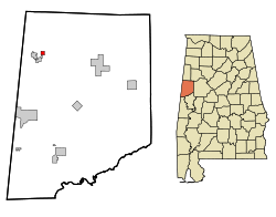
Lage im County und im Bundesstaat
Basisdaten
Staat: Vereinigte Staaten
Bundesstaat: Alabama
County:

Pickens County

Koordinaten: 33° 25′ N, 88° 13′ W33.413333333333-88.215277777778111Koordinaten: 33° 25′ N, 88° 13′ W
Zeitzone: Central Standard Time (UTC−6)
Einwohner: 78 (Stand: 2005)
Bevölkerungsdichte: 52 Einwohner je km²
Fläche: 1,5 km² (ca. 1 mi²)
davon 1,5 km² (ca. 1 mi²) Land
Höhe: 111 m
Postleitzahl: 35461
Vorwahl: +1 205
FIPS: 01-24472
GNIS-ID: 0118045

Ethelsville ist ein Ort im Pickens County, Alabama, USA. Die Gesamtfläche des Ortes beträgt 1,5 km². Nach einer Schätzung aus dem Jahr 2005 hatte Ethelsville 78 Einwohner.

Demographie

Nach der Volkszählung aus dem Jahr 2000 hatte Ethelsville 81 Einwohner, die sich auf 37 Haushalte und 23 Familien verteilten. Die Bevölkerungsdichte betrug somit 54,9 Einwohner/km². 86,42% der Bevölkerung waren weiß, 13,58% afromamerikanisch. In 21,6% der Haushalte lebten Kinder unter 18 Jahren. Das Durchschnittseinkommen betrug 29375 Dollar pro Haushalt, wobei 33,9% der Bevölkerung unterhalb der Armutsgrenze lebten.

Weblink


Wikimedia Foundation.

Игры ⚽ Нужна курсовая?

Schlagen Sie auch in anderen Wörterbüchern nach:

  • Ethelsville — Ethelsville, AL U.S. town in Alabama Population (2000): 81 Housing Units (2000): 43 Land area (2000): 0.565579 sq. miles (1.464843 sq. km) Water area (2000): 0.000000 sq. miles (0.000000 sq. km) Total area (2000): 0.565579 sq. miles (1.464843 sq …   StarDict's U.S. Gazetteer Places

  • Ethelsville, AL — U.S. town in Alabama Population (2000): 81 Housing Units (2000): 43 Land area (2000): 0.565579 sq. miles (1.464843 sq. km) Water area (2000): 0.000000 sq. miles (0.000000 sq. km) Total area (2000): 0.565579 sq. miles (1.464843 sq. km) FIPS code:… …   StarDict's U.S. Gazetteer Places

  • Ethelsville, Alabama — Infobox Settlement official name = Ethelsville, Alabama settlement type = Town imagesize = image caption = image imagesize = image caption = image mapsize = 250px map caption = Location in Pickens County and the state of Alabama mapsize1 = map… …   Wikipedia

  • 35461 — Ethelsville, Al (Miscellaneous » ZIP Codes) …   Abbreviations dictionary

  • Liste der wichtigsten Städte in Alabama — Abbeville Abel Abernant Ada Adamsville Addison Adger Akron Alabama Port Alabaster Alberta Albertville Alexander City Alexandria Aliceville Allgood Alma Alpine Alton Altoona Andalusia Anderson Annemanie …   Deutsch Wikipedia

  • Pickens County, Alabama — Verwaltung US Bundesstaat: Alabama Verwaltungssitz: Carrollton Adresse des Verwaltungssitzes: County Courthouse P.O. Box 460 Carrollton, AL 35447 0460 Gründu …   Deutsch Wikipedia

  • Pickens County, Alabama — Infobox U.S. County county = Pickens County state = Alabama map size = 175 founded = December 20, 1820 seat = Carrollton largest city = Aliceville area total sq mi =890 area land sq mi =881 area water sq mi =9 area percentage = (0.97%) census yr …   Wikipedia

  • McMullen, Alabama —   Town   Location in …   Wikipedia

  • Memphis, Alabama —   Town   Location in …   Wikipedia

  • Alabama locations by per capita income — Alabama has the thirty eighth highest per capita income in the United States of America, at $18,189 (2000). Its personal per capita income is $26,338 (2003), the fortieth highest in the country. Its median household income is $34,135 (2000),… …   Wikipedia

Share the article and excerpts

Direct link
Do a right-click on the link above
and select “Copy Link”