- Amak Island
-
Amak Island Amak Island Gewässer Beringmeer Inselgruppe Fox Islands Geographische Lage 55° 25′ 2,5″ N, 163° 8′ 58″ W55.417361-163.149444488Koordinaten: 55° 25′ 2,5″ N, 163° 8′ 58″ W Fläche 15 km² Höchste Erhebung Mount Amak
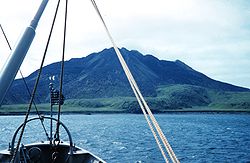
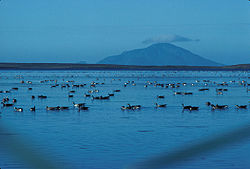
488 mEinwohner (unbewohnt) Die Izembek Lagune und Amak Island Amak Island ist die östlichste Insel der Aleuten und gehört zu den Fox Islands (Alaska). Sie liegt nördlich der Westspitze der Alaska-Halbinsel und nordwestlich von Cold Bay.
Die Vulkaninsel mit einer Fläche von 15 km² erreicht eine Höhe von 488 m. Die höchste Erhebung ist der Schichtvulkan Mount Amak.
Weblinks
- Amak Island im Geographic Names Information System des United States Geological Survey
- Amak Island im Global Volcanism Program der Smithsonian Institution (englisch)
Inseln der Fox IslandsAmak | Amaknak | Ananiuliak | Bird | Bogoslof | Breadloaf | Buck | Caton | Chagulak | Deer | Dushkot | Egg | Emerald | Expedition | Fire | Gargoyle | Gull | Hog | Kigul | Krenitzin | Kudiakof | Ogangen | Ogchul | Pancake Rock | Peter | Poa | Pustoi | The Signals | Samalga | Sanak | Sedanka | Sushilnoi | Tangik | Tanginak | Umnak | Unalaska | Unalga | Unimak | Vsevidof | Wislow
Wikimedia Foundation.
Schlagen Sie auch in anderen Wörterbüchern nach:
Amak Island — Location map Alaska label= lat=55.517362 long= 162.949719 position=right width=250 float=right caption=Location in AlaskaAmak Island (Amax [Bergsland, K Aleut Dictionary Fairbanks: Alaska Native Language Center, 1994] in Aleut) is a stratovolcano … Wikipedia
Amak Volcano — Amak Volcano … Wikipedia
Mount Amak — Amak Island Höhe 488 m … Deutsch Wikipedia
Mount Amak — Infobox Mountain Name=Mount Amak Photo=AmakIsland.jpg Caption=Amak Island Elevation=1,601 feet (488 metres) Location=Amak Island, Alaska, USA Range = Aleutian Range Prominence = Coordinates = coord|55|25|27|N|163|08|57|W|type:mountain region:US… … Wikipedia
Unalaska Island — Unalaska ist eine Insel der Fox Islands in der Mitte der Aleuten, südwestlich von Alaska in den Vereinigten Staaten. Die Insel ist 2721 km² (1051 Quadratmeilen) groß. Im Nordosten, der Beringsee zugewandten Seite der Insel liegt die Stadt… … Deutsch Wikipedia
Nunivak Island — Nunivak Maskette – Nunivak … Wikipedia
Medny Island — Map showing position of Commander Islands to the east of Kamchatka. The smaller island in the east is Medny and the larger island is Bering Island. Medny Island (also spelled Mednyy, Russian: остров Медный, sometimes called Copper Island in… … Wikipedia
Unalaska Island — Unalaska Native name: Nawan Alaxsxa[1] Map of the island … Wikipedia
Nelson Island (Alaska) — Nelson Native name: Qaluyaaq … Wikipedia
Bogoslof Island — Luftaufnahme von Bogoslof Island Gewässer Beringmeer Inselgruppe … Deutsch Wikipedia