Chagulak Island

Chagulak Island
Chagulak
Chagulak Island.jpg
Höhe 1.142 m
Lage Aleuten, USA
Geographische Lage 52° 34′ 20″ N, 171° 8′ 29″ W52.5722222-171.14138891142Koordinaten: 52° 34′ 20″ N, 171° 8′ 29″ W
Chagulak Island (Alaska)
Chagulak Island
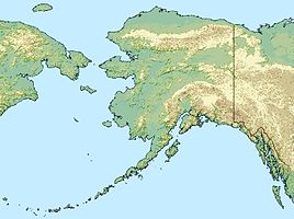
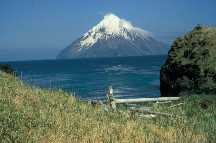
Typ Schichtvulkan
Letzte Eruption (nicht bekannt)

Der Schildvulkan Chagulak bildet die Insel Chagulak und liegt in den zentralen Aleuten zwischen Yunaska Island und Amukta Island. Die etwa 4 km lange und 1142 hohe Vulkan-Insel wurde erstmals von Gawriil Andrejewitsch Sarytschew als Ostrov Chugul beschrieben. Um Verwechslungen mit dem gleichnamigen Chugul Island zu vermeiden wurde die Insel 1931 von der United States Geological Survey in Chagulak Island umbenannt.

Weblinks

 Commons: Chagulak Island – Sammlung von Bildern, Videos und Audiodateien

Wikimedia Foundation.

Игры ⚽ Поможем написать реферат

Schlagen Sie auch in anderen Wörterbüchern nach:

  • Chagulak Island — Location in Alaska …   Wikipedia

  • Unalaska Island — Unalaska ist eine Insel der Fox Islands in der Mitte der Aleuten, südwestlich von Alaska in den Vereinigten Staaten. Die Insel ist 2721 km² (1051 Quadratmeilen) groß. Im Nordosten, der Beringsee zugewandten Seite der Insel liegt die Stadt… …   Deutsch Wikipedia

  • Uliaga Island — Location map Alaska label= lat=53.1314 long= 170.9595 position=right width=250 float=right caption=Location in AlaskaUliaga Island (also spelled Uliagan , Ouliaga , and Ouilliaghui [cite book|url=http://books.google.com/books?id=dUQMAAAAYAAJ… …   Wikipedia

  • Buldir Island — Luftaufnahme von Buldir Island Gewässer Pazifischer Ozean …   Deutsch Wikipedia

  • Amukta Island — Amukta Höhe 1.066 m L …   Deutsch Wikipedia

  • Nunivak Island — Nunivak Maskette – Nunivak …   Wikipedia

  • Medny Island — Map showing position of Commander Islands to the east of Kamchatka. The smaller island in the east is Medny and the larger island is Bering Island. Medny Island (also spelled Mednyy, Russian: остров Медный, sometimes called Copper Island in… …   Wikipedia

  • Unalaska Island — Unalaska Native name: Nawan Alaxsxa[1] Map of the island …   Wikipedia

  • Nelson Island (Alaska) — Nelson Native name: Qaluyaaq …   Wikipedia

  • Bogoslof Island — Luftaufnahme von Bogoslof Island Gewässer Beringmeer Inselgruppe …   Deutsch Wikipedia

Share the article and excerpts

Direct link
Do a right-click on the link above
and select “Copy Link”