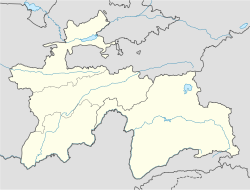
Konibodom

Konibodom
Konibodom (Tadschikistan)
Konibodom
Konibodom

Konibodom (Tadschikisch: Конибодом; Persisch: ‏کانِ بادام‎) ist eine Stadt in der Provinz Sughd im Norden Tadschikistans und gilt als das westliche Tor zum Ferganatal. In Konibodom leben Tadschiken, Usbeken, Russen und Kirgisen. Verkehrssprachen sind Tadschikisch und Usbekisch. Im Jahr 2000 hatte die Stadt ca. 45.000 Einwohner. Die Stadtfläche beträgt 828,9 km².

Inhaltsverzeichnis

Geographie und Klima

Die Stadt liegt im südwestlichen Teil des Ferganatales am Fergana-Kanal 79 km östlich von Chodschent und sechs Kilometer von der Eisenbahnstation Konibodom auf 350 bis 600 m Höhe. Das Klima ist trocken subtropisch, die Jahresdurchschnittstemperatur liegt bei 14,4 °C. Im Sommer wird es bis zu 45 °C heiß, im Winter (Anfang November bis Ende März) werden bis 28 °C minus erreicht.

Geschichte

Konibodom wurde urkundlich zum ersten Mal 1463 erwähnt. Es ist eine der alten asiatischen Städte an der Seidenstraße. Konibodom hat die Stadtrechte seit 1937. An architektonischen Sehenswürdigkeiten sind zwei Medressen - Mir Radschab Dochdo (16. Jahrhundert) und Oim (17. Jahrhundert) - Moscheen und das Mausoleum Langari Bobo vorhanden.

Wirtschaft

Hauptwirtschaftszweige sind Baumwollverarbeitung, Textilindustrie und Lebensmittelproduktion. Die Stadt ist ein Zentrum des traditionellen Kunsthandwerks.

Siehe auch

40.285370.4305421

Weblinks


Wikimedia Foundation.

Игры ⚽ Поможем написать курсовую

Schlagen Sie auch in anderen Wörterbüchern nach:

  • Konibodom — Ubicación de Konibodom en Tayikistán. Konibodom o Kanibadam (en tayiko Конибодом) es una ciudad y un distrito situados en la zona occidental del valle de Fergana, de la provincia de Sughd en Tayikistán …   Wikipedia Español

  • Konibodom — Infobox Settlement official name =Konibodom native name = imagesize = image caption = image map caption = pushpin pushpin label position =bottom pushpin mapsize = 300 pushpin map caption =Location in Tajikistan subdivision type = Country… …   Wikipedia

  • Konibodom — Original name in latin Konibodom Name in other language Kanibadam, Konibodom, Кoнибодом, Канибадам State code TJ Continent/City Asia/Dushanbe longitude 40.29414 latitude 70.43122 altitude 409 Population 50359 Date 2012 04 05 …   Cities with a population over 1000 database

  • Konibodom district — or Nohiya i Konibodom (Ta/PA: Ноҳияи Конибодом,ناحیۀ کان بادام) is a district in Sughd province, Tajikistan. Its capital is Konibodom …   Wikipedia

  • Nohiyai Konibodom — Admin ASC 2 Code Orig. name Nohiyai Konibodom Country and Admin Code TJ.03.8213699 TJ …   World countries Adminstrative division ASC I-II

  • Ortikov —   Town and Jamoat   Country  Tajikistan Province Sug …   Wikipedia

  • Districts of Tajikistan — Tajikistan …   Wikipedia

  • Organización territorial de Tayikistán — Divisiones administrativas: División Administrativa de Tayikistán: 1. Sughd 2. Karotegin 3. Khatlon 4. Alto Badajshán …   Wikipedia Español

  • List of cities in Tajikistan — This is a list of cities in Tajikistan. The largest metropolitan area in Tajikistan is that of the capital Dushanbe, with 843,252. Thirteen percent of the population of the country lives in the region of the capital. Contents 1 Cities of more… …   Wikipedia

  • Sughd — Geobox Region name = Sughd native name = other name = other name1 = category = image size = image caption = flag size = symbol = symbol size = country = Tajikistan state = region = district = capital = Khujand capital type = Capital capital lat d …   Wikipedia

Share the article and excerpts

Direct link
Do a right-click on the link above
and select “Copy Link”