- Nelson County (Kentucky)
-
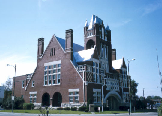
 Nelson County Courthouse in Bardstown
Verwaltung US-Bundesstaat: Kentucky Verwaltungssitz: Bardstown Adresse des
Verwaltungssitzes:County Courthouse
113 E. Stephen Foster Avenue
Bardstown, KY 40004-1500Gründung: 18. Oktober 1784 Gebildet aus: Jefferson County Vorwahl: 001 502 Demographie Einwohner: 37.477 (2000) Bevölkerungsdichte: 34,3 Einwohner/km² Geographie Fläche gesamt: 1.098 km² Wasserfläche: 4 km² Karte 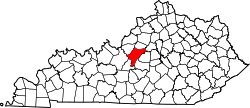
Nelson County[1] ist ein County im US-Bundesstaat Kentucky der Vereinigten Staaten von Amerika. Bei der Volkszählung im Jahr 2000 hatte das County 37.477 Einwohner und eine Bevölkerungsdichte von 34 Einwohner pro Quadratkilometer. Der Verwaltungssitz (County Seat) ist Bardstown, das nach William Bard, einem Förderer der Stadt benannt wurde.
Inhaltsverzeichnis
Geografie
Das County liegt etwas nördlich des geographischen Zentrums von Kentucky, ist im Nordwesten etwa 50 km vom Bundesstaat Indiana entfernt und hat eine Fläche von 1098 Quadratkilometern, wovon 4 Quadratkilometer Wasserfläche sind. Es grenzt im Uhrzeigersinn an folgende Countys: Spencer County, Anderson County, Washington County, Marion County, LaRue County, Hardin County und Bullitt County.
Geschichte
Nelson County wurde am 18. Oktober 1784 aus Teilen des Jefferson County gebildet. Benannt wurde es nach Thomas Nelson junior, einem Unterzeichner der Unabhängigkeitserklärung.
Demografische Daten
Historische Einwohnerzahlen Census Einwohner ± in % 1790 11.315 — 1800 9866 -10 % 1810 14.078 40 % 1820 16.273 20 % 1830 14.932 -8 % 1840 13.637 -9 % 1850 14.789 8 % 1860 15.799 7 % 1870 14.804 -6 % 1880 16.609 10 % 1890 16.417 -1 % 1900 16.587 1 % 1910 16.830 1 % 1920 16.137 -4 % 1930 16.551 3 % 1940 18.004 9 % 1950 19.521 8 % 1960 22.168 10 % 1970 23.477 6 % 1980 27.584 20 % 1990 29.710 8 % 2000 37.477 30 % Vor 1900[2] 1900–1990[3]
Nach der Volkszählung im Jahr 2000 lebten im Nelson County 37.477 Menschen in 13.953 Haushalten und 10.269 Familien. Die Bevölkerungsdichte betrug 34 Einwohner pro Quadratkilometer. Ethnisch betrachtet setzte sich die Bevölkerung zusammen aus 92,84 Prozent Weißen, 5,51 Prozent Afroamerikanern, 0,13 Prozent amerikanischen Ureinwohnern, 0,51 Prozent Asiaten, 0,02 Prozent Bewohnern aus dem pazifischen Inselraum und 0,37 Prozent aus anderen ethnischen Gruppen; 0,63 Prozent stammten von zwei oder mehr Ethnien ab. 1,05 Prozent der Bevölkerung waren spanischer oder lateinamerikanischer Abstammung.
Von den 13.953 Haushalten hatten 38,0 Prozent Kinder und Jugendliche unter 18 Jahren, die bei ihnen lebten. 56,9 Prozent waren verheiratete, zusammenlebende Paare, 12,1 Prozent waren allein erziehende Mütter, 26,4 Prozent waren keine Familien, 22,3 Prozent waren Singlehaushalte und in 7,5 Prozent lebten Menschen im Alter von 65 Jahren oder darüber. Die Durchschnittshaushaltsgröße betrug 2,64 und die durchschnittliche Familiengröße lag bei 3,08 Personen.
Auf das gesamte County bezogen setzte sich die Bevölkerung zusammen aus 27,7 Prozent Einwohnern unter 18 Jahren, 8,7 Prozent zwischen 18 und 24 Jahren, 30,8 Prozent zwischen 25 und 44 Jahren, 22,2 Prozent zwischen 45 und 64 Jahren und 10,6 Prozent waren 65 Jahre alt oder darüber. Das Durchschnittsalter betrug 35 Jahre. Auf 100 weibliche Personen kamen 96,7 männliche Personen. Auf 100 Frauen im Alter von 18 Jahren oder darüber kamen statistisch 94,5 Männer.
Das jährliche Durchschnittseinkommen eines Haushalts betrug 39.010 United States Dollar, das Durchschnittseinkommen der Familien betrug 44.600 USD. Männer hatten ein Durchschnittseinkommen von 32.015 USD, Frauen 21.838 USD. Das Prokopfeinkommen betrug 18.120 USD. 10,0 Prozent der Familien und 12,2 Prozent der Bevölkerung lebten unterhalb der Armutsgrenze. Davon waren 15,7 Prozent Kinder oder Jugendliche unter 18 Jahre und 17,4 Prozent waren Menschen über 65 Jahre. [4]
Einzelnachweise
- ↑ GNIS-ID: 516936. Abgerufen am 22. Februar 2011 (englisch).
- ↑ U.S. Census Bureau _ Census of Population and Housing. Abgerufen am 18. Februar 2011
- ↑ Auszug aus Census.gov. Abgerufen am 18. Februar 2011
- ↑ Nelson County, Kentucky, Datenblatt mit den Ergebnissen der Volkszählung im Jahre 2000 bei factfinder.census.gov.
Weblinks

Liste der Countys in Kentucky
Adair | Allen | Anderson | Ballard | Barren | Bath | Bell | Boone | Bourbon | Boyd | Boyle | Bracken | Breathitt | Breckinridge | Bullitt | Butler | Caldwell | Calloway | Campbell | Carlisle | Carroll | Carter | Casey | Christian | Clark | Clay | Clinton | Crittenden | Cumberland | Daviess | Edmonson | Elliott | Estill | Fayette | Fleming | Floyd | Franklin | Fulton | Gallatin | Garrard | Grant | Graves | Grayson | Green | Greenup | Hancock | Hardin | Harlan | Harrison | Hart | Henderson | Henry | Hickman | Hopkins | Jackson | Jefferson | Jessamine | Johnson | Kenton | Knott | Knox | LaRue | Laurel | Lawrence | Lee | Leslie | Letcher | Lewis | Lincoln | Livingston | Logan | Lyon | Madison | Magoffin | Marion | Marshall | Martin | Mason | McCracken | McCreary | McLean | Meade | Menifee | Mercer | Metcalfe | Monroe | Montgomery | Morgan | Muhlenberg | Nelson | Nicholas | Ohio | Oldham | Owen | Owsley | Pendleton | Perry | Pike | Powell | Pulaski | Robertson | Rockcastle | Rowan | Russell | Scott | Shelby | Simpson | Spencer | Taylor | Todd | Trigg | Trimble | Union | Warren | Washington | Wayne | Webster | Whitley | Wolfe | Woodford

Wikimedia Foundation.