- Johnson County (Kentucky)
-
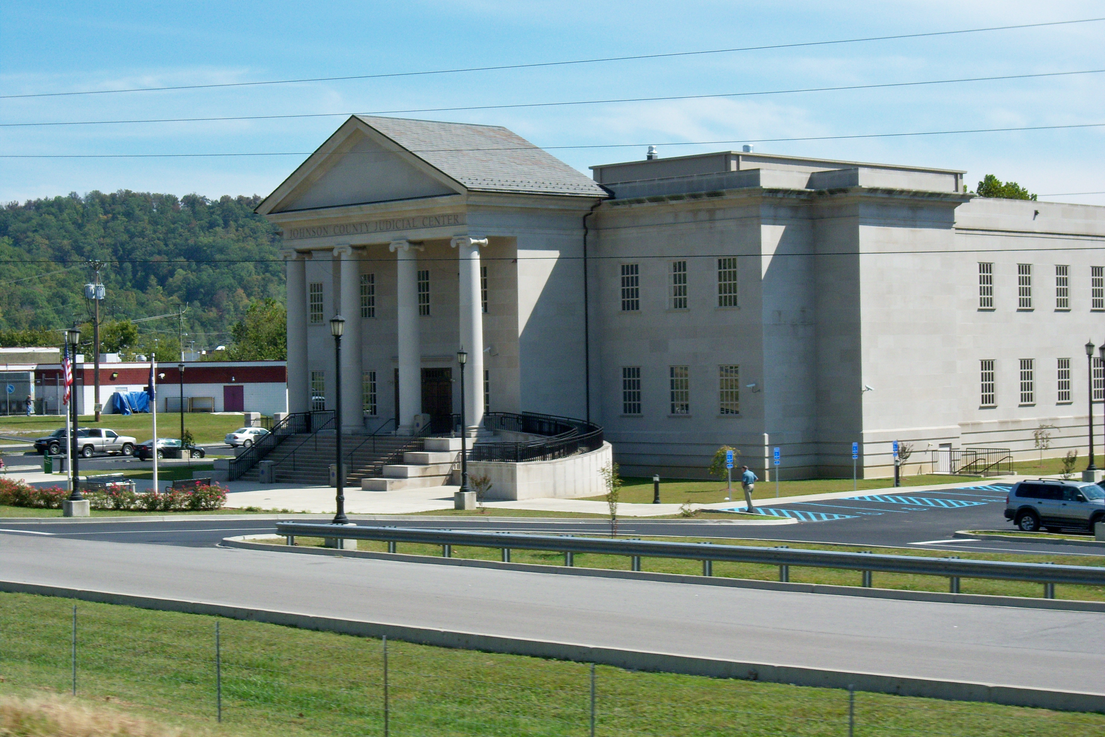
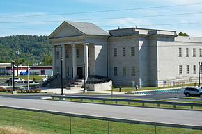 Johnson County Judicial Center in Paintsville
Verwaltung US-Bundesstaat: Kentucky Verwaltungssitz: Paintsville Adresse des
Verwaltungssitzes:County Courthouse
P.O. Box 868
Paintsville, KY 41240-0868Gründung: 24. Februar 1843 Gebildet aus: Floyd County
Lawrence County
Morgan CountyVorwahl: 001 606 Demographie Einwohner: 23.445 (2000) Bevölkerungsdichte: 34,6 Einwohner/km² Geographie Fläche gesamt: 684 km² Wasserfläche: 6 km² Karte 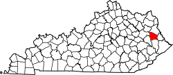
Johnson County[1] ist ein County im Bundesstaat Kentucky der Vereinigten Staaten von Amerika. Bei der Volkszählung im Jahr 2000 hatte das County 23.445 Einwohner und eine Bevölkerungsdichte von 35 Einwohnern pro Quadratkilometer. Der Verwaltungssitz (County Seat) ist Paintsville, das nach dem Paint Creek benannt wurde, an dem es liegt. Das County gehört zu den Dry Countys, was bedeutet, dass der Verkauf von Alkohol eingeschränkt oder verboten ist.
Inhaltsverzeichnis
Geografie
Das County liegt im Osten von Kentucky, ist etwa 30 km von West Virginia entfernt und hat eine Fläche von 684 Quadratkilometern, wovon 6 Quadratkilometer Wasserfläche sind. Es grenzt im Uhrzeigersinn an folgende Countys: Lawrence County, Martin County, Floyd County, Magoffin County und Morgan County.
Geschichte
Johnson County wurde am 24. Februar 1843 aus Teilen des Floyd County, Lawrence County und Morgan County gebildet. Benannt wurde es nach Richard M. Johnson, einem General, US-Senator, Mitglied im US-Kongress und Vize-Präsident.
Demografische Daten
Historische Einwohnerzahlen Census Einwohner ± in % 1850 3873 — 1860 5306 40 % 1870 7494 40 % 1880 9155 20 % 1890 11.027 20 % 1900 13.730 20 % 1910 17.482 30 % 1920 19.622 10 % 1930 22.968 20 % 1940 25.771 10 % 1950 23.846 -7 % 1960 19.748 -20 % 1970 17.539 -10 % 1980 24.432 40 % 1990 23.248 -5 % 2000 23.445 0,8 % Vor 1900[2] 1900–1990[3]
Nach der Volkszählung im Jahr 2000 lebten im Johnson County 23.445 Menschen in 9.103 Haushalten und 6.863 Familien. Die Bevölkerungsdichte betrug 35 Einwohner pro Quadratkilometer. Ethnisch betrachtet setzte sich die Bevölkerung zusammen aus 98,64 Prozent Weißen, 0,25 Prozent Afroamerikanern, 0,13 Prozent amerikanischen Ureinwohnern, 0,29 Prozent Asiaten, 0,02 Prozent Bewohnern aus dem pazifischen Inselraum und 0,09 Prozent aus anderen ethnischen Gruppen; 0,58 Prozent stammten von zwei oder mehr Ethnien ab. 0,61 Prozent der Bevölkerung waren spanischer oder lateinamerikanischer Abstammung.
 Alterspyramide für das Johnson County
Von den 9.103 Haushalten hatten 34,1 Prozent Kinder und Jugendliche unter 18 Jahre, die bei ihnen lebten. 60,5 Prozent waren verheiratete, zusammenlebende Paare, 11,3 Prozent waren allein erziehende Mütter, 24,6 Prozent waren keine Familien, 22,3 Prozent waren Singlehaushalte und in 9,0 Prozent lebten Menschen im Alter von 65 Jahren oder darüber. Die Durchschnittshaushaltsgröße betrug 2,52 und die durchschnittliche Familiengröße lag bei 2,93 Personen.
Auf das gesamte County bezogen setzte sich die Bevölkerung zusammen aus 24,0 Prozent Einwohnern unter 18 Jahren, 8,8 Prozent zwischen 18 und 24 Jahren, 28,9 Prozent zwischen 25 und 44 Jahren, 25,7 Prozent zwischen 45 und 64 Jahren und 12,6 Prozent waren 65 Jahre alt oder darüber. Das Durchschnittsalter betrug 37 Jahre. Auf 100 weibliche Personen kamen 93,1 männliche Personen. Auf 100 Frauen im Alter von 18 Jahren alt oder darüber kamen statistisch 90,7 Männer.
Das jährliche Durchschnittseinkommen eines Haushalts betrug US-$ 24.911, das Durchschnittseinkommen der Familien betrug US-$ 29.142. Männer hatten ein Durchschnittseinkommen von US-$ 29.762, Frauen US-$ 20.136. Das Prokopfeinkommen betrug US-$ 14.051. 21,7 Prozent der Familien und 26,6 Prozent der Bevölkerung lebten unterhalb der Armutsgrenze. Davon waren 35,5 Prozent Kinder oder Jugendliche unter 18 Jahre und 19,3 Prozent waren Menschen über 65 Jahre. [4]
Einzelnachweise
- ↑ GNIS-ID: 516904. Abgerufen am 22. Februar 2011 (englisch).
- ↑ U.S. Census Bureau _ Census of Population and Housing. Abgerufen am 18. Februar 2011
- ↑ Auszug aus Census.gov. Abgerufen am 18. Februar 2011
- ↑ Johnson County, Kentucky, Datenblatt mit den Ergebnissen der Volkszählung im Jahre 2000 bei factfinder.census.gov.

Liste der Countys in Kentucky
Adair | Allen | Anderson | Ballard | Barren | Bath | Bell | Boone | Bourbon | Boyd | Boyle | Bracken | Breathitt | Breckinridge | Bullitt | Butler | Caldwell | Calloway | Campbell | Carlisle | Carroll | Carter | Casey | Christian | Clark | Clay | Clinton | Crittenden | Cumberland | Daviess | Edmonson | Elliott | Estill | Fayette | Fleming | Floyd | Franklin | Fulton | Gallatin | Garrard | Grant | Graves | Grayson | Green | Greenup | Hancock | Hardin | Harlan | Harrison | Hart | Henderson | Henry | Hickman | Hopkins | Jackson | Jefferson | Jessamine | Johnson | Kenton | Knott | Knox | LaRue | Laurel | Lawrence | Lee | Leslie | Letcher | Lewis | Lincoln | Livingston | Logan | Lyon | Madison | Magoffin | Marion | Marshall | Martin | Mason | McCracken | McCreary | McLean | Meade | Menifee | Mercer | Metcalfe | Monroe | Montgomery | Morgan | Muhlenberg | Nelson | Nicholas | Ohio | Oldham | Owen | Owsley | Pendleton | Perry | Pike | Powell | Pulaski | Robertson | Rockcastle | Rowan | Russell | Scott | Shelby | Simpson | Spencer | Taylor | Todd | Trigg | Trimble | Union | Warren | Washington | Wayne | Webster | Whitley | Wolfe | Woodford
Wikimedia Foundation.
Schlagen Sie auch in anderen Wörterbüchern nach:
Johnson County, Kentucky — Infobox U.S. County county = Johnson County state = Kentucky founded year = 1843 founded date = seat wl = Paintsville area total sq mi = 264 area total km2 = 684 area land sq mi = 262 area land km2 = 677 area water sq mi = 2 area water km2 = 6… … Wikipedia
National Register of Historic Places listings in Johnson County, Kentucky — Location of Johnson County in Kentucky This is a list of the National Register of Historic Places listings in Johnson County, Kentucky. This is intended to be a complete list of the properties and districts on the National Register of Historic… … Wikipedia
Johnson County — is the name of several counties in the United States: Johnson County, Arkansas Johnson County, Georgia Johnson County, Illinois Johnson County, Indiana Johnson County, Iowa Johnson County, Kansas Johnson County, Kentucky Johnson County, Missouri… … Wikipedia
Johnson County — Es gibt in den Vereinigten Staaten zwölf Countys mit dem Namen Johnson County: Johnson County (Arkansas) Johnson County (Georgia) Johnson County (Illinois) Johnson County (Indiana) Johnson County (Iowa) Johnson County (Kansas) Johnson County… … Deutsch Wikipedia
Johnson County, Illinois — Infobox U.S. County county = Johnson County state = Illinois seallink = map size = 150 founded = 1812 seat = Vienna largest city = Vienna area total sq mi = 349 area total km2 = 904 area land sq mi = 345 area land km2 = 893 area water sq mi = 4… … Wikipedia
Johnson County (Illinois) — Verwaltung US Bundesstaat: Illinois Verwaltungssitz: Vienna Adresse des Verwaltungssitzes: Johnson County Courthouse 400 Court Sq. P.O. Box 96 Vienna, IL 62995 Gründung: 14. September 181 … Deutsch Wikipedia
Johnson County Museum of History — Masonic Temple U.S. National Register of Historic Places … Wikipedia
Johnson County — Comté de Johnson Cette page d’homonymie répertorie les différents comtés partageant un même nom. Douze comtés des États Unis portent le nom de comté de Johnson (Johnson County) : le comté de Johnson, situé dans l État de l… … Wikipédia en Français
Owsley County, Kentucky — Owsley County courthouse in Booneville, Kentucky … Wikipedia
Magoffin County, Kentucky — Magoffin County justice center in Salyersville, Kentucky … Wikipedia
Johnson County (Kentucky)


18+
© Academic, 2000-2026
- Kontaktieren Sie uns: Unterstützung, Werbung
Wörterbücher Export, schritte mit PHP, Joomla, Drupal, WordPress, MODx.