- Kenton County
-
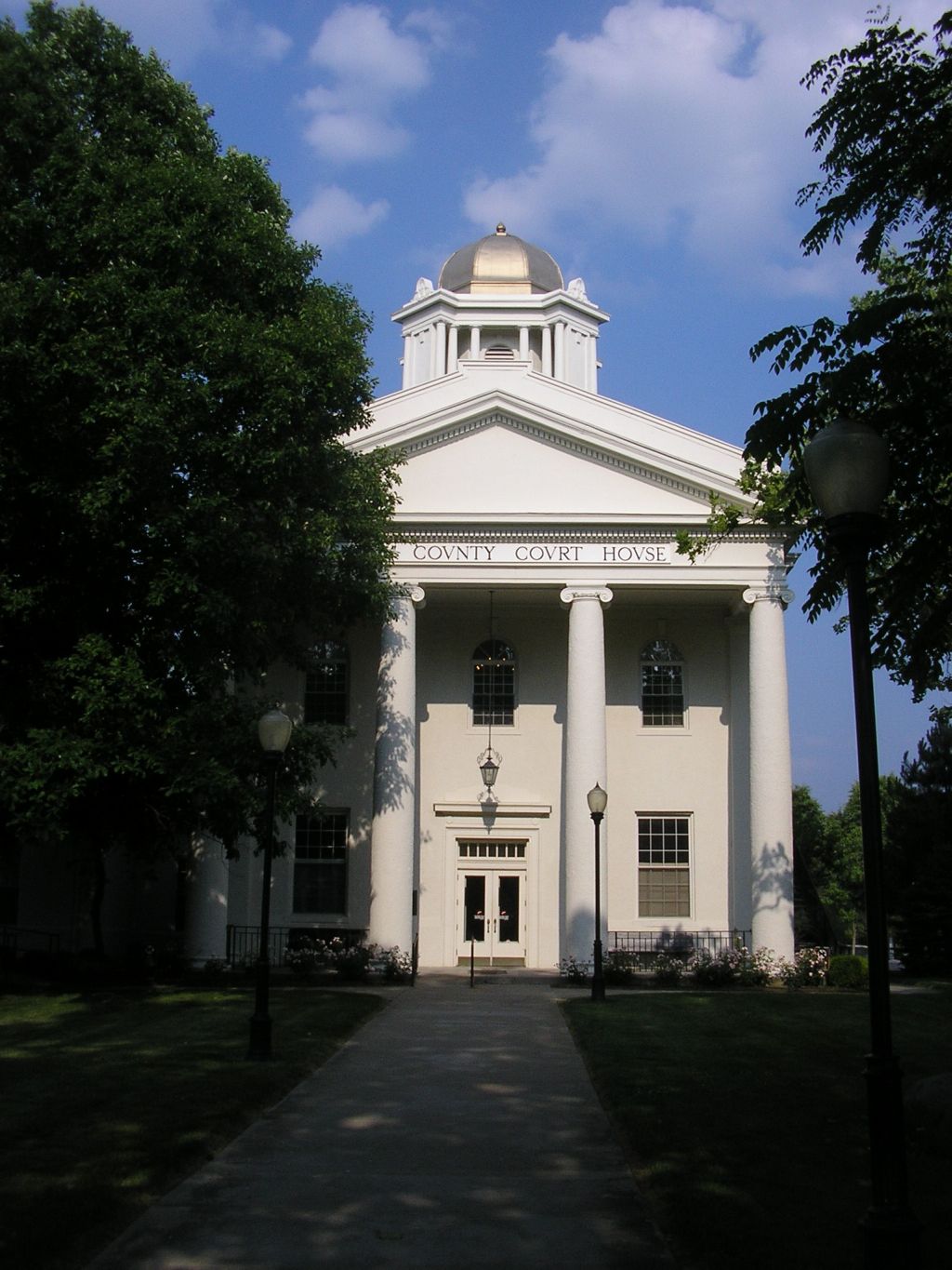
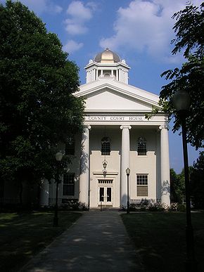 Kenton County Courthouse in Independence
Verwaltung US-Bundesstaat: Kentucky Verwaltungssitz: Covington Adresse des
Verwaltungssitzes:County Courthouse
303 Court Street
Covington, KY 41011-1639Gründung: 29. Januar 1840 Gebildet aus: Campbell County Vorwahl: 001 859 Demographie Einwohner: 151.464 (2000) Bevölkerungsdichte: 360,6 Einwohner/km² Geographie Fläche gesamt: 426 km² Wasserfläche: 6 km² Karte 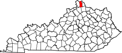
Website: www.kentoncounty.org Kenton County[1] ist ein County im US-Bundesstaat Kentucky der Vereinigten Staaten von Amerika. Bei der Volkszählung im Jahr 2000 hatte das County 151.464 Einwohner und eine Bevölkerungsdichte von 361 Einwohnern pro Quadratkilometer. Der Verwaltungssitz (County Seat) ist Covington, das nach Leonard Covington benannt wurde, einem General im Krieg von 1812.
Inhaltsverzeichnis
Geografie
Das County liegt im äußersten Norden von Kentucky, grenzt an Ohio, getrennt durch den Ohio River und hat eine Fläche von 426 Quadratkilometern, wovon 6 Quadratkilometer Wasserfläche sind. Es grenzt im Uhrzeigersinn an folgende Countys: Campbell County, Pendleton County, Grant County und Boone County.
Geschichte
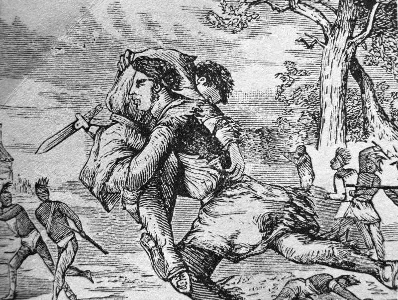
 Simon Kenton
Kenton County wurde am 29. Januar 1840 aus Teilen des Campbell County gebildet. Benannt wurde es nach Simon Kenton.
Historische Objekte
In Covington befindet sich das historische Gebäude des Bavarian Brewing Company. Das ehemalige Brauhaus wurde 1996 vom National Register of Historic Places aufgenommen.[2]
Demografische Daten
Historische Einwohnerzahlen Census Einwohner ± in % 1850 17.038 — 1860 25.467 50 % 1870 36.096 40 % 1880 43.983 20 % 1890 54.161 20 % 1900 63.591 20 % 1910 70.355 10 % 1920 73.453 4 % 1930 93.534 30 % 1940 93.139 -0,4 % 1950 104.254 10 % 1960 120.700 20 % 1970 129.440 7 % 1980 137.058 6 % 1990 142.031 4 % 2000 151.464 7 % Vor 1900[3] 1900–1990[4]
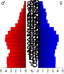 Alterspyramide für das Kenton County
Nach der Volkszählung im Jahr 2000 lebten im Kenton County 151.464 Menschen in 59.444 Haushalten und 39.470 Familien. Die Bevölkerungsdichte betrug 361 Einwohner pro Quadratkilometer. Ethnisch betrachtet setzte sich die Bevölkerung zusammen aus 93,99 Prozent Weißen, 3,84 Prozent Afroamerikanern, 0,15 Prozent amerikanischen Ureinwohnern, 0,59 Prozent Asiaten, 0,03 Prozent Bewohnern aus dem pazifischen Inselraum und 0,41 Prozent aus anderen ethnischen Gruppen; 1,00 Prozent stammten von zwei oder mehr Ethnien ab. 1,10 Prozent der Bevölkerung waren spanischer oder lateinamerikanischer Abstammung.
Von den 59.444 Haushalten hatten 33,4 Prozent Kinder und Jugendliche unter 18 Jahre, die bei ihnen lebten. 50,1 Prozent waren verheiratete, zusammenlebende Paare, 12,1 Prozent waren allein erziehende Mütter, 33,6 Prozent waren keine Familien, 27,8 Prozent waren Singlehaushalte und in 9,0 Prozent lebten Menschen im Alter von 65 Jahren oder darüber. Die Durchschnittshaushaltsgröße betrug 2,52 und die durchschnittliche Familiengröße lag bei 3,11 Personen.
Auf das gesamte County bezogen setzte sich die Bevölkerung zusammen aus 26,3 Prozent Einwohnern unter 18 Jahren, 9,2 Prozent zwischen 18 und 24 Jahren, 31,9 Prozent zwischen 25 und 44 Jahren, 21,4 Prozent zwischen 45 und 64 Jahren und 11,1 Prozent waren 65 Jahre alt oder darüber. Das Durchschnittsalter betrug 34 Jahre. Auf 100 weibliche Personen kamen 96,2 männliche Personen. Auf 100 Frauen im Alter von 18 Jahren alt oder darüber kamen statistisch 91,9 Männer.
Das jährliche Durchschnittseinkommen eines Haushalts betrug 43.906 USD, das Durchschnittseinkommen der Familien betrug 52.953 USD. Männer hatten ein Durchschnittseinkommen von 37.845 USD, Frauen 27.253 USD. Das Prokopfeinkommen betrug 22.085 USD. 7,1 Prozent der Familien und 9,0 Prozent der Bevölkerung lebten unterhalb der Armutsgrenze. Davon waren 12,0 Prozent Kinder oder Jugendliche unter 18 Jahre und 7,7 Prozent waren Menschen über 65 Jahre. [5]
Einzelnachweise
- ↑ GNIS-ID: 516905. Abgerufen am 22. Februar 2011 (englisch).
- ↑ NRIS
- ↑ U.S. Census Bureau _ Census of Population and Housing. Abgerufen am 18. Februar 2011
- ↑ Auszug aus Census.gov. Abgerufen am 18. Februar 2011
- ↑ Kenton County, Kentucky, Datenblatt mit den Ergebnissen der Volkszählung im Jahre 2000 bei factfinder.census.gov.
Weblinks
-
 Commons: Kenton County, Kentucky – Sammlung von Bildern, Videos und Audiodateien

Liste der Countys in Kentucky
Adair | Allen | Anderson | Ballard | Barren | Bath | Bell | Boone | Bourbon | Boyd | Boyle | Bracken | Breathitt | Breckinridge | Bullitt | Butler | Caldwell | Calloway | Campbell | Carlisle | Carroll | Carter | Casey | Christian | Clark | Clay | Clinton | Crittenden | Cumberland | Daviess | Edmonson | Elliott | Estill | Fayette | Fleming | Floyd | Franklin | Fulton | Gallatin | Garrard | Grant | Graves | Grayson | Green | Greenup | Hancock | Hardin | Harlan | Harrison | Hart | Henderson | Henry | Hickman | Hopkins | Jackson | Jefferson | Jessamine | Johnson | Kenton | Knott | Knox | LaRue | Laurel | Lawrence | Lee | Leslie | Letcher | Lewis | Lincoln | Livingston | Logan | Lyon | Madison | Magoffin | Marion | Marshall | Martin | Mason | McCracken | McCreary | McLean | Meade | Menifee | Mercer | Metcalfe | Monroe | Montgomery | Morgan | Muhlenberg | Nelson | Nicholas | Ohio | Oldham | Owen | Owsley | Pendleton | Perry | Pike | Powell | Pulaski | Robertson | Rockcastle | Rowan | Russell | Scott | Shelby | Simpson | Spencer | Taylor | Todd | Trigg | Trimble | Union | Warren | Washington | Wayne | Webster | Whitley | Wolfe | Woodford
Wikimedia Foundation.
Schlagen Sie auch in anderen Wörterbüchern nach:
Kenton County — Admin ASC 2 Code Orig. name Kenton County Country and Admin Code US.KY.117 US … World countries Adminstrative division ASC I-II
Kenton County, Kentucky — Infobox U.S. County county = Kenton County state = Kentucky founded year = 1840 founded date = seat = Covington, and Independence largest city wl = Covington area total sq mi = 164 area total km2 = 426 area land sq mi = 162 area land km2 = 420… … Wikipedia
Kenton County School District — The Kenton County School District (the definite article is part of the district s official name) is charged with educating the young people in a large portion of Kenton County, Kentucky. The district s boundaries are all of Kenton County with… … Wikipedia
National Register of Historic Places listings in Kenton County, Kentucky — Location of Kenton County in Kentucky This is a list of the National Register of Historic Places listings in Kenton County, Kentucky. This is intended to be a complete list of the properties and districts on the National Register of Historic… … Wikipedia
Fairview, Kenton County, Kentucky — Fairview is a city in Kenton County, Kentucky, United States. The population was 156 at the 2000 census.GeographyFairview is located at coor dms|38|59|52|N|84|29|20|W|city (38.997862, 84.488770)GR|1.According to the United States Census Bureau,… … Wikipedia
Kenton (disambiguation) — Kenton may refer to:;People *Darren Kenton *Erle C. Kenton (1896 1980), an American film director *Lou Kenton *Rodrigo Kenton *Simon Kenton *Stan Kenton (1911 1979), an American jazz musician *Kenton Noble (1992 ), a Canadian student, primarily… … Wikipedia
Kenton — ist der Name der Orte Kenton (London), Stadtteil von London, der in zwei verschiedenen Stadtbezirken (Borough of Brent, Borough of Harrow) liegt Kentone (Devon), Ort in der Grafschaft Devon Kenton (Newcastle upon Tyne) Kenton (Suffolk) in den… … Deutsch Wikipedia
County police — are the police of a county in the United States, Sweden and England (formerly in Scotland and Wales). Contents 1 Sweden 2 United Kingdom 3 United States … Wikipedia
Kenton Vale, Kentucky — Infobox Settlement official name = Kenton Vale, Kentucky settlement type = City nickname = motto = imagesize = image caption = image mapsize = 250px map caption = Location of Kenton Vale, Kentucky mapsize1 = map caption1 = subdivision type =… … Wikipedia
County seat — Many county seats in the United States feature a historic courthouse, such as Renville County, Minnesota A county seat is an administrative center, or seat of government, for a county or civil parish. The term is primarily used in the United… … Wikipedia
Kenton County


18+
© Academic, 2000-2026
- Kontaktieren Sie uns: Unterstützung, Werbung
Wörterbücher Export, schritte mit PHP, Joomla, Drupal, WordPress, MODx.