- Osturňa
-
Osturňa
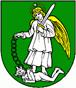
Wappen Karte 
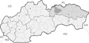

Osturňa BasisdatenKraj: Prešovský kraj Okres: Kežmarok Region: Tatry Fläche: 41,237 km² Einwohner: 332 (31. Dez. 2010) Bevölkerungsdichte: 8,05 Einwohner je km² Höhe: 717 m n.m. Postleitzahl: 059 79 Telefonvorwahl: 0 52 Geographische Lage: 49° 20′ N, 20° 15′ O49.33472222222220.241666666667717Koordinaten: 49° 20′ 5″ N, 20° 14′ 30″ O Kfz-Kennzeichen: KK Gemeindekennziffer: 523771 StrukturGemeindeart: Gemeinde Verwaltung (Stand: November 2010)Bürgermeister: Kristína Gregoričková Adresse: Obecný úrad Osturňa
153
05972 OsturňaWebpräsenz: www.osturna.obce.info Gemeindeinformation
auf portal.gov.skStatistikinformation
auf statistics.skOsturňa (deutsch Asthorn, ungarisch Osztornya - bis 1902 Oszturnya) ist eine Gemeinde in der Nordslowakei. Sie liegt am Fuße der Zipser Magura nahe der polnischen Grenze, etwa 17 km von Spišská Stará Ves und 60 km von Poprad entfernt.
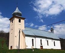 Kirche im Ort
Die Gemeinde wurde 1593 erstmals schriftlich erwähnt. Im Ort lebt eine Minderheit der Goralen. Viele für die typische goralische Kultur beispielhafte Gebäude sind erhalten geblieben, weswegen der Ort ein Volksarchitekturreservat ist.
Weblinks
Abrahámovce (Abrahamsdorf) | Bušovce (Bauschendorf) | Červený Kláštor | Havka (Haffke) | Holumnica (Hollomnitz) | Hradisko (Kuntschhöfchen) | Huncovce (Hunsdorf) | Ihľany | Jezersko (Teichenau) | Jurské (Sankt Girgen) | Kežmarok (Käsmark) | Krížová Ves (Kreuz) | Lechnica (Lechnitz) | Lendak (Landeck) | Ľubica (Leibitz) | Majere (Oberschwaben) | Malá Franková (Kleinfrankenau) | Malý Slavkov (Kleinschlagendorf) | Matiašovce (Matshaus) | Mlynčeky (Mühlerchen) | Osturňa (Asthorn) | Podhorany (Maltern) | Rakúsy (Roks) | Reľov (Rillen) | Slovenská Ves (Windschendorf) | Spišská Belá (Zipser Bela) | Spišská Stará Ves (Altendorf) | Spišské Hanušovce (Henschau) | Stará Lesná (Altwalddorf) | Stráne pod Tatrami (Forberg) | Toporec (Topporz) | Tvarožná (Durelsdorf) | Veľká Franková (Großfrankenau) | Veľká Lomnica (Großlomnitz) | Vlková (Farksdorf) | Vlkovce (Kunzendorf) | Vojňany (Kreig) | Vrbov (Menhardsdorf) | Výborná (Bierbrunn) | Zálesie (Giebel) | Žakovce (Eisdorf)

Wikimedia Foundation.