Rothorn (Zermatt)

Rothorn (Zermatt)
Rothorn
Höhe 3.103 m
Lage Bezirk Visp, Kanton Wallis, Schweiz
Gebirge Walliser Alpen
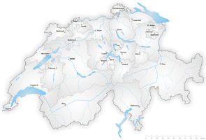
Geographische Lage (627796 / 96776)46.0219638888897.7975753103Koordinaten: 46° 1′ 19″ N, 7° 47′ 51″ O; CH1903: (627796 / 96776)
Rothorn (Schweiz)
DEC
Rothorn

Das Zermatter Rothorn ist ein 3103m hoher Bergspitz im Kanton Wallis, nahe dem weltberühmten Kurort Zermatt. Das Rothorn befindet sich ca. 5km östlich des Dorfes und markiert den obersten Punkt des Skigebiets Zermatt-Rothorn, welches von Sunnegga und Blauherd durch eine Metro, einer Gondelbahn und einer Seilbahn oder von der Kumme her mit einer Sesselbahn erreicht werden kann. Aufgrund seiner schon fast hochalpinen Lage befinden sich auf dem Gipfel nur ein kleines Restaurant, die Bergstation und eine kleine Wetterstation. Im Sommer wie im Winter zieht das Rothorn zahlreiche Touristen an. Vom Rothorn zeigt sich das Matterhorn von seiner fotogensten Seite und der Berg ist der Anfang vieler Abfahrten nach Zermatt, andererseits starten dort auch hochalpine Touren auf das Rimpfischhorn, das Strahlhorn oder nach Cima di Jazzi. Eine weitere, durchführenswerte Wanderung führt auf das Oberrothorn (3450m). Im Panorama des Rothorns befinden sich ausser dem Matterhorn die Dent Blanche, das Monte-Rosa-Massiv, das Weisshorn und die Mischabel.


Wikimedia Foundation.

Игры ⚽ Нужно сделать НИР?

Schlagen Sie auch in anderen Wörterbüchern nach:

  • Zermatt — Basisdaten Staat: Schweiz Kanton …   Deutsch Wikipedia

  • Rothorn — ist der Name folgender Berge: in Österreich: Rothorn (Lechquellengebirge), (2.239 m ü. A.), im Lechquellengebirge Rothornspitze (2.393 m ü. A.), in den Allgäuer Alpen in der Schweiz: Diemtigtaler Rothorn (2… …   Deutsch Wikipedia

  • Zermatt — Infobox Swiss town subject name = Zermatt image photo = 3802 Zermatt Matterhorn viewed from Gornergratbahn.jpg image caption = municipality name = Zermatt municipality type = municipality imagepath coa = Zermatt coat of arms.png|pixel coa=… …   Wikipedia

  • Zermatter Rothorn — Rothorn Höhe 3.103 m Lage Bezirk Visp, Kanton Wallis …   Deutsch Wikipedia

  • Rothorn — The name Rothorn comes from German: Red Peak and may refer to:*Brienzer Rothorn (2350 m), on the border of the cantons of Berne, Lucerne, Obwalden*Canton of Berne **Sigriswiler Rothorn (2051 m), above Lake Thun **Diemtigtaler Rothorn west of… …   Wikipedia

  • Rothorn de Zinal — Zinalrothorn Zinalrothorn Le Zinalrothorn vu du nord ouest Géographie Altitude 4 221 m Massif …   Wikipédia en Français

  • Zermatt — Zer|mạtt: Kurort im Schweizer Kanton Wallis. * * * Zermạtt,   Fremdenverkehrsgemeinde im Kanton Wallis, Schweiz, 1 616 m über dem Meeresspiegel, im von der Matter Vispa (Vispertal) durchflossenen Mattertal, am Nordfuß des Matterhorns, 5 400… …   Universal-Lexikon

  • Praborgne — Zermatt Basisdaten Kanton: Wallis Bezirk: Visp BFS Nr …   Deutsch Wikipedia

  • Praborgne — Zermatt Zermatt Vue aérienne de Zermatt Administration Pays Suisse …   Wikipédia en Français

  • Sunnegga Paradise ski area — The Sunnegga Paradise is a ski area that forms part of the Zermatt ski resort, in Valais, Switzerland.The area relating to skiing is found on the Rothorn mountain, above the town of Zermatt. The trails extend to the valley floor between the… …   Wikipedia

Share the article and excerpts

Direct link
Do a right-click on the link above
and select “Copy Link”