- Barton County (Kansas)
-
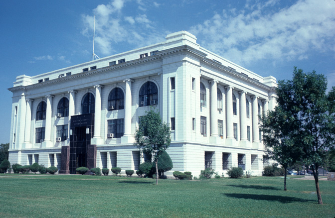
 Barton County Courthouse in Great Bend
Verwaltung US-Bundesstaat: Kansas Verwaltungssitz: Great Bend Adresse des
Verwaltungssitzes:County Courthouse
1400 Main Street
Great Bend, KS 67530-0000Gründung: 26. Februar 1867 Gebildet aus: Marion County Vorwahl: 001 620 Demographie Einwohner: 28.205 (2000) Bevölkerungsdichte: 12,2 Einwohner/km² Geographie Fläche gesamt: 2.332 km² Wasserfläche: 17 km² Karte 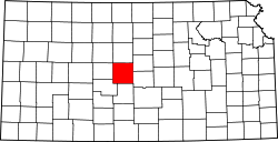
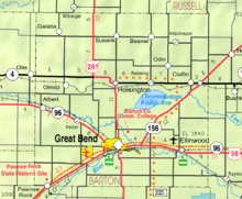
Website: www.bartoncounty.org Barton County[1] ist ein County im Bundesstaat Kansas der Vereinigten Staaten von Amerika. Der Verwaltungssitz (County Seat) ist Great Bend.
Inhaltsverzeichnis
Geografie
Das County liegt nahe dem geographischen Zentrum von Kansas und hat eine Fläche von 2332 Quadratkilometern, wovon 17 Quadratkilometer Wasserfläche sind. Es grenzt im Uhrzeigersinn an folgende Countys: Russell County, Ellsworth County, Rice County, Stafford County, Pawnee County und Rush County.
Geschichte
Barton County wurde am 26. Februar 1867 aus Teilen des Marion County gebildet. Benannt wurde es nach Clara Barton, einer US-amerikanischen Krankenschwester, Lehrerin und Philanthropin. Sie gründete das Amerikanische Rote Kreuz und hatte darüber hinaus auch großen Einfluss auf das Selbstverständnis der Internationalen Rotkreuz- und Rothalbmond-Bewegung.
Demografische Daten
Historische Einwohnerzahlen Census Einwohner ± in % 1870 2 — 1880 10.318 500.000 % 1890 13.172 30 % 1900 13.784 5 % 1910 17.876 30 % 1920 18.422 3 % 1930 19.776 7 % 1940 25.010 30 % 1950 29.909 20 % 1960 32.368 8 % 1970 30.663 -5 % 1980 31.343 2 % 1990 29.382 -6 % 2000 28.205 -4 % Vor 1900[2] 1900–1990[3]
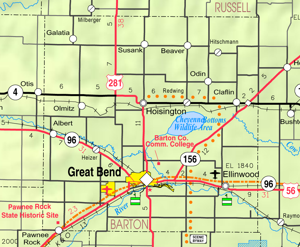
 Karte des Barton County, Kansas
Nach der Volkszählung im Jahr 2000 lebten im Barton County 28.205 Menschen in 11.393 Haushalten und 7.530 Familien im Barton County. Die Bevölkerungsdichte betrug 12 Einwohner pro Quadratkilometer. Ethnisch betrachtet setzte sich die Bevölkerung zusammen aus 92,98 Prozent Weißen, 1,15 Prozent Afroamerikanern, 0,51 Prozent amerikanischen Ureinwohnern, 0,23 Prozent Asiaten, 0,01 Prozent Bewohnern aus dem pazifischen Inselraum und 3,51 Prozent aus anderen ethnischen Gruppen; 1,6 Prozent stammten von 2 oder mehr Ethnien ab. 8,31 Prozent der Bevölkerung waren spanischer oder lateinamerikanischer Abstammung.
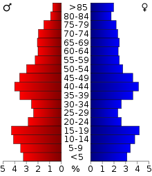 Alterspyramide für das Barton County
Von den 11.393 Haushalten hatten 31,3 Prozent Kinder unter 18 Jahren, die mit ihnen gemeinsam lebten. 55,1 Prozent waren verheiratete, zusammenlebende Paare, 7,8 Prozent waren allein erziehende Mütter und 33,9 Prozent waren keine Familien. 30,2 Prozent aller Haushalte waren Singlehaushalte und in 14,3 Prozent lebten Menschen mit 65 Jahren oder darüber. Die Durchschnittshaushaltsgröße betrug 2,41 und die durchschnittliche Familiengröße betrug 3,01 Personen.
26,0 Prozent der Bevölkerung waren unter 18 Jahre alt. 9,0 Prozent zwischen 18 und 24 Jahre, 25,1 Prozent zwischen 25 und 44 Jahre, 22,0 Prozent zwischen 45 und 64 Jahre und 17,9 Prozent waren 65 Jahre alt oder älter. Das Durchschnittsalter betrug 39 Jahre. Auf 100 weibliche Personen kamen 93,8 männliche Personen. Auf 100 erwachsene Frauen ab 18 Jahren kamen 90,1 Männer.
Das jährliche Durchschnittseinkommen eines Haushalts betrug 32.176 USD, das Durchschnittseinkommen einer Familie betrug 39.929 USD. Männer hatten ein Durchschnittseinkommen von 28.803 USD, Frauen 20.428 USD. Das Prokopfeinkommen betrug 16.695 USD. 9,9 Prozent der Familien und 12,9 Prozent der Bevölkerung lebten unterhalb der Armutsgrenze. [4]
Siehe auch
Weblinks
- Homepage Kansas Government (engl.)
Einzelnachweise
- ↑ GNIS-ID: 484974. Abgerufen am 22. Februar 2011 (englisch).
- ↑ U.S. Census Bureau - Census of Population and Housing. Abgerufen am 15. März 2011
- ↑ Auszug aus Census.gov. Abgerufen am 17. Februar 2011
- ↑ Barton County, Kansas, Datenblatt mit den Ergebnissen der Volkszählung im Jahre 2000 bei factfinder.census.gov.

Liste der Countys in Kansas
Allen | Anderson | Atchison | Barber | Barton | Bourbon | Brown | Butler | Chase | Chautauqua | Cherokee | Cheyenne | Clark | Clay | Cloud | Coffey | Comanche | Cowley | Crawford | Decatur | Dickinson | Doniphan | Douglas | Edwards | Elk | Ellis | Ellsworth | Finney | Ford | Franklin | Geary | Gove | Graham | Grant | Gray | Greeley | Greenwood | Hamilton | Harper | Harvey | Haskell | Hodgeman | Jackson | Jefferson | Jewell | Johnson | Kearny | Kingman | Kiowa | Labette | Lane | Leavenworth | Lincoln | Linn | Logan | Lyon | Marion | Marshall | McPherson | Meade | Miami | Mitchell | Montgomery | Morris | Morton | Nemaha | Neosho | Ness | Norton | Osage | Osborne | Ottawa | Pawnee | Phillips | Pottawatomie | Pratt | Rawlins | Reno | Republic | Rice | Riley | Rooks | Rush | Russell | Saline | Scott | Sedgwick | Seward | Shawnee | Sheridan | Sherman | Smith | Stafford | Stanton | Stevens | Sumner | Thomas | Trego | Wabaunsee | Wallace | Washington | Wichita | Wilson | Woodson | Wyandotte
Wikimedia Foundation.
Schlagen Sie auch in anderen Wörterbüchern nach:
Barton County, Kansas — Infobox U.S. County county=Barton County state=Kansas founded=February 26, 1867 seat wl=Great Bend area total km2=2332|area total sq mi=900 area land km2=2315|area land sq mi=894 area water km2=17|area water sq mi=6 area percentage=0.72% census… … Wikipedia
National Register of Historic Places listings in Barton County, Kansas — Location of Barton County in Kansas This is a list of the National Register of Historic Places listings in Barton County, Kansas. This is intended to be a complete list of the properties on the National Register of Historic Places in Barton… … Wikipedia
Cheyenne Township, Barton County, Kansas — Cheyenne Township Township Location in Barton County … Wikipedia
Clarence Township, Barton County, Kansas — Clarence Township Township Location in Barton County … Wikipedia
Cleveland Township, Barton County, Kansas — Cleveland Township Township Location in Barton County … Wikipedia
Comanche Township, Barton County, Kansas — Comanche Township Township Location in Barton County … Wikipedia
North Homestead Township, Barton County, Kansas — North Homestead Township Township Location in Barton County … Wikipedia
Great Bend Township, Barton County, Kansas — Infobox Settlement official name = Great Bend Township settlement type = Township nickname = motto = imagesize = image caption = image imagesize = image caption = image mapsize = map caption = Location in Barton County mapsize1 = map caption1 =… … Wikipedia
Albion Township, Barton County, Kansas — Infobox Settlement official name = Albion Township settlement type = Township nickname = motto = imagesize = image caption = image imagesize = image caption = image mapsize = map caption = Location in Barton County mapsize1 = map caption1 =… … Wikipedia
Beaver Township, Barton County, Kansas — Infobox Settlement official name = Beaver Township settlement type = Township nickname = motto = imagesize = image caption = image imagesize = image caption = image mapsize = map caption = Location in Barton County mapsize1 = map caption1 =… … Wikipedia
Barton County (Kansas)


18+
© Academic, 2000-2026
- Kontaktieren Sie uns: Unterstützung, Werbung
Wörterbücher Export, schritte mit PHP, Joomla, Drupal, WordPress, MODx.