Bereznik

Bereznik
Siedlung städtischen Typs
Beresnik
Березник
Föderationskreis Nordwestrussland
Oblast Archangelsk
Rajon Winogradowsk
Erste Erwähnung 1676
Siedlung städtischen Typs seit 1962
Höhe des Zentrums 64 m
Bevölkerung 6400 Einw. (Stand: 2007)
Zeitzone UTC+3 (Sommerzeit: UTC+4)
Telefonvorwahl (+7)81831
Postleitzahl 164570
Kfz-Kennzeichen 29
OKATO 11 214 551 7
Geographische Lage
Koordinaten: 62° 51′ N, 42° 45′ O62.8542.7564Koordinaten: 62° 51′ 0″ N, 42° 45′ 0″ O
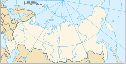
Beresnik (Russland)
DEC
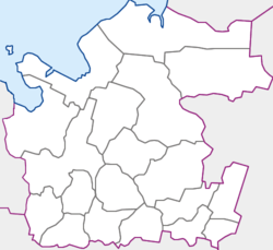
Beresnik (Oblast Archangelsk)
DEC
Oblast Archangelsk
 

Beresnik (russisch Березник) ist eine Siedlung städtischen Typs in Nordwestrussland. Sie gehört zur Oblast Archangelsk und hat 6.400 Einwohner (Stand 2007).

Inhaltsverzeichnis

Geografie

Es liegt etwa 215 km südöstlich der Oblasthauptstadt Archangelsk, am linken Ufer der Nördlichen Dwina etwa 6 km nördlich der Mündung der Waga in selbige. Direkt durch die Stadt verläuft die Fernstraße M8, von Moskau nach Sewerodwinsk.

Geschichte

Beresnik wurde erstmals 1676 erwähnt und bekam 1962 den Status einer Siedlung städtischen Typs. Sie ist administratives Zentrum des Rajon Winogradowsk.

Wirtschaft

Die Siedlung besitzt ein landwirtschaftliches Unternehmen mit Milch- sowie Gemüseproduktion. Des weiteren gibt es ein ansässiges Holzfällerunternehmen.

Weblinks


Wikimedia Foundation.

Игры ⚽ Поможем написать курсовую

Schlagen Sie auch in anderen Wörterbüchern nach:

  • Bereznik — (English) Березник (Russian)   Urban type settlement …   Wikipedia

  • Bereznik — Original name in latin Berznik Name in other language Bereznik, Berjoznik, Berznik, Dvinskoj Bereznik, Dvinskoy Bereznik, Semenovskaya, Semenovskoye, Semnovskoye, Берёзник, Двинской Березник State code RU Continent/City Europe/Moscow longitude 62 …   Cities with a population over 1000 database

  • Semenovskoye Shidrovo — Infobox Airport name = Semenovskoye Shidrovo nativename = nativename a = nativename r = image width = caption = IATA = ICAO = type = Public owner = operator = city served = location = Bereznik elevation f = 105 elevation m = 32 coordinates =… …   Wikipedia

  • Rajon Swaljawa — (Свалявський район/Swaljawskyj rajon) …   Deutsch Wikipedia

  • Aeropuerto de Semenovskoye-Shidrovo — Sumario Tipo Civil Ubicación 8 km al sudeste de Bereznik Elevación 32 …   Wikipedia Español

  • List of rivers of Europe — These are the main rivers of Europe (ecologically, the extreme west of the Palearctic ecozone which includes Russia in the east). See each article for their tributaries, drainage areas, etc.The longest rivers of Europe are: *Volga (3,692 km/2,294 …   Wikipedia

  • List of rivers of Russia — Russia can be divided into a European and an Asian part. The dividing line is generally considered to be the Ural Mountains and the Caspian Sea. The European part is drained into the Arctic Ocean, Baltic Sea, Black Sea and Caspian Sea. The Asian… …   Wikipedia

  • Northern Dvina River — Coordinates: 64°32′00″N 40°29′00″E / 64.5333333°N 40.4833333°E / 64.5333333; 40.4833333 …   Wikipedia

  • Hellboy — Superherobox caption=Hellboy by Mike Mignola. comic color=background:#80ffff character name=Hellboy Born=Scotland real name=Anung un Rama publisher=Dark Horse Comics debut= San Diego Comic Con Comics #2 (1993) creators=Mike Mignola alliance color …   Wikipedia

  • Berezniki — ( ru. Березники) is a city in Perm Krai, Russia, situated on the banks of the Kama River, it lies in the Ural mountains. [ [http://encarta.msn.com/encyclopedia 761584338/berezniki.html Berezniki MSN Encarta ] ] Berezniki has a population of… …   Wikipedia

Share the article and excerpts

Direct link
Do a right-click on the link above
and select “Copy Link”