Brandsø

Brandsø

Vorlage:Infobox Insel/Wartung/Bild fehltVorlage:Infobox Insel/Wartung/Höhe fehlt

Brandsø
Gewässer Ostsee
Inselgruppe Kleiner Belt
Geographische Lage 55° 21′ 30″ N, 9° 42′ 30″ O55.3583333333339.7083333333333Koordinaten: 55° 21′ 30″ N, 9° 42′ 30″ O
Brandsø (Syddanmark)
Brandsø
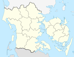
Fläche 2,039 km²
Einwohner (unbewohnt)

Brandsø ist eine dänische Insel im Kleinen Belt, der Meerenge zwischen Jütland und der Insel Fünen, etwa zwischen Middelfart und der Insel Årø gelegen. Die Insel ist 203,9 Hektar groß[1] und gehört zum Kirchspiel Bågø (Bågø Sogn in der Harde Båg Herred im Odense Amt) und gehörte ab 1970 zur Assens Kommune im Fyns Amt, die mit der Kommunalreform zum 1. Januar 2007 in der „neuen“ Assens Kommune in der Region Syddanmark aufgegangen ist.

Bewohnten in den 1920er Jahren noch über 50 Personen die Insel, so ist sie seit Ende der 1960er Jahre unbewohnt,

1974 war Brandsø als möglicher Standort für ein Kernkraftwerk im Gespräch.[2]

Einzelnachweise

  1. http://www.dst.dk/asp2xml/puk/udgivelser/get_file.asp?id=13170&sid=areal , S. 3
  2. Eintrag über Brandsø in „Den Store Danske“. Abgerufen am 15. September 2009.

Wikimedia Foundation.

Игры ⚽ Нужна курсовая?

Schlagen Sie auch in anderen Wörterbüchern nach:

  • Dankvart Dreyer — Dankvart Dreyer, Self portrait, 1838 Born 13 June 1816(1816 06 13) Assens, Denmark …   Wikipedia

  • List of islands of Denmark — Map showing some of the larger islands This is a list of islands of Denmark. Contents 1 Overview 1.1 …   Wikipedia

  • Møn — The title of this article contains the character ø. Where it is unavailable or not desired, the name may be represented as Moen. Møn The white chalk Cliffs of Møn …   Wikipedia

  • North Jutlandic Island — Native name: Nørrejyske Ø The Grenen sand bar at the northern tip of the island …   Wikipedia

  • Mors (island) — Mors Hanklit, Mors Geography Location Limfjor …   Wikipedia

  • Ejby Municipality — Until January 1, 2007, Ejby municipality was a municipality (Danish, kommune ) in Funen County on the north and west coasts of the island of Funen in southern Denmark. The municipality included the island of Brandsø, and covered an area of 163… …   Wikipedia

  • Dänische Inseln — Diese Liste erfasst alle dänischen Inseln, die in den Jahren 1965 oder 2008 bewohnt waren, sowie deren Fläche, Einwohnerzahl (1965 und 2008), kommunale und regionale Zugehörigkeit und bedeutende Ortschaften auf selbigen. Hinweis: Die Endungen ø… …   Deutsch Wikipedia

  • Liste dänischer Inseln — Diese Liste erfasst alle dänischen Inseln, die zur Zeit (2009) bewohnt sind, sowie deren Fläche, Einwohnerzahl (2009), Bevölkerungsdichte, kommunale und regionale Zugehörigkeit und bedeutende Ortschaften auf selbigen. Hinweis: Die Endungen ø bzw …   Deutsch Wikipedia

  • Liste Des Îles Du Danemark — Voici une liste des îles du Danemark. En excluant le Groenland et les îles Féroé, le Danemark compte 443 îles portant un nom, dont 76 sont habitées. Sommaire : Haut A B C D E F G H I J K L M N O P Q R S T U V W X …   Wikipédia en Français

  • Liste des iles du Danemark — Liste des îles du Danemark Voici une liste des îles du Danemark. En excluant le Groenland et les îles Féroé, le Danemark compte 443 îles portant un nom, dont 76 sont habitées. Sommaire : Haut A B C D E F G H I J K L M N O P Q R S T U V W X …   Wikipédia en Français

Share the article and excerpts

Direct link
Do a right-click on the link above
and select “Copy Link”