Peel River (New South Wales)
- Peel River (New South Wales)
-
| Peel River |
|
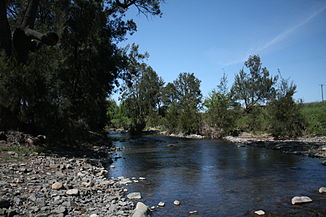
Peel River in NundleVorlage:Infobox Fluss/KARTE_fehlt
|
| DatenVorlage:Infobox Fluss/GKZ_fehlt |
| Lage |
New South Wales (Australien) |
| Flusssystem |
Murray River |
| Abfluss über |
Namoi River → Barwon River (New South Wales) → Darling River → Murray River → Indischer Ozean |
| Quelle |
südlich von Nundle, westlich des Ben-Halls-Gap-Nationalparks
31° 35′ 5″ S, 151° 7′ 35″ O-31.584722222222151.12638888889743 |
| Quellhöhe |
743 m[1] |
| Mündung |
Namoi River bei Gunnedah
-30.921388888889150.49222222222286
30° 55′ 17″ S, 150° 29′ 32″ O-30.921388888889150.49222222222286 |
| Mündungshöhe |
286 m[1] |
| Höhenunterschied |
457 m |
| Länge |
210 km[1]Vorlage:Infobox Fluss/EINZUGSGEBIET_fehlt
Vorlage:Infobox Fluss/ABFLUSS_fehlt
|
| Rechte Nebenflüsse |
Duncans Creek, Dungowan Creek, Cockburn River, Moore Creek, Attunga Creek, Limestone Gully |
| Linke Nebenflüsse |
Sandy Creek, Reedy Creek, Goonoo Goonoo Creek, Timbumburri Creek, Tangaratta Creek, Sandy Creek, Menedebri Creek |
| Durchflossene Stauseen |
Chaffey-Stausee |
| Mittelstädte |
Tamworth |
| Kleinstädte |
Woolomin, Dungowan, Piallamore, Nimingha, Attunga, Somerton, Caroll Gap |
| Gemeinden |
Nundle, Bowing Alley Point |
Der Peel River ist ein Fluss im Norden des australischen Bundesstaates New South Wales.
Er entspringt an den Nordhängen der Liverpool Range südlich des Dorfes Nundle. Von dort fließt er nach Norden durch die Vorberge der Great Dividing Range, durch Woolomin und Piallamore und ergießt sich in die Liverpool Plains bei Tamworth. Er wendet seinen Lauf nach Westen und mündet gleich unterhalb des Keepit-Stausees in den Namoi River. Der Cockburn River ist der wichtigste Nebenfluss des Peel River und mündet bei Nemingha, oöstlich von Tamworth, ein.
Südlich von Woolomin liegt der Chaffey-Stausee, wo der Peel River aufgestaut wird, um Trinkwasser für Tamworth zur Verfügung zu stellen.
Der Peel River wurde nach Sir Robert Peel, einem bekannten britischen Politiker in der Zeit der britischen Entdecker in Australien, benannt.
Der wissenschaftliche Name des Dorschbarschs Mucullochella peeli peeli (engl. Murray cod) wurde vom Peel River abgeleitet. Thomas Livingstone Mitchell hatte ihn zuerst in den Wassern dieses Flusses entdeckt.
Einzelnachweise
- ↑ a b c Map of Peel River, NSW. Bonzle.com
Kategorien: - Flusssystem Darling River
- Fluss in New South Wales
- Fluss in Australien und Ozeanien
Wikimedia Foundation.
Schlagen Sie auch in anderen Wörterbüchern nach:
Peel River (New South Wales) — For the Canadian River in the Yukon and Northwest Territories, see Peel River (Canada) Infobox River river name = Peel River image size = caption = origin = Liverpool Range mouth = confluence with the Namoi River basin countries = Australia… … Wikipedia
New England (New South Wales) — New England New South Wales Mount Duval in New England Population … Wikipedia
Rivers of New South Wales — Thunderbolts Way and the bridge over the Little Manning River. This page discusses the rivers and hydrography of the State of New South Wales, Australia. The principal topographic feature of New South Wales is the series of low highlands and… … Wikipedia
Peel River — steht für: Peel River (Kanada), Nebenfluss des Mackenzie in Kanada Peel River (New South Wales), Nebenfluss des Namoi River in Australien Diese Seite ist eine Begriffsklärung zur Unterscheidung mehrerer mit demselben Wo … Deutsch Wikipedia
North Tamworth, New South Wales — North Tamworth Tamworth, New South Wales North Tamworth Sunset Population … Wikipedia
Parry County, New South Wales — Infobox Australian cadastral name = Parry state = New South Wales caption = Location in New South Wales near nw = Nandewar near n = Inglis near ne = Vernon near e = Vernon near se = Hawes near s = Brisbane near sw = Buckland near w =… … Wikipedia
West Tamworth, New South Wales — Infobox Australian Place | type = suburb name = West Tamworth city = Tamworth state = nsw caption = lga = Tamworth Regional Council postcode = 2340 est = pop = 2001 estimate: 2,621 [Tamworth Community Profile 2001,… … Wikipedia
Peel River — The Peel River may refer to:*Peel River (New South Wales) in Australia *Peel River (Canada) in the Yukon and Northwest Territories, Canada … Wikipedia
Tamworth, New South Wales — Infobox Australian Place | type = city name = Tamworth state = nsw caption = Aerial view of Tamworth lga = Tamworth Regional Council county = Inglis postcode = 2340 pop = 42,499 (2006) poprank = 34th est = 1818 (explored) 1850 (established) 1946… … Wikipedia
Nundle, New South Wales — Nundle New South Wales Nundle valley from the Hanging Rock lookout … Wikipedia