Pikelot

Pikelot

Vorlage:Infobox Insel/Wartung/Bild fehlt

Pikelot
Gewässer Pazifischer Ozean
Inselgruppe Karolinen
Geographische Lage 8° 6′ 17″ N, 147° 38′ 47″ O8.1047222222222147.646388888894Koordinaten: 8° 6′ 17″ N, 147° 38′ 47″ O
Pikelot (Föderierte Staaten von Mikronesien)
Pikelot
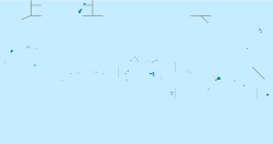
Länge 450 m
Breite 280 m
Fläche 0,13 km²
Höchste Erhebung m
Einwohner (unbewohnt)

Pikelot ist eine kleine unbewohnte Insel in den Föderierten Staaten von Mikronesien und die östlichste Insel des mikronesischen Bundesstaats Yap.

Inhaltsverzeichnis

Geographie

Pikelot ist eine flache Koralleninsel von ovaler Form und dicht bewaldet. Die Insel liegt etwa 100 km nordöstlich von Satawal, der östlichsten bewohnten yapesischen Insel. Das nächste östliche bewohnte Landgebiet befindet sich auf der rund 220 km entfernten Atollinsel Ulul, die politisch zum Nachbar-Bundesstaat Chuuk zählt.

Verwaltung

Pikelot gehörte einst zu Lamotrek, und später zu Puluwat (im heutigen Bundesstaat Chuuk). Aktuell wird die Insel von der Gemeinde Satawal beansprucht, zu der auch die ebenfalls unbewohnte Insel West Fayu gehört.[1]

Siehe auch

Weblinks

Einzelnachweise

  1. Per Hage,Frank Harary: Exchange in Oceania: a graph theoretic analysis, Clarendon Press Oxford, 1991, Seite 95

Wikimedia Foundation.

Игры ⚽ Поможем сделать НИР

Schlagen Sie auch in anderen Wörterbüchern nach:

  • Pikelot — Island is one of the outer islands of the State of Yap, part of the Federated States of Micronesia. It is a low coral islet, with a wet, tropical climate.Flora and FaunaThe island is known to have a rich Ecosystem, with forest and scrub; and… …   Wikipedia

  • Satawal — Gewässer Pazifischer Ozean Inselgruppe Karoline …   Deutsch Wikipedia

  • Yap (Bundesstaat) — Yap Flagge Geographie Staat: Mikronesien Gewässer: Pazifischer Ozean …   Deutsch Wikipedia

  • West Fayu — Vorlage:Infobox Insel/Wartung/Höhe fehlt West Fayu (Piagailoe) Falschfarben Satellitenbild von West Fayu Die Insel erscheint rot Gewässer Pazifischer Ozean …   Deutsch Wikipedia

  • Yap — Infobox Settlement name =Yap official name = other name = native name = nickname = settlement type =Island total type = motto = imagesize = image caption = flag size = image seal size = image shield = shield size = image blank emblem = blank… …   Wikipedia

  • List of administrative divisions of Micronesia — Below is a list of administrative divisions of Micronesia. Cities of Micronesia *Colonia, Yap *Kolonia *Lelu *Palikir National capital *Tol *Weno Federated States of Micronesia Subdivisions Chuuk, State of * Dublon (Tonowas) * Eot * Ettal * Fala… …   Wikipedia

  • Fais — NASA Geocover 2000, teilweise durch Wolken und deren Schatten verdeckt Gewässer Pazifi …   Deutsch Wikipedia

  • Föderierte Staaten von Mikronesien — Federated States of Micronesia Föderierte Staaten von Mikronesien …   Deutsch Wikipedia

  • Woleai — Vorlage:Infobox Insel/Wartung/Höhe fehlt Woleai Lagekarte des Bundesstaates Yap Gewässer Pazifischer Ozean Archipel …   Deutsch Wikipedia

  • Yap-Inseln — Satellitenbild der NASA Gewässer Pazifischer Ozean Archipel Westkarolinen …   Deutsch Wikipedia

Share the article and excerpts

Direct link
Do a right-click on the link above
and select “Copy Link”