- Podvysoká
-
Podvysoká
Wappen Karte 

Podvysoká BasisdatenKraj: Žilinský kraj Okres: Čadca Region: Kysuce Fläche: 5,609 km² Einwohner: 1.309 (31. Dez. 2010) Bevölkerungsdichte: 233,37 Einwohner je km² Höhe: 460 m n.m. Postleitzahl: 023 53 Telefonvorwahl: 0 41 Geographische Lage: 49° 25′ N, 18° 40′ O49.41518.67460Koordinaten: 49° 24′ 54″ N, 18° 40′ 12″ O Kfz-Kennzeichen: CA Gemeindekennziffer: 509361 StrukturGemeindeart: Gemeinde Verwaltung (Stand: Mai 2011)Bürgermeister: Milan Matlák Adresse: Obecný úrad Podvysoká
26
023 53 PodvysokáWebpräsenz: www.podvysoka.sk Gemeindeinformation
auf portal.gov.skStatistikinformation
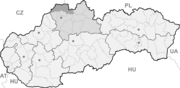
auf statistics.skPodvysoká (ungarisch Határújfalu - bis 1902 Podviszoka) ist eine Gemeinde im Okres Čadca des Žilinský kraj im äußersten Norden der Slowakei. Die Zahl der Einwohner belief sich per 31. Dezember 2010 auf 1.309 Einwohner.
Geographie
Die Gemeinde liegt im oberen Kysuca-Tal am rechten Ufer der nach Osten fließenden Kysuca, am Nordhang des Gebirges Javorníky und liegt unter dem Berg Vysoká (798 m n.m.), der auch der Namensgeber für die Gemeinde ist. Podvysoká liegt nur etwa vier Kilometer von der Stadt Turzovka.
Geschichte
Podvysoká entstand im 17. Jahrhundert durch den Zusammenschluss verschiedener Kleinsiedlungen in der unmittelbaren Gegend. Die erste schriftliche Erwähnung als Podvisoka stammt aus dem Jahr 1658. Das Gemeindegebiet war ein strittiges Gebiet zwischen den Herrscher der Burg Budatín und Burg Strečno, später schloss sich auch das Herrschaftsgut von Bitsch an, das endgültig die Gemeinde gekriegt hat.
1662 lebten im Ort 17 Untertanfamilien. Im Jahre 1784 hatte Podvysoká 51 Häuser, 63 Familien und 356 Einwohner. 1850 sind 560 slowakische Katholiken nachgewiesen.
Verkehr
Podvysoká ist über die Landesstraße 487 (Čadca – Turzovka – Makov) erreichbar. Des Weiteren gibt es eine Haltestelle an der Bahnstrecke Čadca–Makov.
Čadca (Tschadsa) | Čierne | Dlhá nad Kysucou | Dunajov | Klokočov | Klubina | Korňa | Krásno nad Kysucou | Makov | Nová Bystrica | Olešná | Oščadnica | Podvysoká | Radôstka | Raková | Skalité | Stará Bystrica | Staškov | Svrčinovec | Turzovka | Vysoká nad Kysucou | Zákopčie | Zborov nad Bystricou


Wikimedia Foundation.