- Port-Launay
-
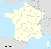
Port-Launay (Meilh-ar-Wern) Region Bretagne Département Finistère Arrondissement Châteaulin Kanton Châteaulin Koordinaten 48° 13′ N, 4° 4′ W48.216388888889-4.0694444444445Koordinaten: 48° 13′ N, 4° 4′ W Höhe 2–86 m Fläche 2,00 km² Einwohner 461 (1. Jan. 2008) Bevölkerungsdichte 231 Einw./km² Postleitzahl 29150 INSEE-Code 29222 Port-Launay (bretonisch Meilh-ar-Wern) ist eine französische Gemeinde im Département Finistère mit 461 Einwohnern (Stand 1. Januar 2008). Sie gehört zum Arrondissement Châteaulin, zum Kanton Châteaulin und zum Gemeindeverband Pays de Châteaulin et Porzay.
Geografie
Die Gemeinde liegt im Westen der Bretagne am östlichen Ende der Trichtermündung des Flusses Aulne, der in die Rade de Brest, einer tief ins Land ragenden Bucht des Atlantiks, mündet. Port-Launay ist der letzte natürliche Hafen an der Aulne; ab hier ist der Fluss als Bestandteil des Canal de Nantes à Brest kanalisiert. Der Hafenort gehört zu der Region Cornouaille und liegt im Naturpark Parc naturel régional d'Armorique. Châteaulin liegt 3 km südwestlich, Quimper 24 km südlich und Brest 36 km nordwestlich (Angaben leicht gerundet in Luftlinie).
Infrastruktur
Die nächstgelegene Abfahrt an der autobahnähnlich ausgebauten Schnellstraße E 60 (Nantes-Brest) und den nächsten Regionalbahnhof an der überwiegend parallel verlaufenden Bahnlinie gibt es bei Châteaulin. Bei Brest befindet sich der Regionalflughafen Aéroport Brest-Bretagne.
Weblinks
- Port-Launay auf cc-chateaulin-porzay.fr (französisch)
Cast | Châteaulin | Dinéault | Kerlaz | Locronan | Ploéven | Plomodiern | Plonévez-Porzay | Port-Launay | Quéménéven | Saint-Coulitz | Saint-Nic | Saint-Ségal | Trégarvan
Wikimedia Foundation.

