- Przygodzice
-
Przygodzice 
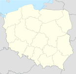
Basisdaten Staat: Polen Woiwodschaft: Großpolen Landkreis: Ostrów Wielkopolski Geographische Lage: 51° 35′ N, 17° 50′ O51.58333333333317.833333333333Koordinaten: 51° 35′ 0″ N, 17° 50′ 0″ O Einwohner: 3000 (2006)
Postleitzahl: 63-421 Telefonvorwahl: (+48) 62 Kfz-Kennzeichen: POS Gemeinde Gemeindeart: Landgemeinde Gemeindegliederung: 16 Ortschaften 14 Schulzenämter Fläche: 75,7 km² Einwohner: 11.759
(31. Dez. 2010) [1]Bevölkerungsdichte: 155 Einw./km² Gemeindenummer (GUS): 3017052 Verwaltung (Stand: 2006) Gemeindevorsteher: Przemysław Piotr Kaźmierczak Adresse: pl. Powstańców Wlkp. 2
63-421 PrzygodziceWebpräsenz: www.przygodzice.pl Przygodzice (deutsch Groß Przygodzice, 1943–1945 Hirschteich) ist ein Dorf und Sitz der gleichnamigen Landgemeinde in Polen. Der Ort liegt im Powiat Ostrowski (Großpolen) der Wojewodschaft Großpolen.
Gemeinde
Zur Landgemeinde Przygodzice gehören 14 Ortsteile (deutsche Namen bis 1945)[2][3][4][5] mit einem Schulzenamt:
- Ludwików (Ludwikow, 1943–1945 Ludwigshof)[4]
- Przygodzice (Groß Przygodzice, 1943–1945 Hirschteich)[4]
- Przygodziczki (Klein Przygodzice, 1943–1945 Kleinhirschteich)[5]
- Smardów (Wiesendorf 1943-1945)
- Topola Wielka (Groß Topola, 1943–1945 Großpappeln)[4]
- Topola-Osiedle (Klein Topola, 1943–1945 Klein-Pappol)[3]
- Wysocko Małe (Klein Wysocko, 1943–1945 Klein Hochkirch)[3]
Weitere Ortschaften der Gemeinde sind Antonin-Strugi und Trzcieliny.
Weblinks
- Deutsche Topograph. Karte, 4372 Ostrowo (1:25000), Ausgabe 1 vom XI. 1944
- Deutsche Topograph. Karte, 4472 Adelnau (1:25000), Ausgabe 1 vom XI. 1944
- Deutsche Topograph. Karte, 4473 Mixstadt (1:25000), Ausgabe 1 vom XI. 1944
Fußnoten
- ↑ Population. Size and Structure by Territorial Division. As of December 31, 2010. Główny Urząd Statystyczny (GUS), abgerufen am 23. Juni 2011.
- ↑ Das Genealogische Orts-Verzeichnis
- ↑ a b c d e Vgl. Deutsche Topograph. Karte, 4372 Ostrowo
- ↑ a b c d e f Vgl. Deutsche Topograph. Karte, 4472 Adelnau
- ↑ a b c Vgl. Deutsche Topograph. Karte, 4473 Mixstadt
Städte und Gemeinden im Powiat OstrowskiNowe Skalmierzyce (Neu Skalmierschütz) – Stadt | Odolanów (Adelnau) – Stadt | Ostrów Wielkopolski (Ostrowo) – Stadt | Przygodzice | Raszków – Stadt | Sieroszewice | Sośnie
Wikimedia Foundation.
Schlagen Sie auch in anderen Wörterbüchern nach:
Przygodzice — Original name in latin Przygodzice Name in other language State code PL Continent/City Europe/Warsaw longitude 51.59195 latitude 17.82412 altitude 143 Population 3000 Date 2010 10 16 … Cities with a population over 1000 database
Gmina de Przygodzice — Bandera … Wikipedia Español
Gmina Przygodzice — Infobox Settlement name = Gmina Przygodzice other name = Przygodzice Commune settlement type = Gmina total type = Total image shield =HerbGminyPrzygodzice.svg subdivision type = Country subdivision name = POL subdivision type1 = Voivodeship… … Wikipedia
Dębnica, Ostrów Wielkopolski County — For other places with the same name, see Dębnica (disambiguation). Dębnica Village … Wikipedia
Ostrów Wielkopolski County — Powiat ostrowski County … Wikipedia
Kreis Ostrowo — Der Kreis Ostrowo im Südosten der preußischen Provinz Posen bestand in der Zeit von 1887 bis 1918. Inhaltsverzeichnis 1 Vorgeschichte 1.1 1793 bis 1807 1.2 1815 bis 1887 2 Verwaltungsge … Deutsch Wikipedia
Гмина Пшигодзице — Gmina Przygodzice Страна: Польша Повят: Острувский повят (Великопольское воеводство) Глава: Пшемыслав Пётр Казмерчак (2006) Площадь: 163,48 км² Население: 11 249 чел. Год переписи: 2004 … Википедия
Chynowa — Village … Wikipedia
Czarnylas, Greater Poland Voivodeship — See also: Czarnylas, Pomeranian Voivodeship Czarnylas Village … Wikipedia
Anton Radziwill — Fürst Anton Radziwill (um 1810) Fürst Anton Heinrich (Antoni Henryk) Radziwiłł, 12. Herzog von Nieśwież und (seit 1813) 11. von Ołyka (* 13. Juni 1775 in Vilnius; † 7. April 1833 in Berlin), war ein polnischer und preu … Deutsch Wikipedia

