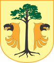
- Sośnie
-
Sośnie 
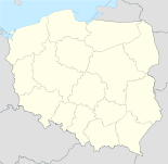
Basisdaten Staat: Polen Woiwodschaft: Großpolen Landkreis: Ostrów Wielkopolski Geographische Lage: 51° 28′ N, 17° 37′ O51.46666666666717.616666666667Koordinaten: 51° 28′ 0″ N, 17° 37′ 0″ O Höhe: 129 m n.p.m Einwohner: -
(31. Dez. 2010)[1]Postleitzahl: 63-435 Telefonvorwahl: (+48) 62 Kfz-Kennzeichen: POS Gemeinde Gemeindeart: Landgemeinde Gemeindegliederung: 17 Schulzenämter Fläche: 187,5 km² Einwohner: 6634
(31. Dez. 2010) [2]Bevölkerungsdichte: 35 Einw./km² Gemeindenummer (GUS): 3017082 Verwaltung (Stand: 2006) Gemeindevorsteher: Michał Wilczura Adresse: ul. Wielkopolska 47
63-435 SośnieWebpräsenz: www.sosnie.pl Sośnie (deutsch Sosnie, 1939–1945 Suschen) ist ein Dorf und Sitz der gleichnamigen Landgemeinde in Polen. Der Ort liegt im Powiat Ostrowski (Großpolen) der Wojewodschaft Großpolen.
Gemeinde
Zur Landgemeinde Sośnie gehören 17 Ortsteile (deutsche Namen bis 1945)[3][4][5][4] mit einem Schulzenamt:
Weitere Ortschaften der Gemeinde sind:
- Bronisławka
- Czesławice (Czeslawice, 1939–1945 Friedrikenau)[4]
- Grabie
- Jarnostaw
- Kopalina (Kopaline)
- Krzyżno
- Lipskie
- Łachów
- Moja Wola
- Piła (Brettmühle)
- Przydziałki
- Smugi
- Sobki
- Starża
- Surmin (Surmin)
- Żabnik
Weblinks
- Deutsche Topograph. Karte, 4471 Uciechow (1:25000), Ausgabe 1 vom XI. 1944
- Deutsche Topograph. Karte, 4571 Tscheschen (1:25000), Ausgabe 1 vom XI. 1940
- Amtsbezirk Tscheschen
Fußnoten
- ↑ Population. Size and Structure by Territorial Division. As of December 31, 2010. Główny Urząd Statystyczny (GUS), abgerufen am 23. Juni 2011.
- ↑ Population. Size and Structure by Territorial Division. As of December 31, 2010. Główny Urząd Statystyczny (GUS), abgerufen am 23. Juni 2011.
- ↑ Das Genealogische Orts-Verzeichnis
- ↑ a b c d e f g h i j k Vgl. Amtsbezirk Tscheschen - Gemeindeumbenennungen
- ↑ a b c d Vgl. Deutsche Topograph. Karte, 4471 Uciechow
Nowe Skalmierzyce (Neu Skalmierschütz) – Stadt | Odolanów (Adelnau) – Stadt | Ostrów Wielkopolski (Ostrowo) – Stadt | Przygodzice | Raszków – Stadt | Sieroszewice | Sośnie
Wikimedia Foundation.

