- Rożniątów
-
Rożniątów 
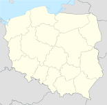
Basisdaten Staat: Polen Woiwodschaft: Oppeln Landkreis: Strzelce Opolskie Gmina: Gmina Strzelce Opolskie Geographische Lage: 50° 31′ N, 18° 15′ O50.51026111111118.250941666667Koordinaten: 50° 30′ 37″ N, 18° 15′ 3″ O Einwohner: Postleitzahl: 47-161 Telefonvorwahl: (+48) 77 Kfz-Kennzeichen: OST Rożniątów (deutsch: Rosniontau) ist eine Ortschaft in Polen in Oberschlesien in der Gemeinde Strzelce Opolskie (Groß Strehlitz) im Powiat Strzelecki in der Woiwodschaft Oppeln.
Geschichte
Bei der Volksabstimmung in Oberschlesien am 20. März 1921 stimmten 46 Wahlberechtigte für einen Verbleib bei Deutschland und 136 für Polen. Auf Gut Rosniontau stimmten 27 Personen für Deutschland und 69 für Polen[1]. Rosniontau verblieb beim Deutschen Reich. 1933 lebten im Ort 566 Einwohner. Am 3. Juli 1936 wurde der Ort in Kurzbach umbenannt. 1939 hatte der Ort 744 Einwohner. Bis 1945 befand sich der Ort im Landkreis Groß Strehlitz.
1945 kam der bisher deutsche Ort unter polnische Verwaltung und wurde in Rożniątów umbenannt und der Woiwodschaft Schlesien angeschlossen. 1950 kam der Ort zur Woiwodschaft Oppeln. 1999 kam der Ort zum wiedergegründeten Powiat Strzelecki.
Vereine
Einzelnachweise
Błotnica Strzelecka (Blottnitz) | Brzezina (Bresina) | Dziewkowice (Schewkowitz) | Grodzisko (Grodisko) | Jędrynie (Jendrin) | Kadłub (Kadlub) | Kadłubski Piec (Hochofen) | Kalinowice (Kalinowitz) | Kalinów (Kalinow) | Ligota Dolna (Nieder Ellguth) | Ligota Górna (Ober Ellguth) | Niwki (Niewke) | Osiek (Oschiek) | Płużnica Wielka (Groß Pluschnitz) | Rozmierka (Rosmierka) | Rozmierz (Rosmierz) | Rożniątów (Rosniontau) | Strzelce Opolskie (Groß Strehlitz) | Sucha (Suchau) | Szczepanek (Stephanshain) | Szymiszów (Schimischow) | Warmątowice (Warmuntowitz)
Wikimedia Foundation.


