- Seal Island (Namibia)
-
Seal Island
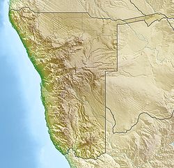
SeehundinselGewässer Lüderitzbucht, Südatlantik Inselgruppe Pinguininseln Geographische Lage 26° 35′ 45″ S, 15° 9′ 22″ O-26.59583333333315.15611111111143Koordinaten: 26° 35′ 45″ S, 15° 9′ 22″ O Länge 1,3 km Breite 540 m Fläche 0.44 km² Höchste Erhebung 43 m Einwohner (unbewohnt) Hauptort - Seal Island (deutsch Seehund(s)insel) ist eine südatlantisches Felseninsel in der nördlichen Lüderitzbucht in Namibia und Teil der Pinguininseln. Die Insel liegt 950 Meter nördlich der Pinguininsel. Einen Kilometer nordöstlich der Seal Island liegt die zwei Hektar kleine Flamingoinsel, die nicht mehr zu den Pinguininseln gezählt wird und die nur 50 Meter vom Festland entfernt ist.
Die Insel ist 1,3 km lang und bis zu 540 Meter breit. Die Fläche beträgt 0,44 km². Damit ist die Seal Island nach Possession Island die zweitgrößte Insel der Pinguininseln.[1]. In einer rundlichen Kuppe erreicht sie die Höhe von 43 Metern.
Wie der Name es nahelegt, leben auf der Insel Seehunde. Es bevölkern aber auch Pinguine, Südafrikanische Seebären und Möwen die Insel.
Die Inseln ist Teil des Meob-Chamais Meeresschutzgebietes und ist zusammen mit Penguin Island die einzige für den Tourismus und andere wirtschaftliche Nutzungen freigegebene Insel im Schutzgebiet.
Einzelnachweise
Inseln und Felsen innerhalb der Penguin IslandsAlbatross Rock | Black Rock | Black Sophie Rock | Boat Bay Rocks | Dumfudgeon Rocks | Flamingo Island | Gallovidea Reef | Halifax Island | Hollamsbird Island | Ichaboe Island | Little Roastbeef Islets | Marshall Rocks | Mercury Island | Neglectus Islet | North Long Island | Penguin Island | Plumpudding Island | Pomona Island | Possession Island | Seal Island | Shark Island | Sinclair Island | South Long Island | Staple Rocks
Wikimedia Foundation.
Schlagen Sie auch in anderen Wörterbüchern nach:
Seal Island — ist der Name mehrerer Inseln in den Vereinigten Staaten: Seal Island (Alaska) Seal Island (Delaware) Seal Island (Hawaii) Seal Island (Knox County, Maine) Seal Island (Sagadahoc County, Maine) Seal Island (Waldo County, Maine) Seal Island (Essex… … Deutsch Wikipedia
Penguin Island (Namibia) — Vorlage:Infobox Insel/Wartung/Fläche fehltVorlage:Infobox Insel/Wartung/Höhe fehlt Penguin Island Pinguininsel Pinguininsel (links im … Deutsch Wikipedia
Shark Island (Namibia) — Shark Island Haifischinsel Shark Island (rechte Bildmitte) mit der Lüderitzbucht (links) und der Stadt Lüderitz im Hintergrund … Deutsch Wikipedia
Possession Island (Namibia) — Vorlage:Infobox Insel/Wartung/Bild fehlt Possession Island Besitz Insel Gewässer Elizabeth Bay, Südatlantik Inselgruppe Penguin Islands Geographische Lage … Deutsch Wikipedia
Seal of Madagascar — The seal of Madagascar (French: Sceau de Madagascar) includes an outline map of the island at the center (together with two smaller islands nearby), and below it the head of a Zebu. Colours used include red, green, yellow, black, and white … Wikipedia
Seal of Rwanda — Coat of Arms of the Kingdom of … Wikipedia
Seal of Mauritania — The seal of Mauritania (Arabic: شعار الجمهورية الإسلامية الموريتانية, French: Sceau de la Mauritanie) is based on the national flag of Mauritania adopted on April 1, 1959. The colours of green and gold are considered … Wikipedia
Seal hunting — Sealing redirects here; for other uses, see sealing (disambiguation). Seal hunting, or sealing, is the personal or commercial hunting of seals for their pelts, blubber, and meat; as well as to ensure the population does not reach levels that… … Wikipedia
Namibia — Namibian, adj., n. /neuh mib ee euh/, n. a republic in SW Africa: a former German protectorate; a mandate of South Africa 1920 66; gained independence 1990. 1,727,183; 318,261 sq. mi. (824,296 sq. km). Cap.: Windhoek. Formerly, German Southwest… … Universalium
Isla Seal (Namibia) — Isla Seal Seal Island[1] Localización País Namibia … Wikipedia Español

