- Skępe
-
Skępe 
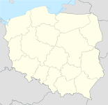
Basisdaten Staat: Polen Woiwodschaft: Kujawien-Pommern Landkreis: Lipno Fläche: 7,48 km² Geographische Lage: 52° 52′ N, 19° 21′ O52.86611111111119.346944444444Koordinaten: 52° 51′ 58″ N, 19° 20′ 49″ O Einwohner: 3529
(31. Dez. 2010)[1]Postleitzahl: 87-630 Telefonvorwahl: (+48) 54 Kfz-Kennzeichen: CLI Gemeinde Gemeindeart: Stadt- und Landgemeinde Gemeindegliederung: 16 Schulzenämter Fläche: 179,2 km² Einwohner: 7543
(31. Dez. 2010) [2]Bevölkerungsdichte: 42 Einw./km² Gemeindenummer (GUS): 0408073 Verwaltung Gemeindevorsteher: Andrzej Józef Gatyński Adresse: ul. Kościelna 2
87-630 SkępeWebpräsenz: www.skepe.pl Skępe (deutsch 1939–1942 Skepe, 1942–1945 Schemmensee) ist eine Stadt und Sitz der gleichnamigen Stadt- und Landgemeinde in Polen. Der Ort liegt im Powiat Lipnowski der Wojewodschaft Kujawien-Pommern.
Gemeinde
Zur Stadt- und Landgemeinde gehören neben der Stadt Skępe weitere 16 Ortsteile (deutsche Namen bis 1945)[3][4] mit einem Schulzenamt.
- Boguchwała (1942–1945 Gottlob)
- Czermno (1939–1942 Czermno, 1942–1945 Schirmen)
- Franciszkowo (1939–1942 Franzischkau, 1942–1945 Franzenshof)
- Huta (1939–1942 Huta Skempska, 1942–1945 Schemmenhütte)
- Jarczewo (1939–1942 Jarczewo, 1942–1945 Jarsen)
- Likiec (1942–1945 Hohlwege)
- Lubówiec (1939–1942 Lubowitz, 1942–1945 Liebenteich)
- Ławiczek (1939–1942 Lawitschek, 1942–1945 Jägerfeld)
- Łąkie (1942–1945 Lonke)
- Moczadła (1939–1942 Modschadla, 1942–1945 Motzenbruch)
- Rumunki-Skępskie
- Sarnowo (1939–1942 Sarnowo, 1942–1945 Rehgart)
- Szczekarzewo (1939–1942 Szczekarzewo, 1942–1945 Scheckensee)
- Wólka (1939–1942 Wolka, 1942–1945 Wulken)
- Żagno (1939–1942 Zagno, 1942–1945 Zangen)
- Żuchowo (1939–1942 Zuchowo, 1942–1945 Suchfeld)
Weitere Ortschaften der Gemeinde sind:
- Babie Ławy (1939–1942 Babe Lawy, 1942–1945 Frauenbänk)
- Bógzapłać (1939–1942 Bugsaplatz, 1942–1945 Gottvergelts)[5]
- Chałacie
- Czarny Las (1942–1945 Schwarzenwald)
- Gęstowarka
- Głęboczek
- Gorzeszyn (1939–1942 Gorscheschin, 1942–1945 Gorshütte)
- Grabówiec (1939–1942 Grabowitz, 1942–1945 Grabenwies)[5]
- Guzowatka
- Józefkowo
- Kamienica
- Kierz
- Koziołek
- Kujawy (1939–1942 Kujawie, 1942–1945 Kuhweide)
- Kukowo (1939–1942 Kukow, 1942–1945 Kuckucksheide)
- Modrzewie
- Narutowo (1939–1942 Narutowo, 1942–1945 Waldhütte)[5]
- Obóz
- Pokrzywnik
- Radziochy (1939–1942 Radsiochi, 1942–1945 Radenholz)[5]
- Wioska
- Zajeziorze (1939–1942 Sajesiuorsche, 1942–1945 Überwasser)
Weblinks
- 3182 Schemmensee (Topograph. Karte, 1:25000), Deutsche Heereskarte, Ausgabe 1 vom XI. 1944
- 3081 Horstfeld (Topograph. Karte, 1:25000), Deutsche Heereskarte, Ausgabe 1 vom XI. 1944
- Amtsbezirk Schemmensee
Fußnoten
- ↑ Population. Size and Structure by Territorial Division. As of December 31, 2010. Główny Urząd Statystyczny (GUS), abgerufen am 9. Juli 2011.
- ↑ Population. Size and Structure by Territorial Division. As of December 31, 2010. Główny Urząd Statystyczny (GUS), abgerufen am 9. Juli 2011.
- ↑ siehe 3182 Schemmensee (Topograph. Karte, 1:25000)
- ↑ http://www.mapywig.org/m/German_maps/German_WIG/Grossblatt_Nr._339_Soldau.jpg
- ↑ a b c d 3081 Horstfeld (Topograph. Karte, 1:25000), Deutsche Heereskarte, Ausgabe 1 vom XI. 1944])
Wikimedia Foundation.

