- Clinton County (Illinois)
-
Verwaltung US-Bundesstaat: Illinois Verwaltungssitz: Carlyle Adresse des
Verwaltungssitzes:County Courthouse
P.O. Box 308
Carlyle, IL 62231-0308Gründung: 27. Dezember 1824 Gebildet aus: Washington County,
Bond County,
Fayette CountyVorwahl: 001 618 Demographie Einwohner: 37.762 (2000) Bevölkerungsdichte: 30,8 Einwohner/km² Geographie Fläche gesamt: 1.304 km² Wasserfläche: 76 km² Karte 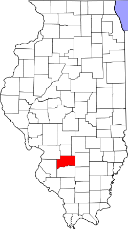
Website: www.clintonco.illinois.gov Das Clinton County[1] ist ein County im US-amerikanischen Bundesstaat Illinois. Bei der Volkszählung im Jahr 2010 hatte das County 37.762 Einwohner und eine Bevölkerungsdichte von 30,8 Einwohnern pro Quadratkilometer. Der Verwaltungssitz (County Seat) ist Carlyle.[2] Größtes Naherholungsgebiet ist der Carlyle Lake und seine nähere Umgebung.
Das Clinton County liegt im Metro-East genannten östlichen Teil der Metropolregion Greater St. Louis um die Stadt St. Louis im benachbarten Missouri.
Inhaltsverzeichnis
Geografie
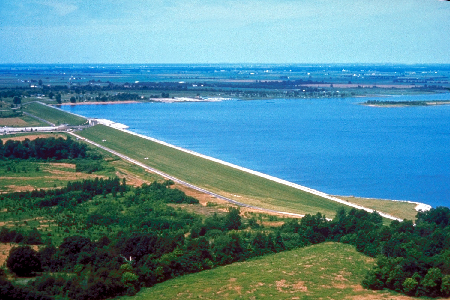
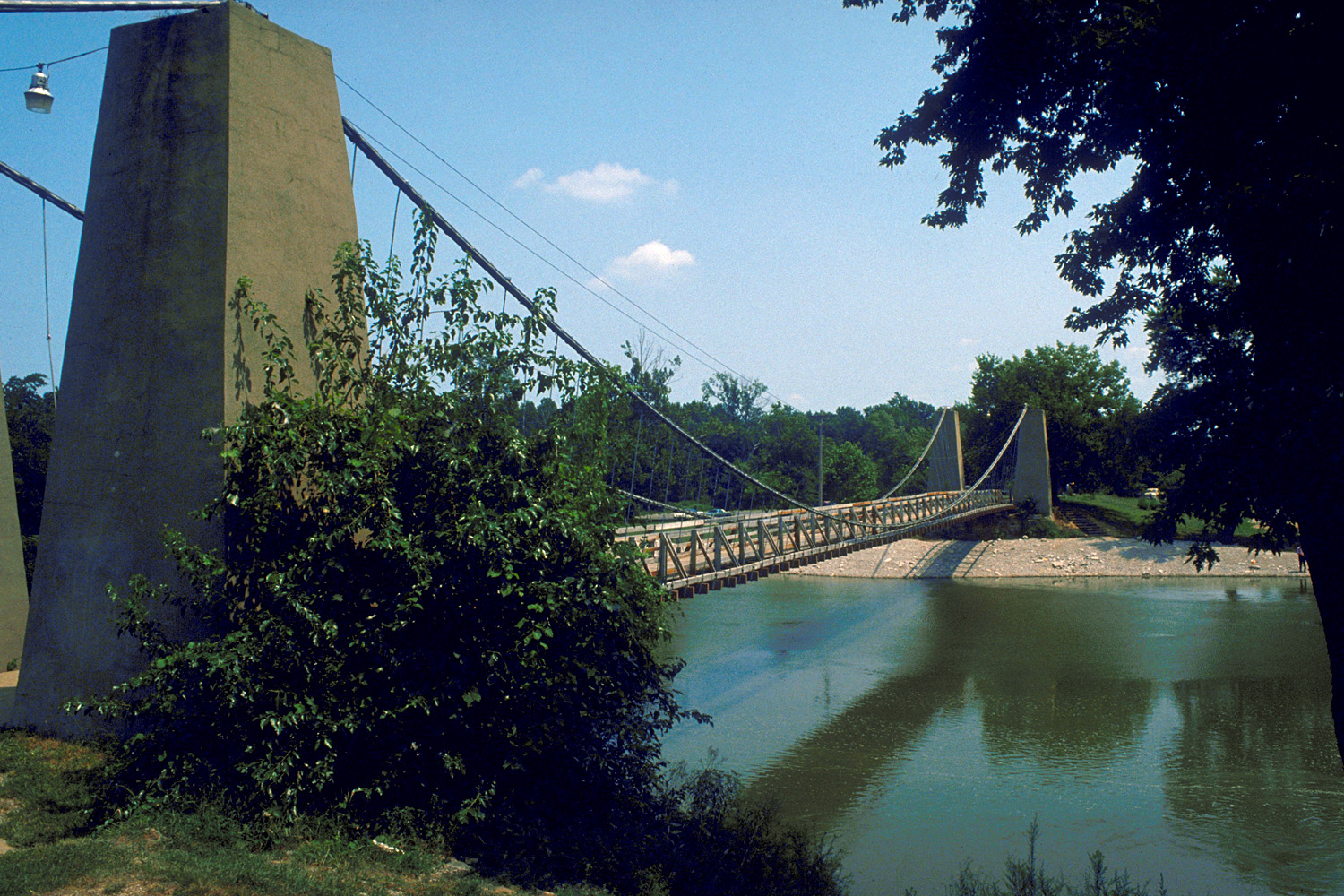
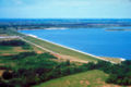 Die Staumauer des Carlyle Lake
Das County liegt im südlichen Illinois und hat eine Fläche von 1.304 Quadratkilometern, wovon 76 Quadratkilometer Wasserfläche sind.
Überwiegend im Clinton County liegt mit dem Carlyle Lake, der durch Aufstauen des Kaskaskia River entstand, der größte Stausee von Illinois.
An das Clinton County grenzen folgende Countys:
Madison County Bond County Fayette County St. Clair County 
Marion County Washington County Geschichte
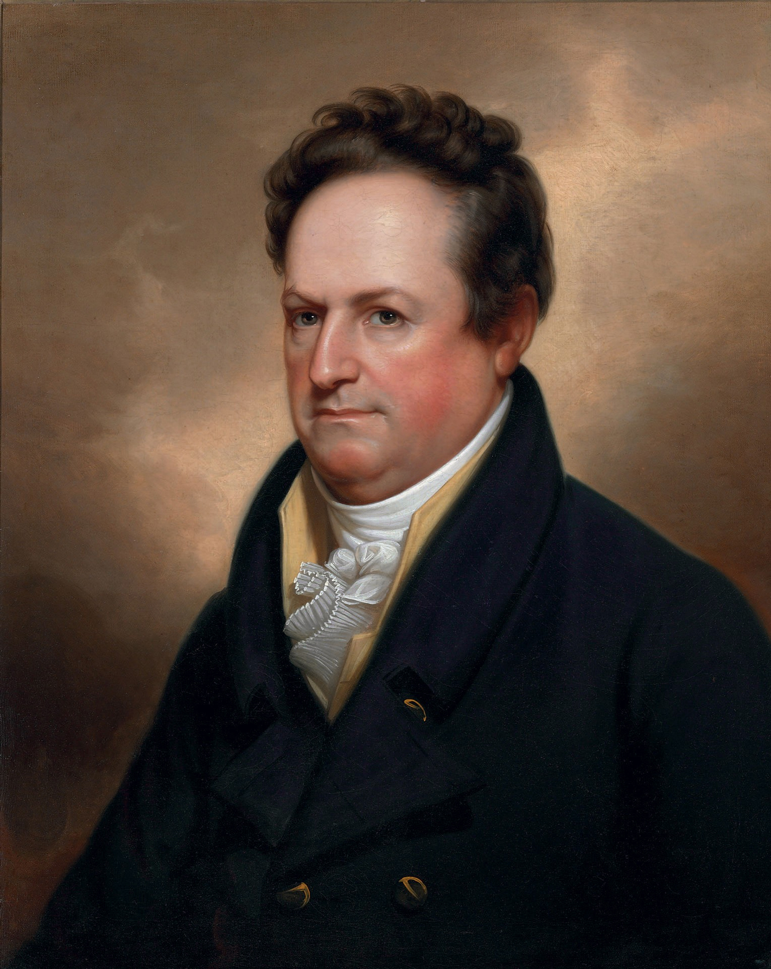
 DeWitt Clinton
Die erste Besiedlung erfolgte 1811 durch einen Mister Hill. Das Hill-Blockhaus war das erste registrierte Gebäude und stand an der Stelle des heutigen Carlyle. Durch das Land führte der Goshen Trace, der ein alter Indianerpfad zu einer Salz-Mine war. Als 1820 die erste befestigte Straße von Vincennes nach St. Louis erbaut wurde, benutzte sie diesen Pfad als Grundlage. Hill war auch der erste, der einen Fährbetrieb über den Kaskaskia River einführte. 1817 kamen weitere Siedler hinzu und 1824 sollen 1.100 Menschen hier gelebt haben, davon 137 in Carlyle.
Am 27. Dezember 1814 wurde das County aus Teilen der Countys Washington, Bond und Fayette gegründet und benannt nach DeWitt Clinton, einem Bürgermeister von New York und späteren Gouverneur des Bundesstaates New York.
1857 wurde in der Gegend durch die Ohio and Mississippi Railroad eine Eisenbahnstrecke verlegt und 1878 lebten bereits mehrere Tausend Menschen in dem County. Der nächste Sprung der Besiedlung begann 1911 durch den Öl-Boom.
Demografische Daten
Historische Einwohnerzahlen Census Einwohner ± in % 1830 2330 — 1840 3718 60 % 1850 5139 40 % 1860 10.941 100 % 1870 16.285 50 % 1880 18.714 10 % 1890 17.411 -7 % 1900 19.824 10 % 1910 22.832 20 % 1920 22.947 0,5 % 1930 21.369 -7 % 1940 22.912 7 % 1950 22.594 -1 % 1960 24.029 6 % 1970 28.315 20 % 1980 32.617 20 % 1990 33.944 4 % 2000 35.535 5 % 2010 37.762 6 % Vor 1900[3] 1900–1990[4] 2010[5] Nach der Volkszählung im Jahr 2010 lebten im Clinton County 37.762 Menschen in 13.871 Haushalten. Die Bevölkerungsdichte betrug 30,8 Einwohner pro Quadratkilometer.
Ethnisch betrachtet setzte sich die Bevölkerung zusammen aus 93,4 Prozent Weißen, 3,5 Prozent Afroamerikanern, 0,2 Prozent amerikanischen Ureinwohnern, 0,4 Prozent Asiaten sowie aus anderen ethnischen Gruppen; 1,1 Prozent stammten von zwei oder mehr Ethnien ab. Unabhängig von der ethnischen Zugehörigkeit waren 2,8 Prozent der Bevölkerung spanischer oder lateinamerikanischer Abstammung.
In den 13.871 Haushalten lebten statistisch je 2,41 Personen.
22,7 Prozent der Bevölkerung waren unter 18 Jahre alt, 62,2 Prozent waren zwischen 18 und 64 und 15,1 Prozent waren 65 Jahre oder älter. 48,2 Prozent der Bevölkerung war weiblich.
Das jährliche Durchschnittseinkommen eines Haushalts lag bei 53.873 USD. Das Pro - Kopf - Einkommen betrug 24.722 USD. 8,4 Prozent der Einwohner lebten unterhalb der Armutsgrenze.[7]
Städte und Gemeinden
- Trenton
- Wamac
- Albers
- Aviston
- Bartelso
- Beckemeyer
- Damiansville
- Germantown
- Hoffman
- Huey
- Keyesport2
- New Baden3
1 - teilweise im Washington, Jefferson und im Marion County
2 - teilweise im Bond County
3 - teilweise im St. Clair CountyEinzelnachweise
- ↑ GNIS-ID: 424215. Abgerufen am 22. Februar 2011 (englisch).
- ↑ National Association of Counties Abgerufen am 23. September 2011
- ↑ U.S. Census Bureau - Census of Population and Housing Abgerufen am 15. März 2011
- ↑ Auszug aus Census.gov Abgerufen am 14. Februar 2011
- ↑ United States Census 2010 Abgerufen am 23. September 2011
- ↑ Auszug aus dem National Register of Historic Places Abgerufen am 13. März 2011
- ↑ U.S. Census Buero, State & County QuickFacts - Clinton County Abgerufen am 23. September 2011
Weblinks
-
 Commons: Clinton County, Illinois – Sammlung von Bildern, Videos und Audiodateien
 - Offizielle Webseite
- U.S. Census Buero, State & County QuickFacts - Clinton County
- Yahoo Bildersuche - Clinton County
- www.city-data.com - Clinton County
- Illinois State Archives - Clinton County

Liste der Countys in Illinois
Adams | Alexander | Bond | Boone | Brown | Bureau | Calhoun | Carroll | Cass | Champaign | Christian | Clark | Clay | Clinton | Coles | Cook | Crawford | Cumberland | DeKalb | DeWitt | Douglas | DuPage | Edgar | Edwards | Effingham | Fayette | Ford | Franklin | Fulton | Gallatin | Greene | Grundy | Hamilton | Hancock | Hardin | Henderson | Henry | Iroquois | Jackson | Jasper | Jefferson | Jersey | Jo Daviess | Johnson | Kane | Kankakee | Kendall | Knox | LaSalle County | Lake | Lawrence | Lee | Livingston | Logan | Macon | Macoupin | Madison | Marion | Marshall | Mason | Massac | McDonough | McHenry | McLean | Menard | Mercer | Monroe | Montgomery | Morgan | Moultrie | Ogle | Peoria | Perry | Piatt | Pike | Pope | Pulaski | Putnam | Randolph | Richland | Rock Island | Saline | Sangamon | Schuyler | Scott | Shelby | St. Clair | Stark | Stephenson | Tazewell | Union | Vermilion | Wabash | Warren | Washington | Wayne | White | Whiteside | Will | Williamson | Winnebago | Woodford
Wikimedia Foundation.
Schlagen Sie auch in anderen Wörterbüchern nach:
Clinton County, Illinois — Location in the state of Illinois … Wikipedia
Meridian Township, Clinton County, Illinois — Meridian Township Township Location in Clinton County … Wikipedia
Clement Township, Clinton County, Illinois — Clement Township Township Location in Clinton County … Wikipedia
Breese Township, Clinton County, Illinois — Geobox Township name = Breese Township native name = other name = other name1 = category = Township image size = image caption = flag size = symbol = symbol size = country = United States state = Illinois region = Clinton region type = County… … Wikipedia
Brookside Township, Clinton County, Illinois — Geobox Township name = Brookside Township native name = other name = other name1 = category = Township image size = image caption = flag size = symbol = symbol size = country = United States state = Illinois region = Clinton region type = County… … Wikipedia
Carlyle Township, Clinton County, Illinois — Geobox Township name = Carlyle Township native name = other name = other name1 = category = Township image size = image caption = flag size = symbol = symbol size = country = United Statesflagicon|United States state = Illinoisflagicon|Illinois… … Wikipedia
East Fork Township, Clinton County, Illinois — Geobox Township name = East Fork Township native name = other name = other name1 = category = Township image size = image caption = flag size = symbol = symbol size = country = United States state = Illinois region = Clinton region type = County… … Wikipedia
Germantown Township, Clinton County, Illinois — Geobox Township name = Germantown Township native name = other name = other name1 = category = Township image size = image caption = flag size = symbol = symbol size = country = United States state = Illinois region = Clinton region type = County … Wikipedia
Irishtown Township, Clinton County, Illinois — Geobox Township name = Irishtown Township native name = other name = other name1 = category = Township image size = image caption = flag size = symbol = symbol size = country = United States state = Illinois region = Clinton region type = County… … Wikipedia
Lake Township, Clinton County, Illinois — Geobox Township name = Lake Township native name = other name = other name1 = category = Township image size = image caption = flag size = symbol = symbol size = country = United States state = Illinois region = Clinton region type = County… … Wikipedia
Clinton County (Illinois)


18+
© Academic, 2000-2024
- Kontaktieren Sie uns: Unterstützung, Werbung
Wörterbücher Export, schritte mit PHP, Joomla, Drupal, WordPress, MODx.