- Edwardsville (Illinois)
-

Dieser Artikel wurde aufgrund von inhaltlichen Mängeln auf der Qualitätssicherungsseite des Projektes USA eingetragen. Hilf mit, die Qualität dieses Artikels auf ein akzeptables Niveau zu bringen, und beteilige dich an der Diskussion! 
Edwardsville 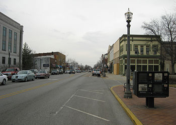
Edwardsville
Siegel
FlaggeLage in Illinois 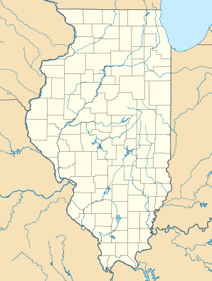

Edwardsville Basisdaten Gründung: 1818 Staat: Vereinigte Staaten Bundesstaat: Illinois County: Koordinaten: 38° 49′ N, 89° 57′ W38.8125-89.9575165Koordinaten: 38° 49′ N, 89° 57′ W Zeitzone: Central Standard Time (UTC−6) Einwohner:
– Metropolregion:24.293 (Stand: Zensus 2010)
2.698.687 (Stand: 2009)Bevölkerungsdichte: 674,8 Einwohner je km² Fläche: 36,52 km² (ca. 14 mi²)
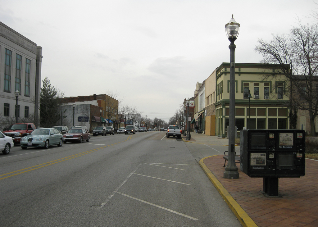
davon 36,0 km² (ca. 14 mi²) LandHöhe: 165 m Postleitzahlen: 62025, 62026 Vorwahl: +1 618 FIPS: 17-22697 GNIS-ID: 407807 Webpräsenz: www.cityofedwardsville.com Bürgermeister: Gary Niebur Edwardsville ist die drittälteste Stadt des US-Bundesstaates Illinois. Ihre Einwohnerzahl beträgt 24.293 (Volkszählung 2010). Sie liegt 29 km nordöstlich der Stadt St. Louis und gehört zu Metro-East, dem östlichen Teil der Metropolregion Greater St. Louis. Edwardsville ist Verwaltungssitz (County Seat) des Madison County. Die Southern Illinois University Edwardsville ist eine staatliche Universität der Stadt.
Söhne und Töchter der Stadt
- Hedy Burress, Schauspielerin
- Charles Deneen, Politiker, von 1905 bis 1913 der 25. Gouverneur von Illinois
Städte und Gemeinden im Madison County (Illinois)Citys: Alton | Collinsville | Edwardsville | Granite City | Highland | Madison | Troy | Venice | Wood River
Villages: Alhambra | Bethalto | East Alton | Fairmont City | Glen Carbon | Godfrey | Grantfork | Hamel | Hartford | Livingston | Marine | Maryville | New Douglas | Pierron | Pontoon Beach | Roxana | South Roxana | St. Jacob | Williamson | Worden
Wikimedia Foundation.
Schlagen Sie auch in anderen Wörterbüchern nach:
Edwardsville (Illinois) — 38° 48′ 14″ N 89° 57′ 30″ W / 38.803889, 89.958333 … Wikipédia en Français
Edwardsville, Illinois — Geobox City name = City of Edwardsville native name = other name = other name1 = category = City image size = image caption = flag type = flag size = symbol type = symbol = symbol size = nickname = motto = country = United States state = Illinois … Wikipedia
Edwardsville — (Illinois) Edwardsville Pays … Wikipédia en Français
Edwardsville — ist die Bezeichnung mehrerer Orte in den Vereinigten Staaten: Edwardsville (Alabama) Edwardsville (Delaware) Edwardsville (Illinois) Edwardsville (Indiana) Edwardsville (Kansas) Edwardsville (New York) Edwardsville (Ohio) Edwardsville… … Deutsch Wikipedia
Edwardsville — is the name of several places in the United States and Wales:*Edwardsville, Alabama *Edwardsville, Illinois *Edwardsville, Indiana *Edwardsville, Kansas *Edwardsville, Pennsylvania *Edwardsville, Wales … Wikipedia
Illinois locations by per capita income — Illinois is the eleventh richest state in the United States of America, with a per capita income of $23,104 (2000). Illinois Places by Per Capita Income # Kenilworth, Illinois ndash; $101,086 # Glencoe, Illinois ndash; $84,134 # North Barrington … Wikipedia
Illinois Route 157 — Infobox Illinois state route article route = 157 length mi = 35.50 length round = 2 length ref = cite web |author=Illinois Technology Transfer Center |url=http://www.dot.state.il.us/gist2/select.html |title=T2 GIS Data |accessdate=2007 11 08… … Wikipedia
Edwardsville — Edwardsville, IL U.S. city in Illinois Population (2000): 21491 Housing Units (2000): 8331 Land area (2000): 13.872144 sq. miles (35.928687 sq. km) Water area (2000): 0.217536 sq. miles (0.563415 sq. km) Total area (2000): 14.089680 sq. miles (36 … StarDict's U.S. Gazetteer Places
Edwardsville, IL — U.S. city in Illinois Population (2000): 21491 Housing Units (2000): 8331 Land area (2000): 13.872144 sq. miles (35.928687 sq. km) Water area (2000): 0.217536 sq. miles (0.563415 sq. km) Total area (2000): 14.089680 sq. miles (36.492102 sq. km)… … StarDict's U.S. Gazetteer Places
Illinois State University — Official Logo of Illinois State University Motto Gladly we Learn and Teach Established 1857 Type Public … Wikipedia
Edwardsville (Illinois)


18+
© Academic, 2000-2026
- Kontaktieren Sie uns: Unterstützung, Werbung
Wörterbücher Export, schritte mit PHP, Joomla, Drupal, WordPress, MODx.