- Hoonah
-
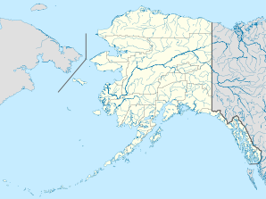
Hoonah Lage in AlaskaBasisdaten Staat: Vereinigte Staaten Bundesstaat: Alaska Borough: Koordinaten: 58° 7′ N, 135° 26′ W58.109436111111-135.4363472222216Koordinaten: 58° 7′ N, 135° 26′ W Zeitzone: Alaska Standard Time (UTC−9) Einwohner: 860 (Stand: 2000) Bevölkerungsdichte: 50,3 Einwohner je km² Fläche: 22,5 km² (ca. 9 mi²)
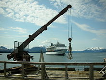
davon 17,1 km² (ca. 7 mi²) LandHöhe: 16 m Vorwahl: +1 907 FIPS: 02-33360 GNIS-ID: 1403488 Hoonah bedeutet Dorf auf den Klippen und ist das größte Tlingit-Dorf in Alaska. Es liegt im Hoonah-Angoon Census Area, 40 Meilen westlich von Juneau auf Chichagof Island an der Icy Strait. Es hatte im Jahr 2000 860 Einwohner, die seit langer Zeit von kommerziellem Fischfang und von Holzwirtschaft leben. Im Sommer legen Kreuzfahrtschiffe hier an.
Geschichte
Hoonah war das Hauptdorf der Huna, einem Tlingit-Stamm. 1880 errichtete die North West Company hier ihren ersten Laden. 1881 wurde eine Presbyterianer Mission und eine Schule gebaut. 1887 überwinterten hier etwa 450 bis 500 Leute. 1901 wurde ein Postamt eingerichtet. 1912 erstellte die Hoonah Packing Co. eine große Konservenfabrik nördlich der Stadt. 1944 zerstörte ein Feuer einen großen Teil der Stadt und viele unschätzbare kulturelle Gegenstände der Tlingit.
Verkehr
Wegen der exklusiven Insellage gibt es nur zwei wichtige Transportmittel: Die Fähre und das Flugzeug. Die täglich verkehrende Fähre M/V LeConte des AMHS verbindet Hoonah mit Juneau. Aus der Luft wird der Hoonah Airport von Wings of Alaska und L.A.B. Flying Service täglich mehrmals angeflogen.
Weblinks
- Informationen über Hoonah (englisch)
Akutan | Angoon | Bellingham | Chenega | Chignik | Cold Bay | Cordova | False Pass | Haines | Homer | Hoonah | Juneau | Kake | Ketchikan | King Cove | Kodiak | Metlakatla | Petersburg | Port Lions | Prince Rupert | Sand Point | Seldovia | Sitka | Skagway | Tatitlek | Tenakee Springs | Unalaska | Valdez | Whittier | Wrangell | Yakutat
Wikimedia Foundation.


