- Johnson County (Georgia)
-
Verwaltung US-Bundesstaat: Georgia Verwaltungssitz: Wrightsville Adresse des
Verwaltungssitzes:County Courthouse
P.O. Box 269
Wrightsville, GA 31096-0269Gründung: 11. Dezember 1858 Gebildet aus: Emanuel County
Laurens County
Washington CountyVorwahl: 001 478 Demographie Einwohner: 8560 (2000) Bevölkerungsdichte: 10,9 Einwohner/km² Geographie Fläche gesamt: 794 km² Wasserfläche: 6 km² Karte 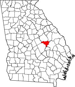
Das Johnson County[1] ist ein County im Bundesstaat Georgia der Vereinigten Staaten von Amerika. Der Verwaltungssitz (County Seat) ist Wrightsville, benannt nach James B. Wright, einem Mitbegründer der Stadt. Im Jahr 2000 hatte das County 8.560 Einwohner und eine Bevölkerungsdichte von 11 Einwohnern pro Quadratkilometer.
Inhaltsverzeichnis
Geografie
Das County liegt im Osten von Georgia und ist im Nordosten etwa 90 km von South Carolina entfernt. Es hat eine Fläche von 794 Quadratkilometern, wovon 6 Quadratkilometer Wasseroberfläche sind und grenzt im Uhrzeigersinn an folgende Countys: Jefferson County, Emanuel County, Laurens County, Wilkinson County und Washington County.
Geschichte
Johnson County wurde am 11. Dezember 1858 als 129. County und Georgia aus Teilen des Emanuel County, des Laurens County und des Washington County gebildet. Benannt wurde es nach Herschel Johnson, einem Gouverneur von Georgia, Senator und glückloser US-Vizepräsident.
Demografische Daten
Historische Einwohnerzahlen Census Einwohner ± in % 1860 2919 — 1870 2964 2 % 1880 4800 60 % 1890 6129 30 % 1900 11.409 90 % 1910 12.897 10 % 1920 13.546 5 % 1930 12.681 -6 % 1940 12.953 2 % 1950 9893 -20 % 1960 8048 -20 % 1970 7727 -4 % 1980 8660 10 % 1990 8329 -4 % 2000 8560 3 % Vor 1900[2] Nach der Volkszählung im Jahr 2000 lebten im Johnson County 8.560 Menschen. Davon wohnten 627 Personen in Sammelunterkünften, die anderen Einwohner lebten in 3.130 Haushalten und 2.241 Familien. Die Bevölkerungsdichte betrug 11 Einwohner pro Quadratkilometer. Ethnisch betrachtet setzte sich die Bevölkerung zusammen aus 62,44 Prozent Weißen, 36,96 Prozent Afroamerikanern, 0,13 Prozent amerikanischen Ureinwohnern, 0,12 Prozent Asiaten, 0,01 Prozent Bewohnern aus dem pazifischen Inselraum und 0,07 Prozent aus anderen ethnischen Gruppen; 0,27 Prozent stammten von zwei oder mehr Ethnien ab. 0,91 Prozent der Gesamtbevölkerung waren spanischer oder lateinamerikanischer Abstammung.
 Alterspyramide für das Johnson County
Von den 3.130 Haushalten hatten 32,3 Prozent Kinder und Jugendliche unter 18 Jahren, die bei ihnen lebten. 49,7 Prozent waren verheiratete, zusammenlebende Paare, 18,2 Prozent waren allein erziehende Mütter und 28,4 Prozent waren keine Familien. 26,6 Prozent waren Singlehaushalte und in 12,7 Prozent lebten Menschen im Alter von 65 Jahren oder darüber. Die Durchschnittshaushaltsgröße betrug 2,53 und die durchschnittliche Familiengröße betrug 3,06 Personen.
30,1 Prozent der Bevölkerung waren unter 18 Jahre alt, 8,9 Prozent zwischen 18 und 24, 24,3 Prozent zwischen 25 und 44, 21,1 Prozent zwischen 45 und 64 und 15,6 Prozent waren 65 Jahre oder älter. Das Durchschnittsalter betrug 35 Jahre. Auf 100 weibliche Personen kamen statistisch 97,1 männliche Personen und auf 100 Frauen im Alter von 18 Jahren oder darüber kamen 83,5 Männer.
Das jährliche Durchschnittseinkommen eines Haushalts betrug 23.848 US-$, das Durchschnittseinkommen der Familien 29.663 US-$. Männer hatten ein Durchschnittseinkommen von 28.952 US-$, Frauen 18.171 US-$. Das Prokopfeinkommen betrug 12.384 US-$. 20,9 Prozent der Familien und 22,6 Prozent der Bevölkerung lebten unterhalb der Armutsgrenze. [5]
Städte und Gemeinden
- Adrian
- Kite
- Wrightsville
Siehe auch
Einzelnachweise
- ↑ GNIS-ID: 346664. Abgerufen am 22. Februar 2011 (englisch).
- ↑ U.S. Census Bureau - Census of Population and Housing. Abgerufen am 15. März 2011
- ↑ Auszug aus Census.gov. Abgerufen am 28. Februar 2011
- ↑ Auszug aus factfinder.census.gov Abgerufen am 28. Februar 2011
- ↑ Johnson County, Georgia, Datenblatt mit den Ergebnissen der Volkszählung im Jahre 2000 bei factfinder.census.gov.
Weblinks
- www.georgia.gov (engl.)

Liste der Countys in Georgia
Appling | Atkinson | Bacon | Baker | Baldwin | Banks | Barrow | Bartow | Ben Hill | Berrien | Bibb | Bleckley | Brantley | Brooks | Bryan | Bulloch | Burke | Butts | Calhoun | Camden | Candler | Carroll | Catoosa | Charlton | Chatham | Chattahoochee | Chattooga | Cherokee | Clarke | Clay | Clayton | Clinch | Cobb | Coffee | Colquitt | Columbia | Cook | Coweta | Crawford | Crisp | Dade | Dawson | Decatur | DeKalb | Dodge | Dooly | Dougherty | Douglas | Early | Echols | Effingham | Elbert | Emanuel | Evans | Fannin | Fayette | Floyd | Forsyth | Franklin | Fulton | Gilmer | Glascock | Glynn | Gordon | Grady | Greene | Gwinnett | Habersham | Hall | Hancock | Haralson | Harris | Hart | Heard | Henry | Houston | Irwin | Jackson | Jasper | Jeff Davis | Jefferson | Jenkins | Johnson | Jones | Lamar | Lanier | Laurens | Lee | Liberty | Lincoln | Long | Lowndes | Lumpkin | Macon | Madison | Marion | McDuffie | McIntosh | Meriwether | Miller | Mitchell | Monroe | Montgomery | Morgan | Murray | Muscogee | Newton | Oconee | Oglethorpe | Paulding | Peach | Pickens | Pierce | Pike | Polk | Pulaski | Putnam | Quitman | Rabun | Randolph | Richmond | Rockdale | Schley | Screven | Seminole | Spalding | Stephens | Stewart | Sumter | Talbot | Taliaferro | Tattnall | Taylor | Telfair | Terrell | Thomas | Tift | Toombs | Towns | Treutlen | Troup | Turner | Twiggs | Union | Upson | Walker | Walton | Ware | Warren | Washington | Wayne | Webster | Wheeler | White | Whitfield | Wilcox | Wilkes | Wilkinson | Worth
Wikimedia Foundation.
Schlagen Sie auch in anderen Wörterbüchern nach:
Johnson County, Georgia — Infobox U.S. County county = Johnson County state = Georgia seallink = founded = December 11, 1858 seat wl = Wrightsville largest city wl = Wrightsville area total sq mi = 307 area total km2 = 794 area land sq mi = 304 area land km2 = 788 area… … Wikipedia
National Register of Historic Places listings in Johnson County, Georgia — This is a list of properties and districts in Johnson County, Georgia that are listed on the National Register of Historic Places (NRHP). Map of all coordinates from Google Map of all coordinates from Bing … Wikipedia
Johnson County — is the name of several counties in the United States: Johnson County, Arkansas Johnson County, Georgia Johnson County, Illinois Johnson County, Indiana Johnson County, Iowa Johnson County, Kansas Johnson County, Kentucky Johnson County, Missouri… … Wikipedia
Johnson County — Es gibt in den Vereinigten Staaten zwölf Countys mit dem Namen Johnson County: Johnson County (Arkansas) Johnson County (Georgia) Johnson County (Illinois) Johnson County (Indiana) Johnson County (Iowa) Johnson County (Kansas) Johnson County… … Deutsch Wikipedia
Johnson County Courthouse — can refer to:* Johnson County Courthouse (Arkansas), (Clarksville, Arkansas) * Johnson County Courthouse (Georgia), (Wrightsville, Georgia) * Johnson County Courthouse (Iowa), (Iowa City, Iowa) * Johnson County Courthouse (Missouri), (Warrensburg … Wikipedia
Johnson County Courthouse — bezeichnet mehrere gleichnamige, im NRHP gelistete, Objekte: Johnson County Courthouse (Arkansas), ID Nr. 91000680 Johnson County Courthouse (Georgia), ID Nr. 80001101 Johnson County Courthouse (Iowa), ID Nr. 75000692 Johnson County Courthouse… … Deutsch Wikipedia
Jefferson County, Georgia — Location in the state of Georgia … Wikipedia
Emanuel County, Georgia — Infobox U.S. County county = Emanuel County state = Georgia seallink = map size = 225 founded = 1812 seat = Swainsboro largest city = Swainsboro area total sq mi = 690 area total km2 = 1788 area land sq mi = 686 area land km2 = 1776 area water sq … Wikipedia
Laurens County, Georgia — Infobox U.S. County county = Laurens County state = Georgia map size = 225 founded = December 10, 1807 seat = Dublin largest city = Dublin area total sq mi = 819 area total km2 = 2120 area land sq mi = 812 area land km2 = 2104 area water sq mi =… … Wikipedia
Johnson County Museum of History — Masonic Temple U.S. National Register of Historic Places … Wikipedia
Johnson County (Georgia)


18+
© Academic, 2000-2026
- Kontaktieren Sie uns: Unterstützung, Werbung
Wörterbücher Export, schritte mit PHP, Joomla, Drupal, WordPress, MODx.