- Kozłowo
-
Kozłowo 
Basisdaten Staat: Polen Woiwodschaft: Ermland-Masuren Landkreis: Nidzica Geographische Lage: 53° 18′ N, 20° 17′ O53.320.283333333333Koordinaten: 53° 18′ 0″ N, 20° 17′ 0″ O Einwohner: 3000
Postleitzahl: 13-124 Telefonvorwahl: (+48) 89 Kfz-Kennzeichen: NNI Wirtschaft und Verkehr Straße: Nidzica–Działdowo Nächster int. Flughafen: Warschau Gemeinde Gemeindeart: Landgemeinde Gemeindegliederung: 28 Schulzenämter Fläche: 254 km² Einwohner: 6028
(31. Dez. 2010) [1]Bevölkerungsdichte: 24 Einw./km² Gemeindenummer (GUS): 2811032 Verwaltung (Stand: 2007) Gemeindevorsteher: Jacek Jankowski Adresse: 60a
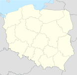
13-124 KozłowoWebpräsenz: www.kozlowo.pl Kozłowo [kɔz'wɔvɔ] (deutsch Koslau) ist eine Gemeinde in Polen. Sie liegt zwölf Kilometer südwestlich der Stadt Nidzica und gehört dem Powiat Nidzicki, Woiwodschaft Ermland-Masuren an.
Inhaltsverzeichnis
Geschichte
Kozłowo besteht historisch aus den beiden Dörfern Klein Koslau (1938–1945 Klein Kosel) und Groß Koslau (1938–1945 Groß Kosel). Die Orte gehörten bis 1945 zum Landkreis Neidenburg in der Provinz Ostpreußen.
Klein Koslau wurde erstmalig am 29. Juni 1328 urkundlich erwähnt. Das Dorf war bereits vor der Reformation Mittelpunkt eines Kirchspieles. Am 19. Januar 1945 wurde der Ort von sowjetischen Truppen erobert und mit Ende des Zweiten Weltkriegs Teil Polens.
Kirchspiel
Bis 1945 war der Ortsteil Klein Koslau ein evangelisches Kirchspiel. Zu diesem gehörten auch die Orte:
Groß-Koslau, Opacznickmühle, Polko, Posaren, Groß-Sakrau, Sakrau, Sabloczyn, Sontop, Wilmsdorf.
Landgemeinde
Die Landgemeinde (gmina wiejska) Kozłowo umfasst eine Fläche von 254 km², auf denen 6.000 Einwohner leben. Dazu gehören folgende Ortschaften:
- Bartki (Bartkenguth)
- Browina (Browienen, 1938–45: Froben)
- Cebulki (Pilgramsaue)
- Dziurdziewo (Dziurdziau, 1938–45: Thalheim), mit
- Kamionki (Kamiontken, 1938–45: Steinau)
- Górowo (Gorau)
- Kozłowo (Groß Koslau, 1938–45: Groß Kosel) mit
- Sątop (Sontopp, Santop)
- Zakrzewo (Sakrau)
- Krokowo (Krokau) mit
- Michałki (Michalken, 1938–45: Michelsau)
- Januszkowo (Januschkau, 1938-45: Osterschau)
- Niedanowo (Niedenau)
- Pielgrzymowo (Pilgramsdorf)
- Rogóż (Roggenhausen) mit
- Lipowo (Lippona, 1938–45: Lippau)
- Sarnowo (Scharnau)
- Siemianowo (Schiemienau)
- Sławka Mała (Klein Schläfken)
- Sławka Wielka (Groß Schläfken)
- Szkotowo (Skottau) mit
- Kownatki (Kownatken, 1938–45: Kaunen)
- Szkudaj (Scuday, 1938–45: Skudayen)
- Szymany (Schiemanen)
- Turowo (Thurau)
- Turówko (Thurowken, 1938-45: Turauken)
- Ważyny (Waschinnen, Wasienen)
- Wierzbowo (Wiersbau, 1938–45: Wiesenfeld) mit
- Gołębiewo (Taubendorf)
- Borowiec (Neu Borowen)
- Miłkowiec
- Wola (Wolla, 1938–45: Grenzdamm)
- Zabłocie Kozłowskie (Sablotschen, 1938–45: Winrichsrode)
- Zaborowo (Saberau)
- Zakrzewko (Klein Sakrau) mit
- Kadyki (Kadicki)
- Zalesie (Saleschen, 1938–45: Salleschen)
Verweise
Weblinks
Fußnoten
- ↑ Population. Size and Structure by Territorial Division. As of December 31, 2010. Główny Urząd Statystyczny (GUS), abgerufen am 23. Juni 2011.
Wikimedia Foundation.

