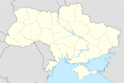
- Krasnoperekopsk
-
Krasnoperekopsk (Красноперекопськ) 
Basisdaten Oblast: Autonome Republik Krim Rajon: Kreisfreie Stadt Höhe: keine Angabe Fläche: 22 km² Einwohner: 30.902 (2004) Bevölkerungsdichte: 1.405 Einwohner je km² Postleitzahlen: 96000 Vorwahl: +380 6565 Geographische Lage: 45° 58′ N, 33° 47′ O45.96666666666733.783333333333Koordinaten: 45° 58′ 0″ N, 33° 47′ 0″ O KOATUU: 111300000 Verwaltungsgliederung: 1 Stadt Bürgermeister: Wolodymyr Abissow Adresse: пл. Героїв Перекопу 1а
96000 м. КрасноперекопськStatistische Informationen Krasnoperekopsk (ukrainisch Красноперекопськ; russisch Красноперекопск) ist eine Stadt auf der Krim, Ukraine mit 33.000 Einwohnern. Sie liegt auf der Landenge von Perekop ca. 120 km nordwestlich von Simferopol. In Krasnoperekopsk befindet sich die größte Sodafabrik der Ukraine, wegen dieser wurde der Ort 1932 als Siedlung für die Arbeiter des heutigen Sodawerkes gegründet und besitzt das Stadtstatut seit 1966. Der Name bezieht sich auf die 1920 zerstörte Stadt Perekop, der Namenszusatz „Krasno-“ bedeutet dabei „Rot-“. Die Stadt liegt an der Bahnstrecke Dschankoj–Cherson, eine der 2 Bahnstrecken die die Krim mit dem Festland verbinden.
Weblinks
Alupka | Aluschta | Armjansk | Bachtschyssaraj | Bilohirsk | Dschankoj | Feodossija | Jalta | Jewpatorija | Kertsch | Krasnoperekopsk | Saky | Schtscholkine | Simferopol | Staryj Krym | Sudak
Siedlungen städtischen Typs
Ahrarne | Aeroflotskyj | Asowske | Baherowe | Berehowe | Foros | Haspra | Holuba Zatoka | Hressiwksyj | Hursuf | Hwardijske | Kaziweli | Kirowske | Koktebel | Komsomolske | Korejis | Krasnohwardijske | Krasnokamjanka | Kujbyschewe | Kurortne | Kurpaty | Lenine | Liwadija | Massandra | Mykolajiwka | Myrnyj | Molodischne | Nautschnyj | Nyschnjohirskyj | Nikita | Nowyj Swit | Nowooserne | Nowoseliwske | Nowofedoriwka | Oktjabrske | Ordschonikidse | Oreanda | Parkowe | Partenit | Perwomajske | Ponysiwka | Poschtowe | Prymorskyj | Rosdolne | Sanatorne | Saoserne | Simejis | Schtschebetowka | Sowjetske | Sowjetskyj | Suja | Tschornomorske | Widradne | Wilne | Woschod | Wynohradne
Wikimedia Foundation.

