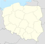
- Limanowa
-
Limanowa 
Basisdaten Staat: Polen Woiwodschaft: Kleinpolen Landkreis: Limanowa Fläche: 18,6 km² Geographische Lage: 49° 43′ N, 20° 26′ O49.71666666666720.433333333333Koordinaten: 49° 43′ 0″ N, 20° 26′ 0″ O Höhe: 400 m n.p.m Einwohner: 14.918
(31. Dez. 2010)[1]Postleitzahl: 34-600, 34-601, 34-651 Telefonvorwahl: (+48) 18 Kfz-Kennzeichen: KLI Wirtschaft und Verkehr Straße: Landesstraße 28 Zator–Sanok–Przemyśl (DK28) (UA) Schienenweg: Nowy Sącz Nächster int. Flughafen: Krakau-Balice Gemeinde Gemeindeart: Stadtgemeinde Fläche: 18,6 km² Einwohner: 14.918
(31. Dez. 2010) [2]Bevölkerungsdichte: 800 Einw./km² Gemeindenummer (GUS): 1207011 Verwaltung (Stand: 2007) Bürgermeister: Marek Czeczótka Adresse: ul. Jana Pawła II 9
34-600 LimanowaWebpräsenz: www.miasto.limanowa.pl Limanowa [lʲima'nɔva] (deutsch Ilmenau) ist eine Stadt im Ostteil der Inselbeskiden (Beskid Wyspowy) in Südpolen mit etwa 14.700 Einwohnern. Sie liegt 23 km nordwestlich von Nowy Sącz und ist Kreisstadt des Powiat Limanowski, Wojewodschaft Kleinpolen.
Inhaltsverzeichnis
Geschichte
Das Stadtrecht erhielt der Ort 1565 nach Magdeburger Recht. Während des Ersten Weltkriegs fand hier 1914 die Schlacht bei Limanowa-Lapanow statt.
Söhne und Töchter der Stadt
- Zygmunt Berling (1896-1980), polnischer General und Politiker
- Justyna Kowalczyk (*1983), polnische Skilangläuferin
- Maciej Kot (*1991), polnischer Skispringer
- Jakub Kot (*1990), polnischer Skispringer
Partnerstädte
- Dolný Kubín, Slowakei
- Nagykallo, Ungarn
- Niles (Illinois), USA
- Truskawez, Ukraine
- Samtgemeinde Wathlingen, Deutschland
Verweise
Weblinks
 Commons: Limanowa – Album mit Bildern und/oder Videos und Audiodateien
Fußnoten
- ↑ Population. Size and Structure by Territorial Division. As of December 31, 2010. Główny Urząd Statystyczny (GUS), abgerufen am 4. Juli 2011.
- ↑ Population. Size and Structure by Territorial Division. As of December 31, 2010. Główny Urząd Statystyczny (GUS), abgerufen am 4. Juli 2011.
Städte und Gemeinden im Powiat LimanowskiDobra | Jodłownik | Kamienica | Laskowa | Limanowa – Stadt | Limanowa-Gmina | Łukowica | Mszana Dolna – Stadt | Mszana Dolna-Gmina | Niedźwiedź | Słopnice | Tymbark
Wikimedia Foundation.
Schlagen Sie auch in anderen Wörterbüchern nach:
Limanowa — Bandera … Wikipedia Español
Limanowa — Héraldique Drap … Wikipédia en Français
Limanōwa — Limanōwa, Stadt in Galizien, an der Staatsbahnlinie Zwardón Neu Sandec, Sitz einer Bezirkshauptmannschaft und eines Bezirksgerichts, mit Bierbrauerei und (1900) 1806 poln. Einwohnern … Meyers Großes Konversations-Lexikon
Limanowa — Infobox Settlement name = Limanowa image shield = POL Limanowa COA.svg pushpin pushpin label position = bottom subdivision type = Country subdivision name = POL subdivision type1 = Voivodeship subdivision name1 = Lesser Poland subdivision type2 … Wikipedia
Limanowa — Original name in latin Limanowa Name in other language Limanova, Limanowa, li ma nuo wa, Лиманова, Ліманова State code PL Continent/City Europe/Warsaw longitude 49.70594 latitude 20.42204 altitude 408 Population 14714 Date 2010 09 10 … Cities with a population over 1000 database
Limanowa County — Infobox Settlement name = Limanowa County native name = Powiat limanowski settlement type = image shield = POL powiat limanowski COA.svg map caption = Location within the voivodeship subdivision type = Country subdivision name = POL subdivision… … Wikipedia
Gmina Limanowa — Infobox Settlement name = Gmina Limanowa other name = Limanowa Commune settlement type = Gmina total type = Total image shield = subdivision type = Country subdivision name = POL subdivision type1 = Voivodeship subdivision name1 = Lesser Poland… … Wikipedia
Młynne, Limanowa County — See also: Młynne, Nowy Targ County Młynne Village … Wikipedia
Lipowe, Limanowa County — Infobox Settlement name = Lipowe settlement type = Village total type = image shield = subdivision type = Country subdivision name = POL subdivision type1 = Voivodeship subdivision name1 = Lesser Poland subdivision type2 = County subdivision… … Wikipedia
Siekierczyna, Limanowa County — Infobox Settlement name = Siekierczyna settlement type = Village total type = image shield = subdivision type = Country subdivision name = POL subdivision type1 = Voivodeship subdivision name1 = Lesser Poland subdivision type2 = County… … Wikipedia

