- Magarao
-
Municipality of Magarao Lage von Magarao in der Provinz Camarines Sur 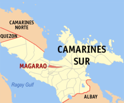
Basisdaten Bezirk: Bicol-Region Provinz: Camarines Sur Barangays: 15 Distrikt: 2. Distrikt von Camarines Sur PSGC: 051720000 Einkommensklasse: 5. Einkommensklasse Haushalte: 3910 Zensus 1. Mai 2000Einwohnerzahl: 22.515 Zensus 1. August 2007Bevölkerungsdichte: 577,2 Einwohner je km² Fläche: 39,01 km² Koordinaten: 13° 40′ N, 123° 11′ O13.666666666667123.18333333333Koordinaten: 13° 40′ N, 123° 11′ O Postleitzahl: 4403 Vorwahl: +63 54 Bürgermeister: Nelson B. Julia Geographische Lage auf den Philippinen 

Magarao Magarao ist eine philippinische Stadtgemeinde in der Provinz Camarines Sur. Nach dem Zensus vom 1. Mai 2000 hat sie 20.964 Einwohner in 3910 Haushalten.
Baranggays
Magarao ist politisch in 15 Baranggays unterteilt.
- Barobaybay
- Bell (Pob.)
- Carangcang
- Carigsa
- Casuray
- Montserrat (Pob.)
- Ponong
- San Francisco (Pob.)
- San Isidro (Pob.)
- San Juan (Pob.)
- San Miguel
- San Pantaleon (Pob.)
- Santa Lucia (Pob.)
- Santa Rosa
- Santo Tomas (Pob.)
Städte und Stadtgemeinden in der Provinz Camarines SurStädte: Iriga City | Naga City
Stadtgemeinden: Baao | Balatan | Bato | Bombon | Buhi | Bula | Cabusao | Calabanga | Camaligan | Canaman | Caramoan | Del Gallego | Gainza | Garchitorena | Goa | Lagonoy | Libmanan | Lupi | Magarao | Milaor | Minalabac | Nabua | Ocampo | Pamplona | Pasacao | Pili | Presentacion | Ragay | Sagñay | San Fernando | San Jose | Sipocot | Siruma | Tigaon | Tinambac
Wikimedia Foundation.
Schlagen Sie auch in anderen Wörterbüchern nach:
Magarao — Original name in latin Magarao Name in other language Magarao State code PH Continent/City Asia/Manila longitude 13.6604 latitude 123.1869 altitude 5 Population 15205 Date 2011 07 31 … Cities with a population over 1000 database
Magarao, Camarines Sur — Magarao Municipality Map of Camarines Sur showing the location of Magarao … Wikipedia
Metro Naga — is a metropolitan area composed of 14 municipalities centered around Naga City, Camarines Sur, Philippines. The MNDC covers most of 2nd district of the province of Camarines Sur, and part of its 1st, 3rd and 4th districts. Metro Naga … Wikipedia
Poro (Barangay) — Municipality of Canaman Lage von Canaman in der Provinz Camarines Sur Basisdaten Bezirk: Bicol Region … Deutsch Wikipedia
Naga, Camarines Sur — City of Naga Ciudad nin Naga Lungsod ng Naga Seal Nickname(s) … Wikipedia
Languages of the Philippines — See also: Philippine languages Languages of the Philippines Map of the dominant ethnolinguistic groups of the Philippines … Wikipedia
Canaman, Camarines Sur — Infobox Philippine municipality infoboxtitle = Municipality of Canaman locatormapfile = Ph locator camarines sur canaman.png caption = Map of Camarines Sur showing the location of Canaman region = Bicol Region province = Municipality in Camarines … Wikipedia
Milaor, Camarines Sur — Milaor Municipality Map of Camarines Sur showing the location of Milaor … Wikipedia
Minalabac, Camarines Sur — Minalabac Municipality Map of Camarines Sur showing the location of Minalabac … Wikipedia
Ocampo, Camarines Sur — Ocampo Municipality Map of Camarines Sur showing the location of Ocampo … Wikipedia
Magarao


18+
© Academic, 2000-2026
- Kontaktieren Sie uns: Unterstützung, Werbung
Wörterbücher Export, schritte mit PHP, Joomla, Drupal, WordPress, MODx.