- Maoka
-
Stadt Cholmsk
ХолмскWappen Föderationskreis Ferner Osten Oblast Sachalin Rajon Cholmsk Gegründet 1870 Frühere Namen Maoka (bis 1946) Stadt seit 1946 Fläche 32 km² Höhe des Zentrums 29 m Bevölkerung 31.819 Einw. (Stand: 2008) Bevölkerungsdichte 994 Ew./km² Zeitzone UTC+10 (Sommerzeit: UTC+11) Telefonvorwahl (+7) 42433 Postleitzahl 694620–694627 Kfz-Kennzeichen 65 OKATO 64 440 Webseite adm.kholmsk.ru Geographische Lage Koordinaten: 47° 3′ N, 142° 3′ O47.05142.0529Koordinaten: 47° 3′ 0″ N, 142° 3′ 0″ O Liste der Städte in Russland Cholmsk (russisch Холмск) ist eine Stadt in der Oblast Sachalin (Russland) mit 31.819 Einwohnern (Berechnung 2008).
Inhaltsverzeichnis
Geographie
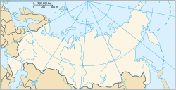
Die Stadt liegt an der Westküste des Südteils der Insel Sachalin, etwa 80 km westlich der Oblasthauptstadt Juschno-Sachalinsk, an der Newelskoi-Bucht des Japanischen Meeres.
Die Stadt Cholmsk ist der Oblast administrativ direkt unterstellt und zugleich Verwaltungszentrum des gleichnamigen Rajons.
Geschichte
Der Ort wurde 1870 als russischer Militärposten gegründet. Von 1905 bis 1945 gehörte er nach dem Vertrag von Portsmouth, der den Russisch-Japanischen Krieg 1904–1905 beendete, als Maoka (jap. 真岡町, -chō, wörtlich: „echter/wahrer Hügel“) zu Japan. Als Ergebnis des Zweiten Weltkrieges kam die Stadt wieder zur Sowjetunion und erhielt 1946 unter dem heutigen Namen Stadtrecht (von russisch cholm für Hügel, in Bezug auf die terrassenförmige Anlage des Ortes um die Hafenbucht).
Einwohnerentwicklung
Jahr Einwohnerzahlen 1941 19.193 * 1959 31.500 ** 1979 45.100 ** 1989 51.400 * 2002 35.141 * 2006 31.819 Anmerkung: * Volkszählung ** Volkszählung (gerundet)
Wirtschaft und Infrastruktur
Die Stadt wird von der Schifffahrt und der Fischwirtschaft geprägt. Der Hafen dient als See-, Fähr- und Fischereihafen und ist Operationsbasis der Fischfangflotte von Sachmoreprodukt sowie der Sachaliner Seereederei (Sachalinskoje morskoje parochodstwo). Daneben gibt es eine Papierfabrik sowie Betriebe der Bau- und Lebensmittelwirtschaft.
Cholmsk ist Endpunkt der Eisenbahnfährverbindung nach Wanino auf dem russischen Festland (Region Chabarowsk). Die Stadt liegt an der entlang der Westküste der Insel verlaufenden schmalspurigen Eisenbahnstrecke (Kapspur 1067 mm) Iljinsk–Schachta-Sachalinskaja. Die direkte Bahnverbindung in die Oblasthauptstadt Juschno-Sachalinsk wurde wegen des schlechten Steckenzustandes 1994 stillgelegt. Die Stadt besitzt einen Flughafen.
Weblinks
- Webseite der Stadtverwaltung (russisch)
- Stadtportal (russisch)
- Cholmsk auf mojgorod.ru (russisch)
Verwaltungszentrum: Juschno-Sachalinsk
Alexandrowsk-Sachalinski | Aniwa | Cholmsk | Dolinsk | Gornosawodsk | Juschno-Kurilsk | Korsakow | Krasnogorsk | Kurilsk | Makarow | Newelsk | Nogliki | Ocha | Poronaisk | Schachtjorsk | Sewero-Kurilsk | Smirnych | Tomari | Tschechowo | Tymowskoje | Uglegorsk
Wikimedia Foundation.

_coat_fof_arms.png)

_(1972).png)
