- Narvacan
-
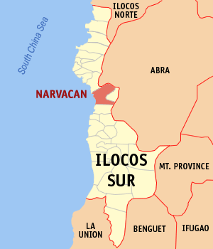
Municipality of Narvacan Lage von Narvacan in der Provinz Ilocos Sur 
Basisdaten Bezirk: Ilocos-Region Provinz: Ilocos Sur Barangays: 34 Distrikt: 2. Distrikt von Ilocos Sur PSGC: 012914000 Einkommensklasse: 2. Einkommensklasse Haushalte: 7803 Zensus 1. Mai 2000Einwohnerzahl: 41.578 Zensus 1. August 2007Koordinaten: 17° 27′ N, 120° 31′ O17.4463120.51041Koordinaten: 17° 27′ N, 120° 31′ O Postleitzahl: 2704 Vorwahl: +63 77 Geographische Lage auf den Philippinen 

Narvacan Narvacan ist eine Stadtgemeinde in der philippinischen Provinz Ilocos Sur und liegt am Südchinesischen Meer. Im Osten grenzt sie an die Provinz Abra. Im Jahre 2000 zählte sie 38.435 Einwohner und 7.803 Haushalte. Narvacan liegt in einem flachen Tal, dessen Lage sich gut für den Anbau von Getreide und anderen Nutzpflanzen eignet.
Narvacan ist in folgende 34 Baranggays aufgeteilt:
- Abuor
- Ambulogan
- Aquib
- Banglayan
- Bantay Abot
- Bulanos
- Cadacad
- Cagayungan
- Camarao
- Casilagan
- Codoog
- Dasay
- Dinalaoan
- Estancia
- Lanipao
- Lungog
- Margaay
- Marozo
- Naguneg
- Orence
- Pantoc
- Paratong
- Parparia
- Quinarayan
- Rivadavia
- San Antonio
- San Jose
- San Pablo
- San Pedro
- Santa Lucia
- Sarmingan
- Sucoc
- Sulvec
- Turod
Städte und Stadtgemeinden in der Provinz Ilocos SurStadtgemeinden: Alilem | Banayoyo | Bantay | Burgos | Cabugao | Caoayan | Cervantes | Galimuyod | Gregorio del Pilar | Lidlidda | Magsingal | Nagbukel | Narvacan | Quirino | Salcedo | San Emilio | San Esteban | San Ildefonso | San Juan | San Vicente | Santa | Santa Catalina | Santa Cruz | Santa Lucia | Santa Maria | Santiago | Santo Domingo | Sigay | Sinait | Sugpon | Suyo | Tagudin
Wikimedia Foundation.
Schlagen Sie auch in anderen Wörterbüchern nach:
Narvacan — es un municipio de segunda categoría que se encuentra situada en la provincia de Ilocos Sur en Filipinas. Situado cerca de la costa occidenta de la isla de Luzón, Narvacan está en un valle rodeado de montañas. Una fértil región con clima tropical … Wikipedia Español
Narvacan — Original name in latin Narvacan Name in other language Narvacan State code PH Continent/City Asia/Manila longitude 17.4175 latitude 120.4753 altitude 9 Population 3019 Date 2011 07 31 … Cities with a population over 1000 database
Narvacan, Ilocos Sur — Narvacan Municipality Map of Ilocos Sur showing the location of Narvacan … Wikipedia
Santa Maria, Ilocos Sur — Santa Maria is a 3rd class municipality in the province of Ilocos Sur, Philippines. According to the 2007 census final count, it has a population of 28,002 people.BarangaysSanta Maria is politically subdivided into 33 barangays. * Ag agrao *… … Wikipedia
Ilokano writers — There are hundreds of published Ilokano writers (or Ilocano writers ) from the time Ilokano literature emerged through the efforts of Ilokano ilustrados in the 18th century to the present. The following list of Ilokano writers is not extensive… … Wikipedia
Nagbukel, Ilocos Sur — Nagbukel Municipality Map of Ilocos Sur showing the location of Nagbukel … Wikipedia
Legislative districts of Ilocos Sur — Philippines This article is part of the series: Politics and government of the Philippines … Wikipedia
Guimba, Nueva Ecija — Guimba is a 1st class municipality in the province of Nueva Ecija, Philippines.It was created by the King of Spain in 1897. According to the 2000 census, it has a population of 87,295 people in 19,207 households.BarangaysGuimba is politically… … Wikipedia
List of Philippine National Railways stations — Philippine National Railways, operating two different rail lines, serves various parts of Luzon with its numerous stations. This list of stations lists all stations of both PNR Northrail and Southrail, as well as stations within Metro Manila,… … Wikipedia
Manuel Tinio — Youngest General of the Philippine Revolution Army Former Governor of Nueva Ecija Governor of Nueva Ecija, Philippines I … Wikipedia
Narvacan

18+
© Academic, 2000-2025
- Kontaktieren Sie uns: Unterstützung, Werbung
Wörterbücher Export, schritte mit PHP, Joomla, Drupal, WordPress, MODx.