- Shire of Buloke
-
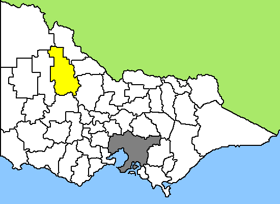
Buloke Shire 
Lage des Buloke Shire in Victoria Basisdaten Bundesstaat: Victoria Hauptort: Wycheproof Fläche: 8.020 km² Einwohner: 6.981 (Juni 2006) Wards: 3 Buloke Shire ist ein lokales Verwaltungsgebiet (LGA) im australischen Bundesstaat Victoria. Das Gebiet ist 8.020 km² groß und hat etwa 7.000 Einwohner.
Buloke liegt im Nordwesten Victorias etwa 350 km entfernt von der Hauptstadt Melbourne und schließt folgende Ortschaften ein: Birchip, Charlton, Donald, Sea Lake, Wycheproof, Berriwillock, Culgoa, Nandaly, Nullawil und Watchem. Der Sitz des City Councils befindet sich in der Ortschaft Wycheproof in der Südhälfte der LGA, in der etwa 750 Einwohner leben.
Das Gebiet gehört zur Mallee-Region, der trockensten und heißesten Region Victorias. Auf dem ebenen, tief gelegenen Land wird vor allem Getreide angebaut und Viehzucht betrieben. Buloke wird dem Weizengürtel (Wheat belt) von Victoria zugerechnet.
Das Mallee war ein ehemaliges Meeres-Basin und so hat die Landwirtschaft mit dem stark salzhaltigen Boden und Grundwasser zu kämpfen. Außerdem haben die letzten regenarmen Jahre die Situation in der Region verschärft.
Verwaltung
Der Buloke Shire Council hat neun Mitglieder, die von den Bewohnern der drei Wards gewählt werden (je drei Councillor aus Mallee, Mount Jeffcott und Lower Avoca). Aus dem Kreis der Councillor rekrutiert sich auch der Mayor (Bürgermeister) des Councils.
Weblinks
- Offizielle Seite (englisch)
Ländliche Gebiete: Alpine | Ararat | Ballarat | Bass Coast | Baw Baw | Benalla | Buloke | Campaspe | Central Goldfields | Colac Otway | Corangamite | East Gippsland | Gannawarra | Glenelg | Golden Plains | Greater Bendigo | Greater Geelong | Greater Shepparton | Hepburn | Hindmarsh | Horsham | Indigo | Latrobe | Loddon | Macedon Ranges | Mansfield | Mildura | Mitchell | Moira | Moorabool | Mount Alexander | Moyne | Murrindindi | Northern Grampians | Pyrenees | Queenscliffe | South Gippsland | Southern Grampians | Strathbogie | Surf Coast | Swan Hill | Towong | Wangaratta | Warrnambool | Wellington | West Wimmera | Wodonga | Yarriambiack
Greater Melbourne: Banyule | Bayside | Boroondara | Brimbank | Cardinia | Casey | Darebin | Frankston | Glen Eira | Greater Dandenong | Hobsons Bay | Hume | Kingston | Knox | Manningham | Maroondah | Maribyrnong | Melbourne | Melton | Monash | Moonee Valley | Moreland | Mornington Peninsula | Nillumbik | Port Phillip | Stonnington | Whitehorse | Whittlesea | Wyndham | Yarra | Yarra Ranges
Wikimedia Foundation.