- Søndre Land
-
Wappen Karte 

Søndre Land Basisdaten Kommunennummer: 0536 (auf Statistik Norwegen) Provinz (fylke): Oppland Verwaltungssitz: Hov Koordinaten: 60° 45′ N, 10° 14′ O60.74194444444410.233055555556135Koordinaten: 60° 45′ N, 10° 14′ O Höhe: 135 moh. Fläche: 728,4 km² Einwohner: 5836 (1. Jan. 2011)[1]
Bevölkerungsdichte: 8 Einwohner je km² Sprachform: Bokmål Webpräsenz: Politik Bürgermeister: Reidar Eriksen (Bygdeliste) (2004) Lage in der Provinz Oppland 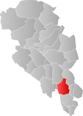
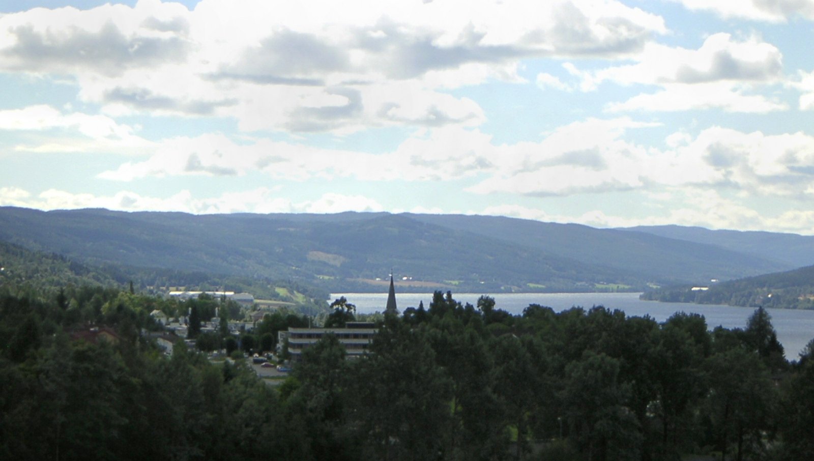
Die Kommune Søndre Land in Norwegen hat eine Fläche von 728 km² mit einer Nord-Süd-Ausdehnung von 39,2 km und einer Ost-West-Ausdehnung von 31,3 km. Bei 5836 Einwohnern (Stand 1. Januar 2011) liegt die Bevölkerungsdichte bei 8 Einwohnern pro Quadratkilometer. Die Kommune liegt in der Fylke Oppland im Norden des Randsfjord und wird vom Ort Hov aus verwaltet. Die höchste Erhebung ist der Skjellinghøvde mit einer Höhe von 856 Metern. Die größten Siedlungen sind Holmen und Hov.
Einzelnachweise
- ↑ Statistics Norway – Berekna folkemengd 1. januar 2011 og berekna folketilvekst i 2010. Fylke og kommunar
Weblinks
 Commons: Søndre Land – Sammlung von Bildern, Videos und Audiodateien
- Statistik Søndre Land. Abgerufen am 25. November 2007.
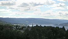 Hov vor dem Randsfjord

Dovre | Etnedal | Gausdal | Gjøvik | Gran | Jevnaker | Lesja | Lillehammer | Lom | Lunner | Nord-Aurdal | Nord-Fron | Nordre Land | Østre Toten | Øyer | Øystre Slidre | Ringebu | Sel | Skjåk | Søndre Land | Sør-Aurdal | Sør-Fron | Vang | Vestre Slidre | Vestre Toten | Vågå
Wikimedia Foundation.
Schlagen Sie auch in anderen Wörterbüchern nach:
Søndre Land — Blason de Søndre Land Localisation de Søndre Land dans le Oppland … Wikipédia en Français
Søndre Land — Infobox Kommune name=Søndre Land idnumber=0536 county=Oppland landscape=Land, Norway capital=Hov governor=Reidar Eriksen ( Søndre Land Bygdeliste ) governor as of=2003 arearank=150 area=728 arealand=659 areapercent=0.22 population as of=2004… … Wikipedia
Sondre Land — Admin ASC 2 Code Orig. name Søndre Land Country and Admin Code NO.11.0536 NO … World countries Adminstrative division ASC I-II
Land, Norway — Land is a traditional district in Oppland, Norway consisting of the municipalities Nordre Land and Søndre Land. Land was a formannskapsdistrikt from 1837, and split into Nordre and Søndre Land in 1847. By the time of partition Land had a… … Wikipedia
-land — Places ends with land (or in some cases lands). Anybody is welcomed to add this list. Islands and islandses (archipelagos) might have been created elsewhere, but they can still be included here if they re famous. (Such as Rhode Island) Countries… … Wikipedia
Nordre Land — kommune Municipality Dokka in Nordre Land … Wikipedia
Nordre-Land — Wappen Karte … Deutsch Wikipedia
Nordre Land — Wappen Karte … Deutsch Wikipedia
Сённре-Ланн — норв. Søndre Land коммуна Норвегии … Википедия
Коммуны Норвегии — Коммуны (норв. kommune, er … Википедия
Søndre Land


18+
© Academic, 2000-2025
- Kontaktieren Sie uns: Unterstützung, Werbung
Wörterbücher Export, schritte mit PHP, Joomla, Drupal, WordPress, MODx.