- Lunner
-
Wappen Karte 
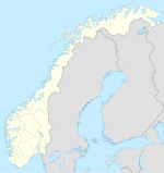

Lunner Basisdaten Kommunennummer: 0533 (auf Statistik Norwegen) Provinz (fylke): Oppland Verwaltungssitz: Roa Koordinaten: 60° 14′ N, 10° 41′ O60.23361111111110.675277777778420Koordinaten: 60° 14′ N, 10° 41′ O Höhe: 420 moh. Fläche: 291,9 km² Einwohner: 8658 (1. Jan. 2011)[1]
Bevölkerungsdichte: 30 Einwohner je km² Sprachform: Bokmål Webpräsenz: Politik Bürgermeister: Anders Larmerud (Parteiangabe fehlt!) (2007) Lage in der Provinz Oppland 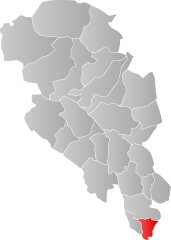
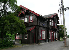 Bahnhof Lunner
Die Kommune Lunner in Norwegen hat eine Fläche von 292 km² mit einer Nord-Süd-Ausdehnung von 23 km (mit Wasser 23,1 km) und einer Ost-West-Ausdehnung von 16,2 km. Lunner hatte am 1. Januar 2011 8658 Einwohner. Die Bevölkerungsdichte beträgt 30 Einwohner pro Quadratkilometer. Die Kommune liegt im äußersten Süden der Fylke Oppland und wird von dem Ort Roa verwaltet. Größere Siedlungen sind Grua, Harestua, Lunner und Roa. Die höchste Erhebung ist der Bisflingflaka mit einer Höhe von 691 Metern.
Weblinks
- Statistik Lunner. Abgerufen am 25. November 2007.
- Offizielle Webseite der Kommune Lunner. Abgerufen am 5. August 2011.
Einzelnachweise
- ↑ Statistics Norway – Berekna folkemengd 1. januar 2011 og berekna folketilvekst i 2010. Fylke og kommunar

Dovre | Etnedal | Gausdal | Gjøvik | Gran | Jevnaker | Lesja | Lillehammer | Lom | Lunner | Nord-Aurdal | Nord-Fron | Nordre Land | Østre Toten | Øyer | Øystre Slidre | Ringebu | Sel | Skjåk | Søndre Land | Sør-Aurdal | Sør-Fron | Vang | Vestre Slidre | Vestre Toten | Vågå


Wikimedia Foundation.