- Øystre Slidre
-
Wappen Karte 
Basisdaten Kommunennummer: 0544 (auf Statistik Norwegen) Provinz (fylke): Oppland Verwaltungssitz: Heggenes Koordinaten: 61° 15′ N, 9° 3′ O61.259.05027777777781080Koordinaten: 61° 15′ N, 9° 3′ O Höhe: 1080 moh. Fläche: 963,1 km² Einwohner: 3178 (1. Jan. 2011)[1]
Bevölkerungsdichte: 3 Einwohner je km² Sprachform: Nynorsk Webpräsenz: Politik Bürgermeisterin: Gro Lundby (Ap) (2004) Lage in der Provinz Oppland 
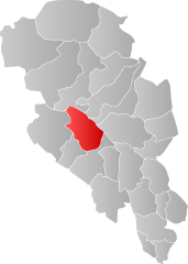
Die Kommune Øystre Slidre in Norwegen hat eine Fläche von 963 km² mit einer Nord-Süd-Ausdehnung von 45,1 km und einer Ost-West-Ausdehnung von 39,8 km. Øystre Slidre hat 3178 Einwohner (Stand 1. Januar 2011). Die Bevölkerungsdichte beträgt 3,3 Einwohner pro Quadratkilometer. Die Kommune liegt in der Fylke Oppland und wird von dem Ort Heggenes/Tingvang verwaltet. Das Wappen stellt als Symbol für die Schieferindustrie Schieferplatten dar.
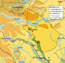
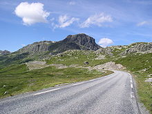
Die höchste Erhebung ist der Øystre Rasletind mit einer Höhe von 2.010 Metern. 73 Prozent der Landschaft erhebt sich über 900 Meter. 60 km² besteht aus Wasser und 25 Prozent der Landschaft besteht aus Wald. Der tiefste Punkt der Landschaft liegt auf einer Höhe von 410 Metern. In der Kommune liegt auch einer der bekanntesten Wintersportorte Norwegens, der Ort Beitostølen. Die größten Seen sind Vinstri, Yddin, Vangsjøen, Javnin und Olevatn.
Eine Sehenswürdigkeit ist die Stabkirche Hegge.
Einzelnachweise
- ↑ Statistics Norway – Berekna folkemengd 1. januar 2011 og berekna folketilvekst i 2010. Fylke og kommunar
Weblinks
 Commons: Øystre Slidre – Sammlung von Bildern, Videos und Audiodateien
Dovre | Etnedal | Gausdal | Gjøvik | Gran | Jevnaker | Lesja | Lillehammer | Lom | Lunner | Nord-Aurdal | Nord-Fron | Nordre Land | Østre Toten | Øyer | Øystre Slidre | Ringebu | Sel | Skjåk | Søndre Land | Sør-Aurdal | Sør-Fron | Vang | Vestre Slidre | Vestre Toten | Vågå
Wikimedia Foundation.
Schlagen Sie auch in anderen Wörterbüchern nach:
Øystre Slidre — kommune Municipality Buahaugen in Øystre Slidre … Wikipedia
Øystre Slidre — Blason d Øystre Slidre Localisation d Øystre Slidre dans l … Wikipédia en Français
Oystre Slidre — Admin ASC 2 Code Orig. name Øystre Slidre Country and Admin Code NO.11.0544 NO … World countries Adminstrative division ASC I-II
Slidre — is the administrative centre of Vestre Slidre municipality, Norway. It is located by the Slidrefjord. Its population (SSB 2005) is 293.Slidre (with its surrounding areas) was established as a municipality January 1, 1838 (see… … Wikipedia
Vestre Slidre — is a municipality in the county of Oppland, Norway.The old municipality of Slidre was divided into Vestre Slidre and Øystre Slidre in 1849.Infobox Kommune name=Vestre Slidre idnumber=0543 county=Oppland landscape=Valdres capital=Slidre… … Wikipedia
Vestre Slidre — Wappen Karte … Deutsch Wikipedia
Коммуны Норвегии — Коммуны (норв. kommune, er … Википедия
List of municipalities of Norway — Norway This article is part of the series: Politics and government of Norway … Wikipedia
Эйстре-Слидре — норв. Øystre Slidre коммуна Норвегии … Википедия
Rasletind — Infobox Mountain Name = Rasletind Photo = Rasletind.jpg Caption = Rasletind seen from southeast, February 2004 Elevation = convert|2105|m|ft|0|lk=on Location = Vang, Vågå, Øystre Slidre (only the eastern summit), Oppland, NOR Range = Jotunheimen… … Wikipedia


