- Nordre Land
-
Wappen Karte 
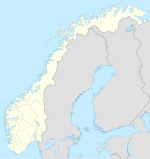
Basisdaten Kommunennummer: 0538 (auf Statistik Norwegen) Provinz (fylke): Oppland Verwaltungssitz: Dokka Koordinaten: 60° 54′ N, 10° 1′ O60.90527777777810.018888888889600Koordinaten: 60° 54′ N, 10° 1′ O Höhe: 600 moh. Fläche: 955,3 km² Einwohner: 6707 (1. Jan. 2011)[1]
Bevölkerungsdichte: 7 Einwohner je km² Sprachform: Bokmål Postleitzahl: N 2870 Gliederung: Dokka, Østsinni, Nordsinni, Vest-Torpa, Nord-Torpa und Aust-Torpa Webpräsenz: Politik Bürgermeister: Liv Solveig Alfstad (Ap) (2004) Lage in der Provinz Oppland 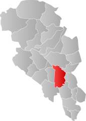
Nordre Land ist eine Kommune in der Provinz (Fylke) Oppland in Norwegen.
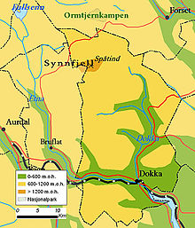
Die Kommune liegt am Nordende des Randsfjordes in der Mitte der Provinz Oppland. Es handelt sich im Wesentlichen um eine Streusiedlung mit drei geschlossenen Bebauungen. Dabei handelt es sich um die Ortschaften Dokka, Nord-Torpa und Aust-Torpa. In Dokka befindet sich auch das Verwaltungszentrum der Kommune.
Die 3.500 Erwerbstätigen der Kommune arbeiten zu 48 % im Dienstleistungssektor, 32 % arbeiten in der Industrie (Möbel) und im Baugewerbe, sowie 19 % in der Land- und Forstwirtschaft. Außerdem gibt es eine größere Zahl von Pendlern, die außerhalb der Kommune arbeiten, meist Wochenendpendler.
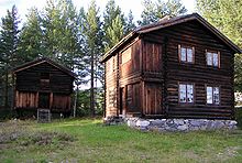
Dokka verfügt über ein Freilichtmuseum. Alte Felsritzungen finden sich am Møllerstufoss und am Etna-Fluss.
Aus Nordre Land stammte Anna Georgine Rogstad (1845–1938), die erste Frau im Storting.
Weblinks
-
 Commons: Nordre Land – Sammlung von Bildern, Videos und Audiodateien
 - Statistik Nordre Land. Abgerufen am 25. November 2007.
Einzelnachweise
- ↑ Statistics Norway – Berekna folkemengd 1. januar 2011 og berekna folketilvekst i 2010. Fylke og kommunar
Dovre | Etnedal | Gausdal | Gjøvik | Gran | Jevnaker | Lesja | Lillehammer | Lom | Lunner | Nord-Aurdal | Nord-Fron | Nordre Land | Østre Toten | Øyer | Øystre Slidre | Ringebu | Sel | Skjåk | Søndre Land | Sør-Aurdal | Sør-Fron | Vang | Vestre Slidre | Vestre Toten | Vågå
Wikimedia Foundation.
Schlagen Sie auch in anderen Wörterbüchern nach:
Nordre Land — kommune Municipality Dokka in Nordre Land … Wikipedia
Nordre Land — Blason de Nordre Land Localisation de Nordre Land dans le Oppland … Wikipédia en Français
Nordre Land IL — Full name Nordre Land Idrettslag Founded 1912 Ground Dokka stadion, Dokka … Wikipedia
Nordre-Land — Wappen Karte … Deutsch Wikipedia
Nordre Land — Admin ASC 2 Code Orig. name Nordre Land Country and Admin Code NO.11.0538 NO … World countries Adminstrative division ASC I-II
Land, Norway — Land is a traditional district in Oppland, Norway consisting of the municipalities Nordre Land and Søndre Land. Land was a formannskapsdistrikt from 1837, and split into Nordre and Søndre Land in 1847. By the time of partition Land had a… … Wikipedia
-land — Places ends with land (or in some cases lands). Anybody is welcomed to add this list. Islands and islandses (archipelagos) might have been created elsewhere, but they can still be included here if they re famous. (Such as Rhode Island) Countries… … Wikipedia
Nordre Isfjorden National Park — IUCN Category II (National Park) … Wikipedia
Nordre-Isfjorden-Nationalpark — Isfjorden … Deutsch Wikipedia
Nordre Isfjorden Land National Park — Infobox protected area name = Nordre Isfjorden Land National Park iucn category = II caption = locator x = locator y = location = Spitsbergen, Svalbard, Norway nearest city = Longyearbyen lat degrees = 78 lat minutes = 24 lat seconds = lat… … Wikipedia
-

