- Tsuyama
-
Tsuyama-shi
津山市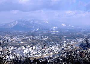
Geographische Lage in Japan 

Region: Chūgoku Präfektur: Okayama Koordinaten: 35° 4′ N, 134° 0′ O35.069116666667134.00455277778Koordinaten: 35° 4′ 9″ N, 134° 0′ 16″ O Basisdaten Fläche: 506,36 km² Einwohner: 105.727
(1. September 2011)Bevölkerungsdichte: 209 Einwohner je km² Gemeindeschlüssel: 33203-8 Symbole Flagge/Wappen: 
Baum: Campherbaum Blume: Rhododendron indicum, Kirschblüte Rathaus Adresse: Tsuyama City Hall
520 Yamakita
Tsuyama-shi
Okayama 708-8501Webadresse: http://www.city.tsuyama.lg.jp Lage Tsuyamas in der Präfektur Okayama 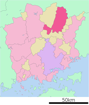
Tsuyama (jap. 津山市, -shi) ist eine Stadt in der japanischen Präfektur Okayama.
Inhaltsverzeichnis
Geographie
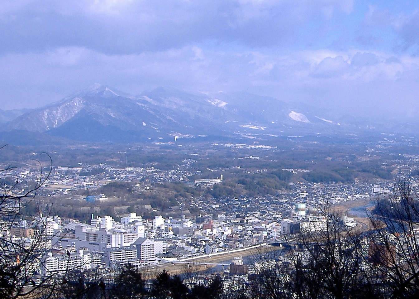
Tsuyama liegt nördlich von Okayama und südlich von Tottori. Die nördlichen und westlichen Stadtteile liegen am Rand des Chūgoku-Gebirges.
Geschichte
Die Stadt Tsuyama wurde am 11. Februar 1929 aus der Vereinigung von 2 Gemeinden (津山町, 津山東町) und 3 Dörfern (西苫田村, 二宮村, 院庄村) des Landkreises Tomata und einem Dorf (福岡村) des Landkreises Kume gegründet.
Sehenswürdigkeiten
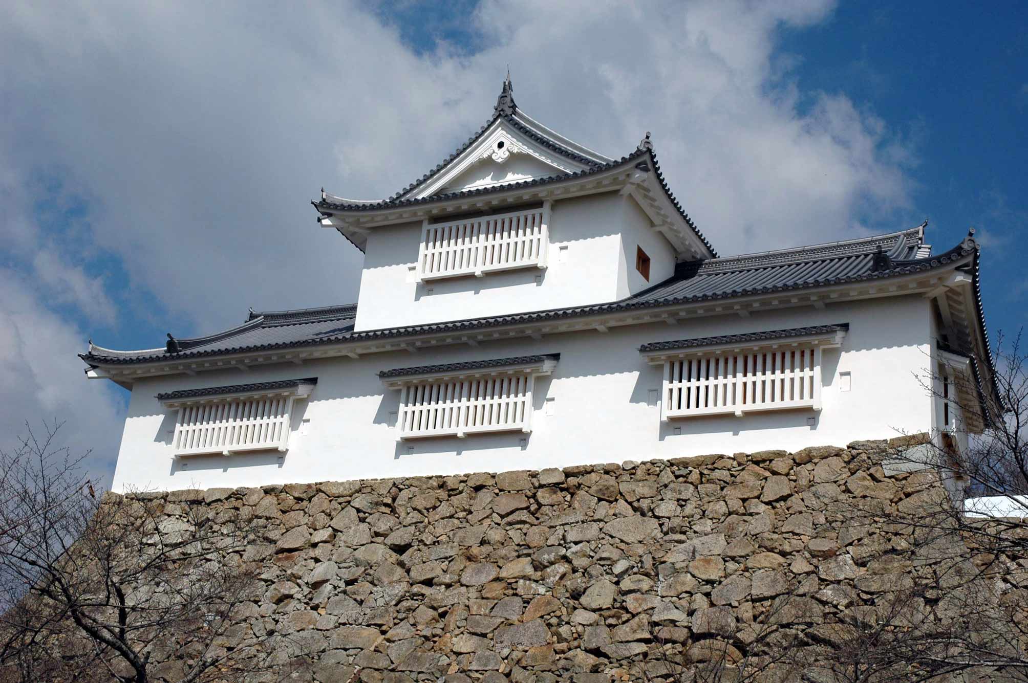
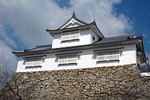 Bitchū-Turm der Burg Tsuyama
- Burg Tsuyama (津山城, Tsuyama-jō)
Verkehr
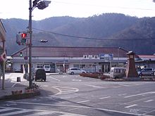 Bahnhof Tsuyama
- Straße:
- Chugoku-Autobahn
- Nationalstraße 53: nach Okayama und Tottori
- Nationalstraßen 179, 181, 374, 429
- Zug:
- JR Kishin-Linie
- JR Inbi-Linie
- JR Tsuyama-Linie
Städtepartnerschaften
 Santa Fe (New Mexico), Vereinigte Staaten
Söhne und Töchter der Stadt
- Saitō Sanki (Haiku-Dichter)
- Hiranuma Kiichirō (Premierminister)
- Joe Odagiri (Schauspieler)
Angrenzende Städte und Gemeinden
- Prafektur Okayama
- Maniwa
- Shōō
- Kagamino
- Nagi
- Misaki
- Präfektur Tottori
- Tottori
- Chizu
Weblinks

Kreisfreie Städte (shi): Akaiwa | Asakuchi | Bizen | Ibara | Kasaoka | Kurashiki | Maniwa | Mimasaka | Niimi | Okayama (Verwaltungssitz) | Setouchi | Sōja | Takahashi | Tamano | Tsuyama
Aida-gun: Nishiawakura | Asakuchi-gun: Satoshō | Kaga-gun: Kibichūō | Katsuta-gun: Nagi | Shōō | Kume-gun: Kumenan | Misaki | Maniwa-gun: Shinjō | Oda-gun: Yakage | Tomata-gun: Kagamino | Tsukubo-gun: Hayashima | Wake-gun: Wake


Wikimedia Foundation.