- Caledonia County
-
Verwaltung US-Bundesstaat: Vermont Verwaltungssitz: St. Johnsbury Adresse des
Verwaltungssitzes:County Courthouse
27 Main Street, P.O. Box 4129
Saint Johnsbury, VT 05819-2637Gründung: 1792 Gebildet aus: Orange County Vorwahl: 001 802 Demographie Einwohner: 30.440 (2005) Bevölkerungsdichte: 18,1 Einwohner/km² Geographie Fläche gesamt: 1.703 km² Wasserfläche: 18 km² Karte 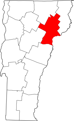
Caledonia County[1] ist ein County im Bundesstaat Vermont der Vereinigten Staaten von Amerika. Der Sitz der Countyverwaltung (County Seat) befindet sich in St. Johnsbury.
Inhaltsverzeichnis
Geografie
Das County liegt im Nordosten von Vermont, grenzt im Südosten an New Hampshire und hat eine Fläche von 1703 Quadratkilometern, wovon 18 Quadratkilometer Wasserfläche sind. Es grenzt im Uhrzeigersinn an folgende Countys: Orleans County, Essex County, Grafton County (New Hampshire), Washington County, Orange County und Lamoille County.
Geschichte
Caledonia County wurde 1792 aus Teilen des Orange County gebildet.
Demografische Daten
Historische Einwohnerzahlen Census Einwohner ± in % 1900 24.381 — 1910 26.031 7 % 1920 25.762 -1 % 1930 27.253 6 % 1940 24.320 -10 % 1950 24.049 -1 % 1960 22.786 -5 % 1970 22.789 0,01 % 1980 25.808 10 % 1990 27.846 8 % 2000 29.702 7 % 1900–1990[2] 2000[3]
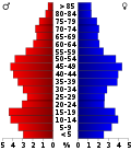 Alterspyramide des Caledonia Countys (Stand: 2000)
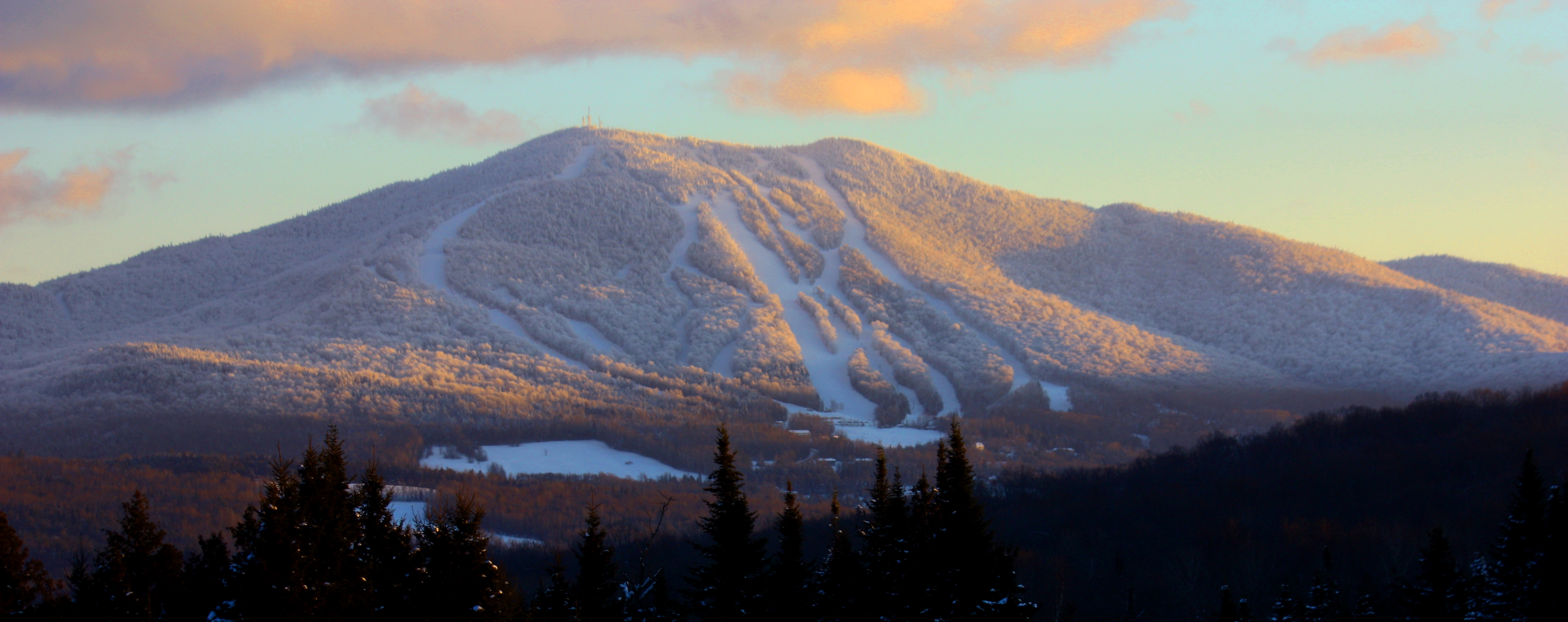
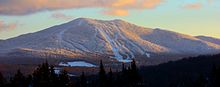 Der Burke Mountain
Nach der Volkszählung im Jahr 2000 lebten im County 29.702 Menschen. Es gab 11.663 Haushalte und 7.895 Familien. Die Bevölkerungsdichte betrug 18 Einwohner pro Quadratkilometer. Ethnisch betrachtet setzte sich die Bevölkerung zusammen aus 97,48% Weißen, 0,29% Afroamerikanern, 0,55% amerikanischen Ureinwohnern, 0,37% Asiaten, 0,01% Bewohnern aus dem pazifischen Inselraum und 0,23% Prozent aus anderen ethnischen Gruppen; 1,07% stammten von zwei oder mehr ethnischen Gruppen ab. 0,68% der Bevölkerung waren spanischer oder lateinamerikanischer Abstammung.
Von den 11.663 Haushalten hatten 32,40% Kinder und Jugendliche unter 18 Jahre, die bei ihnen lebten. 53,60% waren verheiratete, zusammenlebende Paare, 10,40% waren allein erziehende Mütter. 32,30% waren keine Familien. 25,60% waren Singlehaushalte und in 11,00% lebten Menschen im Alter von 65 Jahren oder darüber. Die Durchschnittshaushaltsgröße betrug 2,46 und die durchschnittliche Familiengröße lag bei 2,95 Personen.
Auf das gesamte County bezogen setzte sich die Bevölkerung zusammen aus 25,30% Einwohnern unter 18 Jahren, 8,80% zwischen 18 und 24 Jahren, 26,30% zwischen 25 und 44 Jahren, 25,30% zwischen 45 und 64 Jahren und 14,40% waren 65 Jahre alt oder darüber. Das Durchschnittsalter betrug 38 Jahre. Auf 100 weibliche Personen kamen 97,50 männliche Personen, auf 100 Frauen im Alter ab 18 Jahren kamen statistisch 94,50 Männer.
Das jährliche Durchschnittseinkommen eines Haushalts betrug 34.800 USD, das Durchschnittseinkommen der Familien betrug 42.215 USD. Männer hatten ein Durchschnittseinkommen von 30.438 USD, Frauen 21.973 USD. Das Prokopfeinkommen betrug 16.976 USD. 12,30% der Bevölkerung und 9,00% der Familien lebten unterhalb der Armutsgrenze. 16,60% davon waren unter 18 Jahre und 10,00% waren 65 Jahre oder älter.[4]
Städte und Gemeinden
Ortschaft Status Einwohner
(2000)Gesamte Fläche
[km²]Landfläche
[km²]Bevölkerungsdichte
[Einwohner / km²]Gründung Besonderheit Barnet town 1690 112,9 109,8 15,4 16. Dez. 1763 Burke town 1571 88,2 88,2 17,8 4. Nov. 1780 Danville town 2211 158,4 157,7 14,0 31. Okt. 1786 Groton town 876 142,4 139,8 6,3 20. Okt. 1789 Hardwick town 3174 100,7 99,8 31,8 19. Aug. 1781 Kirby town 456 63,3 63,2 7,2 28. Okt. 1807 Lyndon town 5448 103,1 103,0 52,9 20. Nov. 1780 Newark town 470 96,3 95,3 4,9 15. Aug. 1781 Peacham town 665 123,5 121,5 5,5 31. Dez. 1763 Ryegate town 1150 95,3 94,7 12,1 8. Sep. 1763 Sheffield town 727 84,9 84,5 8,6 25. Okt. 1793 St. Johnsbury town 7571 95,2 95,0 79,7 1. Nov. 1786 County Seat Stannard town 185 32,5 32,4 5,7 19. Aug. 1867 Sutton town 1001 99,4 99,4 10,1 26. Feb. 1782 Walden town 782 101,1 100,3 7,8 18. Aug. 1781 Waterford town 1104 102,9 98,8 11,2 8. Nov. 1780 Wheelock town 621 103,1 102,5 6,1 14. Juni 1785 Einzelnachweise
- ↑ Caledonia County im Geographic Names Information System des United States Geological Survey. Abgerufen am 22. Februar 2011
- ↑ Auszug aus Census.gov. Abgerufen am 28. Februar 2011
- ↑ Auszug aus factfinder.census.gov Abgerufen am 28. Februar 2011
- ↑ Caledonia County, Vermont, Datenblatt mit den Ergebnissen der Volkszählung im Jahre 2000 bei factfinder.census.gov.
Weblinks
 Commons: Caledonia County, Vermont – Sammlung von Bildern, Videos und Audiodateien
Liste der Countys in Vermont
Addison | Bennington | Caledonia | Chittenden | Essex | Franklin | Grand Isle | Lamoille | Orange | Orleans | Rutland | Washington | Windham | Windsor
Wikimedia Foundation.
Schlagen Sie auch in anderen Wörterbüchern nach:
Caledonia County — Admin ASC 2 Code Orig. name Caledonia County Country and Admin Code US.VT.005 US … World countries Adminstrative division ASC I-II
Caledonia County, Vermont — Infobox U.S. County county = Caledonia County state = Vermont map size = 100 founded = 1796 seat = St. Johnsbury | area total sq mi =658 area water sq mi =7 area percentage = 1.06% census yr = 2000 pop = 29702 density km2 =18 web = |Caledonia… … Wikipedia
Historical U.S. Census totals for Caledonia County, Vermont — This article shows U.S. Census totals for Caledonia County, Vermont, broken down by municipality, from 1900 to 2000.Like most areas of New England, Caledonia County is (and has been at all times since well before the 20th century) entirely… … Wikipedia
National Register of Historic Places listings in Caledonia County, Vermont — Location of Caledonia County in Vermont This is a list of the National Register of Historic Places listings in Caledonia County, Vermont. This is intended to be a complete list of the properties and districts on the National Register of Historic… … Wikipedia
List of Registered Historic Places in Caledonia County, Vermont — List of Registered Historic Places in Caledonia County, Vermont.This is intended to be a complete list of properties and districts listed on the National Register of Historic Places in Caledonia County, Vermont. The locations of National Register … Wikipedia
Caledonia (disambiguation) — Caledonia is an old name for northern Great Britain. Caledonia may also refer to:* Caledonia, a Roman name of Celtic origin for most of the area that has become Scotland * Caledonians, also known as Caledonii or Caledonia Confederacy, name given… … Wikipedia
Caledonia State Park — Geobox Protected Area name = Caledonia State Park native name = other name = other name1 = category local = Pennsylvania State Park category iucn = III image caption = Reconstruction of Caledonia furnace etymology type = Named for etymology =… … Wikipedia
Caledonia Vermont Senate District, 2002–2012 — The Caledonia Senate District is one of 13 Vermont Senate districts included in the redistricting and reapportionment plan developed by the Vermont General Assembly following the 2000 U.S. Census. The plan applies to legislatures elected in 2002 … Wikipedia
Caledonia-Washington-1 Vermont Representative District, 2002-2012 — The Caledonia Washington 1 Representative District is a one member state Representative district in the U.S. state of Vermont. It is one the 108 one or two member districts into which the state was divided by the redistricting and reapportionment … Wikipedia
Caledonia-1 Vermont Representative District, 2002-2012 — The Caledonia 1 Representative District is a one member state Representative district in the U.S. state of Vermont. It is one the 108 one or two member districts into which the state was divided by the redistricting and reapportionment plan… … Wikipedia
Caledonia County


18+
© Academic, 2000-2026
- Kontaktieren Sie uns: Unterstützung, Werbung
Wörterbücher Export, schritte mit PHP, Joomla, Drupal, WordPress, MODx.