- Kanianka
-
Kanianka
Wappen Karte 
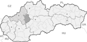

Kanianka BasisdatenKraj: Trenčiansky kraj Okres: Prievidza Region: Horná Nitra Fläche: 7,938 km² Einwohner: 4.145 (31. Dez. 2010) Bevölkerungsdichte: 522,17 Einwohner je km² Höhe: 330 m n.m. Postleitzahl: 972 17 Telefonvorwahl: 0 46 Geographische Lage: 48° 49′ N, 18° 35′ O48.81527777777818.586388888889330Koordinaten: 48° 48′ 55″ N, 18° 35′ 11″ O Kfz-Kennzeichen: PD Gemeindekennziffer: 514071 StrukturGemeindeart: Gemeinde Verwaltung (Stand: Februar 2011)Bürgermeister: Ivor Husár Adresse: Obecný úrad Kanianka
ulica SNP 583/1
97217 KaniankaWebpräsenz: www.kanianka.sk Gemeindeinformation
auf portal.gov.skStatistikinformation
auf statistics.skKanianka (bis 1927 slowakisch auch „Kaňanka“; ungarisch Kányahegy - bis 1907 Kanyánka) ist ein Dorf und Gemeinde im Okres Prievidza in der Region Trenčín in der Westslowakei.
Geschichte
Die erste Erwähnung dieses Dorfes stammt aus dem Jahre 1479.
Geographie
Die Gemeinde liegt in einer Höhe von etwa 380 Metern und umfasst ein Gebiet von 7,94 km². Die Bevölkerungszahl beträgt 4134 Einwohner (Stand 2009).
Bojnice (Weinitz) | Bystričany (Bistrizin) | Cigeľ (Ziegel) | Čavoj (Sauershau) | Čereňany | Diviacka Nová Ves (Divickneudorf) | Diviaky nad Nitricou (Divick) | Dlžín | Dolné Vestenice (Unterwestenitz) | Handlová (Krickerhau) | Horná Ves | Horné Vestenice (Oberwestenitz) | Chrenovec-Brusno | Chvojnica (Fundstollen) | Jalovec | Kamenec pod Vtáčnikom (Kamenetz) | Kanianka | Kľačno (Gaidel) | Kocurany | Kostolná Ves (Kostolnadorf) | Koš (Andreasdorf) | Lazany | Lehota pod Vtáčnikom | Liešťany | Lipník | Malá Čausa (Kleintschauscha) | Malinová (Zeche) | Nedožery-Brezany | Nevidzany | Nitrianske Pravno (Deutschproben) | Nitrianske Rudno | Nitrianske Sučany | Nitrica | Nováky | Opatovce nad Nitrou (Abtsdorf) | Oslany | Podhradie | Poluvsie (Halbendorf) | Poruba (Nickelsdorf) | Pravenec (Kleinproben) | Prievidza (Priwitz) | Radobica | Ráztočno | Rudnianska Lehota | Sebedražie (Siebenandreas) | Seč | Šútovce (Schutotz) | Temeš | Tužina (Schmiedshau) | Valaská Belá | Veľká Čausa (Großtschauscha) | Zemianske Kostoľany (Edl-Kostolany)


Wikimedia Foundation.