- Pouembout
-
Basisdaten Land: Neukaledonien Provinz: Province Nord Höhe: 0 m - 1134 m Fläche: 674,3 km² Einwohner: 1.471
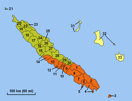
(2004)Bevölkerungsdichte: 2 Einwohner je km² INSEE-Code: 98825[1] Postleitzahl: 98825[2] Karte (Nr. 15 ist Pouembout) 
Pouembout ist eine Gemeinde in der Nordprovinz in Neukaledonien. Sie liegt auf der Hauptinsel Grande Terre und umfasst ebenfalls einige kleine Inseln vor der Küste der Hauptinsel.
Die höchste Erhebung ist das Massif de Kopeto mit 1134 m.
Bevölkerung
Bevölkerungsentwicklung in Pouembout (2009 geschätzt)[3] Einwohner 482 577 587 734 692 854 1.189 1.471 1.687 Jahr 1956 1963 1969 1976 1983 1989 1996 2004 2009 Einzelnachweise
- ↑ Mairie de Pouembout
- ↑ Les codes postaux, Nouvelle-Calédonie
- ↑ Bevölkerungsentwicklung in Pouembout 1956–2009
Gemeinden in NeukaledonienBelep | Bouloupari | Bourail | Canala | Dumbéa | Farino | Hienghène | Houaïlou | L’Île-des-Pins | Kaala-Gomen | Koné | Kouaoua | Koumac | La Foa | Lifou | Maré | Moindou | Le Mont-Dore | Nouméa | Ouégoa | Ouvéa | Païta | Poindimié | Ponérihouen | Pouébo | Pouembout | Poum | Poya | Sarraméa | Thio | Touho | Voh | Yaté
Wikimedia Foundation.
Schlagen Sie auch in anderen Wörterbüchern nach:
Pouembout — 21° 07′ 40″ S 164° 53′ 18″ E / 21.127889, 164.888306 … Wikipédia en Français
Pouembout — French commune |nomcommune=Pouembout province=North Province map size=300px adjustable mapcaption=Location of the commune (in red) within New Caledonia insee=98825 cp=98825 maire=Jean Naouna |mandat= lat long= |longitude=164.9|latitude= 21.13 alt … Wikipedia
Pouembout — Original name in latin Pouembout Name in other language Pouembout, Puembut State code NC Continent/City Pacific/Noumea longitude 21.13333 latitude 164.9 altitude 11 Population 1511 Date 2012 01 18 … Cities with a population over 1000 database
Pouembout — Admin ASC 2 Code Orig. name Pouembout Country and Admin Code NC.01.98825 NC … World countries Adminstrative division ASC I-II
Comité des signataires — Un Comité des signataires a été créé par l accord de Nouméa signé le 5 mai 1998 par le gouvernement français, les anti indépendantistes du Rassemblement pour la Calédonie dans la République (RPCR) et les indépendantistes du Front de… … Wikipédia en Français
Province Nord (Nouvelle-Calédonie) — 21°0′S 165°0′E / 21, 165 … Wikipédia en Français
Koné (Nouvelle-Calédonie) — Pour les articles homonymes, voir Koné. 21° 03′ 32″ S 164° 51′ 07″ E … Wikipédia en Français
Nouvelle-Calédonie — Pour les articles homonymes, voir Nouvelle Calédonie (homonymie). Nouvelle Calédonie … Wikipédia en Français
Province Nord (Nouvelle-Caledonie) — Province Nord (Nouvelle Calédonie) Province nord Géographie Pays … Wikipédia en Français
Province nord (nouvelle-calédonie) — Province nord Géographie Pays … Wikipédia en Français
Pouembout
18+
© Academic, 2000-2026
- Kontaktieren Sie uns: Unterstützung, Werbung
Wörterbücher Export, schritte mit PHP, Joomla, Drupal, WordPress, MODx.