- Chingford
-
London Borough of Waltham Forest 
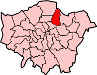
Lage in Greater LondonStatus London Borough Region Greater London Verwaltungssitz Leyton Fläche 38,82 km² (323.) Einwohner (2007) 222.300 (59.) ONS-Code 00BH Website www.lbwf.gov.uk London Borough of Waltham Forest [ˈwɔːlθəm ˈfɒɹɪst] ist ein Stadtbezirk im Nordosten von London. Bei der Gründung von Greater London im Jahr 1965 entstand er aus den Gemeinden Chingford, Leyton und Walthamstow in der Grafschaft Essex, trotz des Widerstandes einer Reihe von Bürgern Chingfords gegen den Namen.
Die Bevölkerung besteht aus 64,5 % Weißen, 14,8 % Südasiaten und 15,4 % Schwarzen. In dem Bezirk befinden sich das Walthamstow College, die William Morris-Gallery und das Vestry House Museum, Vestry Road, ein ehemaliges Arbeitshaus. Der Straßenmarkt in der High Street ist mit einem Kilometer der angeblich längste in Europa. Er wurde 1885 begründet.
Inhaltsverzeichnis
Stadtteile
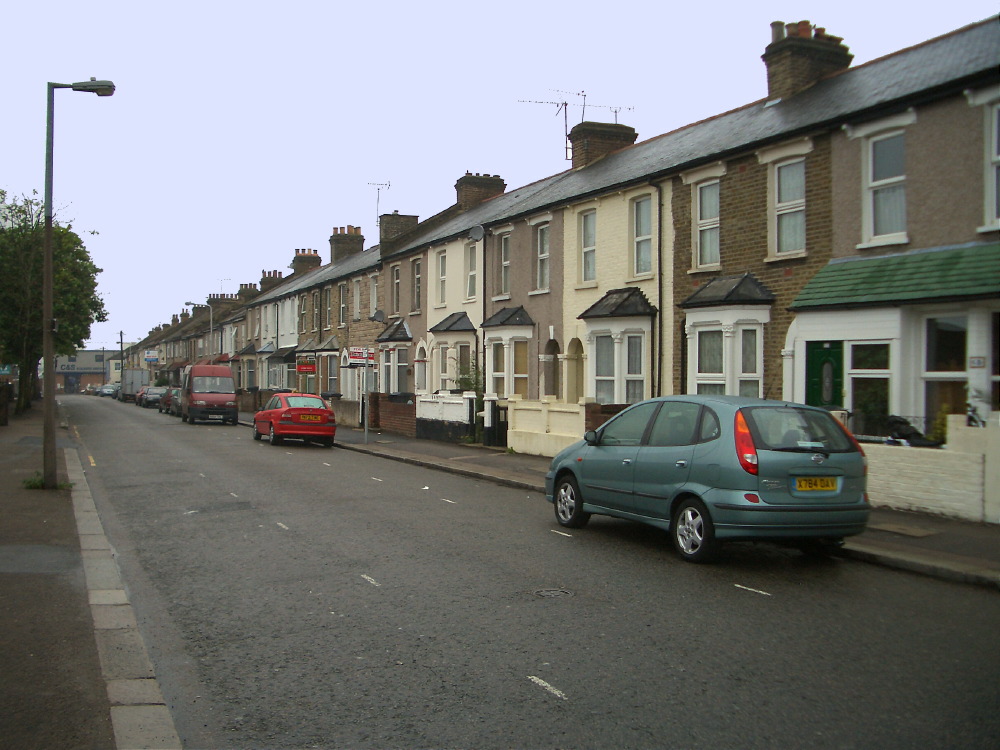
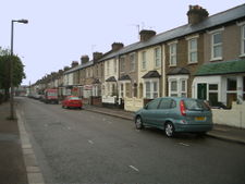 St. Andrews Road, Walthamstow
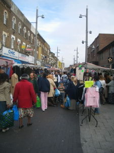 Walthamstow High Street
- Chingford
- Chingford Hatch
- Friday Hill
- Hale End
- Higham Hill
- Highams Park
- Leyton
- Leytonstone
- South Chingford
- Upper Walthamstow
- Walthamstow
Der Bezirk Hamburg-Wandsbek unterhält seit 1949 eine Bezirkspatenschaft mit dem Borough of Waltham Forest. [1]
Persönlichkeiten
- Colin Kazim-Richards - englisch-türkischer Fußballspieler
- Jodi Albert - Schauspielerin und Sängerin
- David Beckham - Fußballspieler
- Thomas George Cowling - Astronom und Mathematiker
- Derek de Solla Price - Professor für Wissenschaftsgeschichte
- Keith Greene - Autorennfahrer
- Steve Hillage - Musiker und Produzent
- Alfred Hitchcock - Filmregisseur
- Steve Harris - Heavy Metal-Bassist
- Derek Jacobi - Schauspieler
- Simon Khan - Profigolfer
- William Morris - Künstler und Mitbegründer der Fabier
- Jane Ray - Illustratorin
- East 17 - Boyband der 1990er Jahre
- Kaikhosru Shapurji Sorabji - englischer Komponist, Pianist und Musikkritiker parsischer Herkunft
- William Cotton (Bankier) - englischer Bankier und Erfinder
Literatur
- Down memory lane in Waltham Forest. Waltham Forest Magazine April 2006, 20-21.
Quellen
Weblinks
Barking and Dagenham | Barnet | Bexley | Brent | Bromley | Camden | City of London | City of Westminster | Croydon | Ealing | Enfield | Greenwich | Hackney | Hammersmith and Fulham | Haringey | Harrow | Havering | Hillingdon | Hounslow | Islington | Kensington and Chelsea | Kingston | Lambeth | Lewisham | Merton | Newham | Redbridge | Richmond | Southwark | Sutton | Tower Hamlets | Waltham Forest | Wandsworth
Sonstige Einteilung: Greater London | Inner London | Outer London | County of London

Wikimedia Foundation.